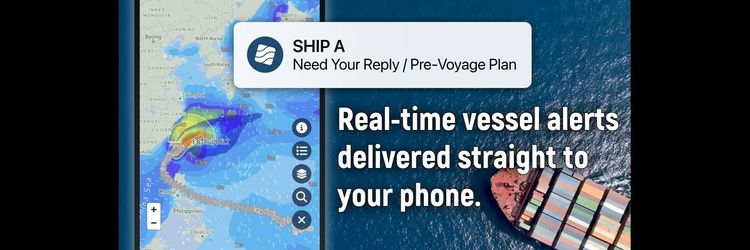
The Impact of Climate Change on Marine Forecasting
Weathernews is a weather intelligence company and weather forecast technology is one of our core competencies. Through the lens of climate change adaptation and in the context of marine weather forecasting, we are looking at how we can use weather forecast technology to improve voyage optimization in a warming climate.
The recent report from the International Panel on Climate Change reads, “Climate change has often been perceived as a slow and gradual process, but by now it is abundantly clear that many of its impacts arise through shocks, such as extreme weather events. Many places face more frequent and intense extremes and more surprises.” Surprises - events that are unexpected or haven’t been observed in the past. A growing body of research attributes extreme weather events to a warming climate.
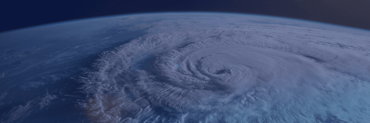
Rising Risks: Extreme Weather and Rapid Intensification
Rapid intensification of tropical cyclones has been attributed to climate change due to increasing sea surface temperatures. Warm sea surface temperatures are the fuel for tropical cyclones, so warmer water can increase the strength of TCs and allow for rapid intensification of TCs, which is very dangerous - and difficult to forecast. The first hurricane of the 2024 season, Beryl, was unprecedented in several ways, including rapid intensification with wind speeds increasing by 55 knots in 24 hours. Rapid intensification is becoming more frequent; the top 5 records for rapid intensification of tropical cyclones have occurred in the last 10 years. The nature of weather risk is changing with more frequent extreme events, and our ability to forecast these extremes is also changing.
The Growing Challenge of Accurate Weather Forecasting
A recent study from Stanford University suggests that the window of forecast accuracy is decreasing in a warming climate - with each degree of global warming increase, the window for an accurate weather forecast, normally considered within a week to ten days, decreases to a shorter period of time. This follows anecdotal evidence from weather agencies noting that weather prediction is becoming more difficult.
So, if extreme/unprecedented events are becoming more frequent, but also harder to forecast, that means that the nature of weather risk is also changing. So, we need to think about how to manage weather risk in this new context.
Enhancing Forecast Accuracy: The Role of Observations and Models
There are a couple of ways to target managing weather risk - increasing forecast accuracy and understanding forecast uncertainty. Forecast accuracy allows us to have a clearer picture of the latest forecast information; uncertainty places the weather forecast in context, to understand how the forecast might change and in what ways.
As one of our goals as a company, Weathernews is working to develop the most accurate forecast in the market. Weathernews develops our forecast output, which is made up of several inputs, including Observations - from satellites, upper air observations, and surface observations- and Input from global models, which are widely available, the Global Forecasting System from NOAA, the European Model, from the Japan Metr. Agency, and so on.
These inputs are ingested to create the scenario we think best represents the atmosphere and used to calculate our global model output. From there, we have post-processing schemes, which use algorithms to improve forecasts in regions where we know global models are weak - for example areas, like the Mediterranean, where there are gap winds on smaller scales that are difficult for global models to resolve. We can enhance those winds after the fact with post-processing schemes for a more accurate outcome. Finally, we have verification schemes to confirm forecast quality and inform ongoing improvements.
We have been working to improve our forecast accuracy by data assimilation and improving forecast resolution. More observations contribute to a better model initialization, which helps create a better forecast. Weathernews has our proprietary observation infrastructure, including proprietary observation stations set up to support areas where there are few observations, reports from ships under our service - nearly 6,000 every day - as well as aircraft reports for upper air observations. We can assimilate these observations into the initialization of the forecast model, to fill in gaps to have a more representative starting point for model solutions to be calculated from. In addition, we have improved our model resolution to improve forecast accuracy for smaller-scale features and localized weather maxima.
But an accurate forecast is only one-half of the story.
Uncertainty in Forecasts: A Critical Element of Risk Management
Understanding forecast uncertainty gives us additional context on the nature of weather risk, enabling us to make more informed decisions about how to mitigate that risk. Uncertainties in Weather forecasts are due to 3 main things:
1. Inaccurate, incomplete description of the initial 3-dimensional state of the atmosphere
2. Inaccurate and incomplete descriptions of physical processes in modeling systems
3. The chaotic character of the atmosphere
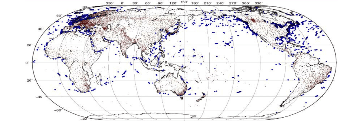
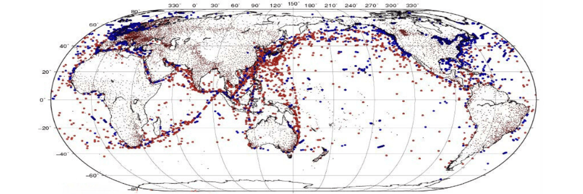
As an example, forecasting over the ocean is an area where there necessarily is a ceiling to forecast accuracy, due to lack of observations and vast distances between weather stations and buoys.
From WMO, synoptic weather observice station locations
Harnessing Ensemble Forecasting to Navigate Uncertainty
While assimilating weather observations from ships improves forecast accuracy, there are still areas with few observations across the oceans, especially in the Southern Hemisphere.
How can we understand forecast uncertainty? Via ensemble forecasting.
Ensemble Forecast is a set of many calculations of model output, which is accomplished by slightly changing the initial condition and parameters of numerical weather prediction models and running the model to obtain many solutions for the weather forecast period. These solutions are referred to as ensemble members.
The output of ensemble members represents a sample of the probability distribution of future weather events. Using that output, we can calculate the probability of an outcome - probability of wave height exceeding a certain value; probability of wave height exceeding the deterministic forecast value by a certain amount, and so on… The probability of precipitation is probably most commonly encountered in day-to-day life.
The probability distribution also tells us information about the nature of how the forecast can change:
A: confidence that the forecast will verify as it is - high confidence (good agreement between ensemble members) or low confidence (poor agreement between ensemble members)
B: if low confidence, the output can also tell us how the forecast might be different - higher than expected or lower than expected
This information allows us to make a more informed decision than just what the deterministic forecast can tell us alone.
In this example, we have the forecast snow accumulation for a period of time on the left. On the right, we can see the probability that the accumulation during this period exceeds 5cm.
If you are a regional manager allocating resources for snow removal, this information can help you make your decision: in the area of low snow accumulation totals (1-2cm) in the red box, we can see there is also a 50% probability of exceeding 5cm accumulation. How does that change your decision about allocating resources for safety?
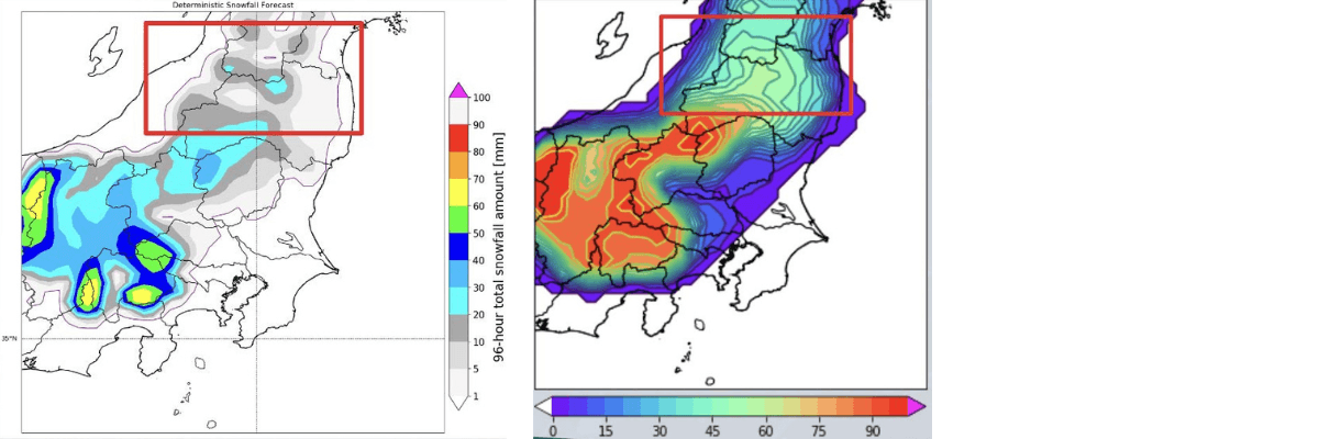
The probabilistic information gives the opportunity to understand the additional risk, and “hedge” that risk based on what the scenario is.
Probabilistic Forecasting in Voyage Optimization
Applying this concept to ocean forecasting and voyage optimization, using ensemble forecasts we are calculating the probability of exceeding certain wind or wave thresholds - for example, the probability of waves exceeding a particular wave height, in this case, 5.5M.
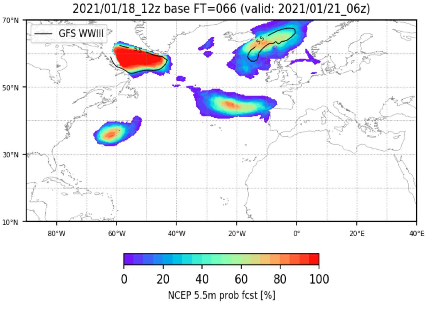
We can compare areas with high probabilities of wave heights exceeding 5.5m (colored shading) against deterministic forecasts for areas with wave heights over 5.5m (solid black lines). The differences in this information can give us information about how the forecast may change. Take the area of higher probabilities off the US Coast as an example: high waves are not forecast in that area based on the deterministic forecast, but the probabilities are high for waves exceeding 5.5m - this would be an area to watch for the risk of the forecast worsening compared to the current scenario. If developing a voyage plan for a vessel in the area, one might carefully consider whether to sail through that region based on this information.
This can also be applied to systematic voyage optimization.
Balancing Risk Tolerance in Route Planning
When a human being is involved in the voyage optimization process, the voyage planner develops ship routes based on single model ocean wave forecast output, using their judgment regarding forecast uncertainty to create a strategic route and hedge against changes they think may be possible based on their expertise. For systematic voyage optimization, those solutions only optimize based on a single forecast output, the deterministic forecast.
Using the probabilistic wave forecast made from ensemble forecast members, it is possible to develop automatic route optimization using probability thresholds, using individual risk tolerance to create a strategic route. This is a promising technology to better account for forecast uncertainty in route optimization, similar to how a human might.
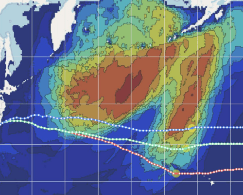
Example graphic of systematized route optimizations basis 75% probability of exceeding 4m significant wave height (blue), 50% probability (green), and 25% probability (red). The field is the probability of exceeding 4m significant wave height for the period.
The value of using the probabilistic forecast in a systematized optimization is that the optimization accounts for how the forecast may change in a way that a systematized optimization using the deterministic forecast cannot.
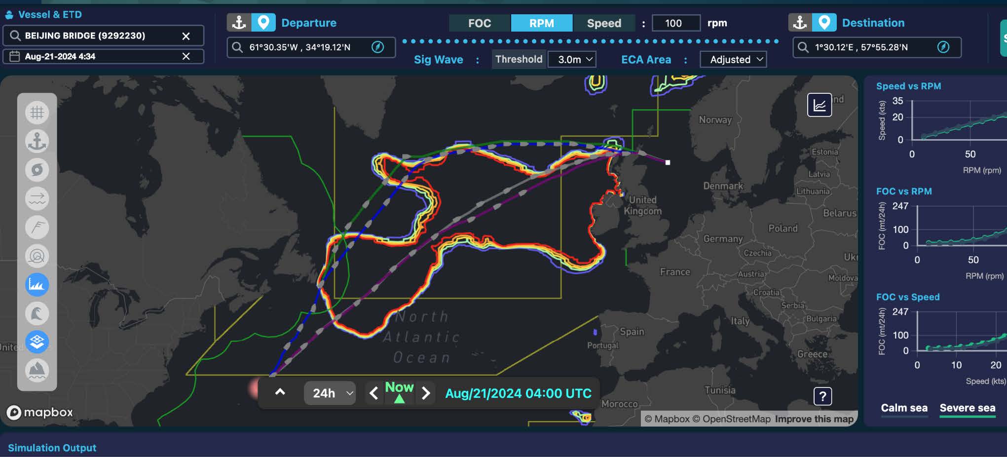
Weathernews has developed our SeaNavigator Route Search Engine, a technology that allows users to input their desired wave height threshold, and the system will generate 3 route options - conservative (a route that avoids areas where the probability of exceeding the wave height is over 30%), balanced (a route that avoids areas where the probability of exceeding the wave height is over 50%) and aggressive (as with the others, but for 75% probability) based on the probabilistic forecast data (as well as other valuable inputs, such as currents).
Strategic Decision-Making for Decarbonization and Safety
There are two schools of thought when dealing with forecast changes -
One approach is to react to changes as quickly as possible when they happen, immediately updating the course or the speed to account for the change based on the latest information.
Another approach is to wait for a second data point, and then make a strategic decision based on the developing trend.
Using forecast probability for optimization allows us to approach the situation more strategically but with quantifiable risk - understanding how the forecast may change and making decisions using that information.
These examples think about safety thresholds, but we’re now thinking about how this can be used to take it beyond this stage - using probabilistic forecasts and simulation technology for calculating the probability of achieving a particular ETA, or the risk of exceeding a specific consumption based on this information, to consider business insights based on probabilistic forecasts in addition to weather risk assessments.
The nature of weather risk is changing due to climate change, so we need to consider ways to manage those risks. Probabilistic Forecasts are one way to use weather forecast technology to better understand and manage weather risk in a warming climate. Decisions or optimization based on a single forecast can’t account for the whole story: real optimization can be achieved with the additional context provided by probability forecasts.
In this respect, this quantification of risk allows for strategic, data-driven decision-making to support vessel safety and decarbonization targets.