Background
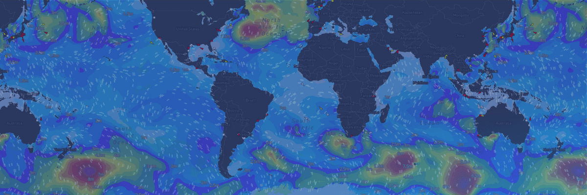
In recent years, due to the increasing extremes of meteorological and oceanographic conditions on a global scale, the shipping market has seen a yearly rise in safety risks for crew members, vessels, and cargo. Moreover, there are growing economic concerns, particularly around increased voyage duration on transoceanic voyages due to the higher frequency and wider geographic spread of extreme weather events. In response to this climate of growing risks, Weathernews (hereinafter referred to as our company), intends to reinforce our strategic route selection support for everyone in the shipping industry by maximizing our data utilization efforts and driving continuous technological advancement in weather routing solutions.
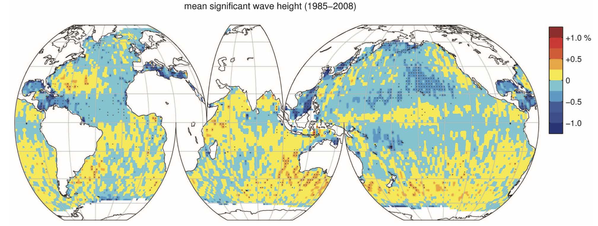
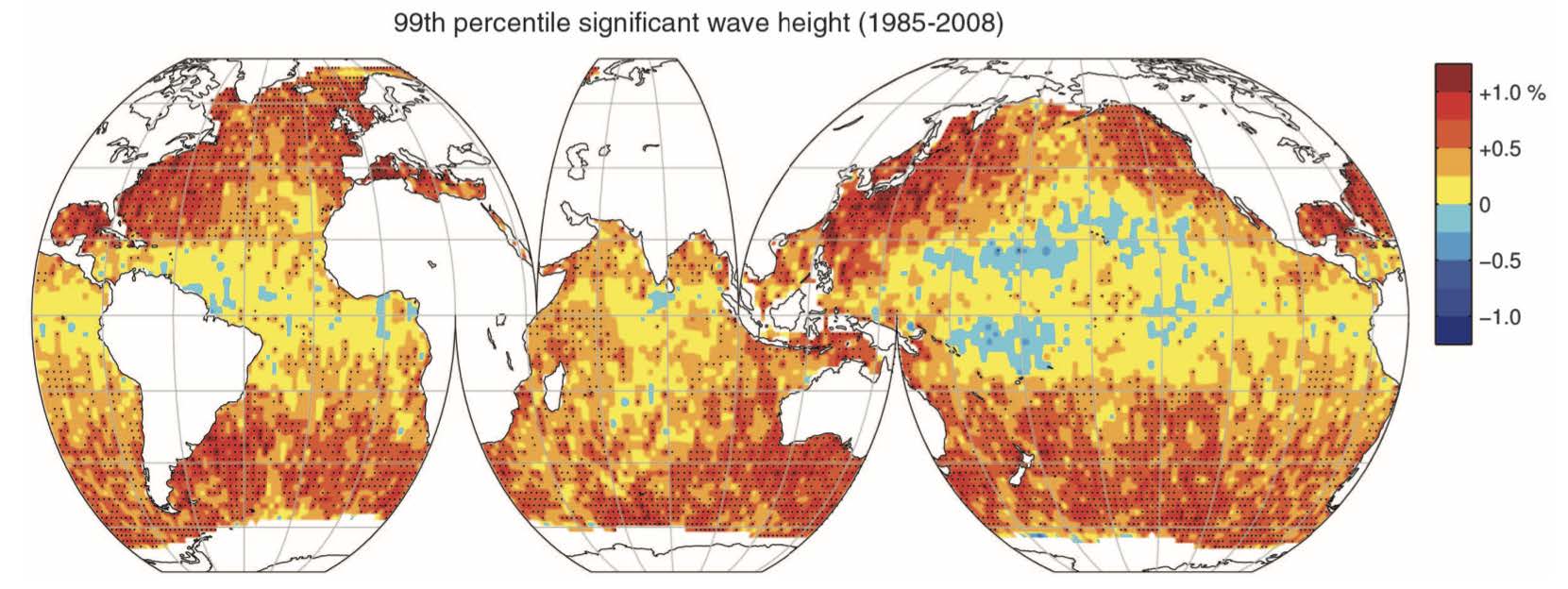
Figure 1. Top: Rate of change in mean wave heights from 1985-2008; Bottom: Rate of change in significant wave heights over the same period
(Note: While mean wave heights showed little change, maximum wave heights increased by around 1% annually, rising from 6m to 7.3m over the 20-year period)
Our Initiatives Towards Enhancing Wave Forecast Accuracy
1. Comparison of forecast models with major global meteorological agencies
At Weathernews, by utilizing global observational data and forecast models, we have developed our proprietary wave forecast model (COMPASS Wave). As shown in Figure 2, factors such as; horizontal resolution, forecast range, and update frequency of our model surpass those of major global meteorological agencies. Furthermore, while each agency’s forecast model has its strengths and weaknesses when it comes to forecast range and certain areas, (eg. typhoon forecast accuracy around Japanese waters); a notable strength of our in-house ensemble methods is that it accounts for those factors, thus increasing our forecast quality.
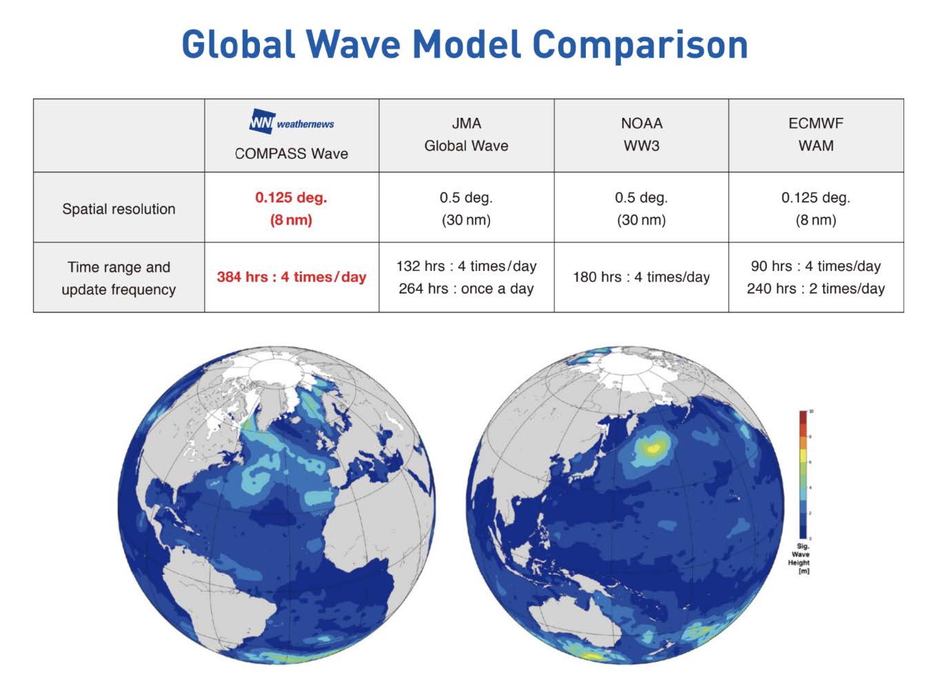
Figure 2. Comparison of Wave Forecast Models Between Our Company and Major Global Meteorological Agencies.
2. Enhancing Forecast Accuracy through Observation Data Collection and Assimilation
Concerning our routing solutions, as we aim to provide users with a nuanced and strategic selection of routes, we strive to collect and assimilate observational data from a comprehensive range of areas and sources For instance, in addition to Noon Reports (using our proprietary Quick Report Template, QRT) that we receive from vessels en route, we also collect and assimilate various additional data such as ASCAT satellite data, buoy data, and ship observation data. Assimilation of this observational data, along with enhancing the resolution of the model initialization grids (from 100km to 15km resolution), has allowed us to improve the accuracy of our wind speed forecasts.
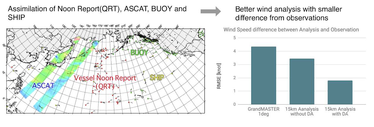
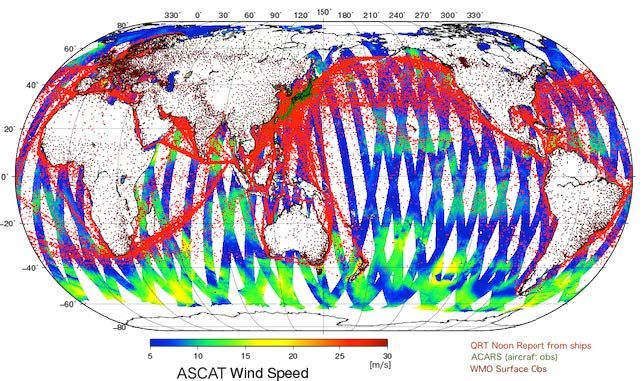
Figure 3. Improved Forecast Accuracy Through Assimilation of Various Observation Data Sources and Enhanced Initial Analysis Resolution
Regarding data collection and how to approach it, other private weather companies, aiming to improve their forecast accuracy, tend to use wave spectra data observed from ocean buoys. While this approach is useful for enhancing forecasts for stationary operations such as oil rigs, offshore wind farms, berthing or unberthing, and cargo handling, it faces significant limitations for routing purposes. Specifically, an extremely high quantity of ocean buoys would need to be installed to obtain observation data at a level useful for routing ocean-going vessels.
In practice, deploying several hundred drifting buoys, as seen with some private weather companies, results in weather observations limited to certain oceanic areas. These buoys often drift towards central oceanic regions due to currents. In contrast, Figure 4 illustrates the comprehensive global coverage provided by satellites and the widespread availability of QRT Reports along major shipping routes.
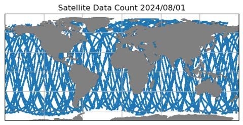
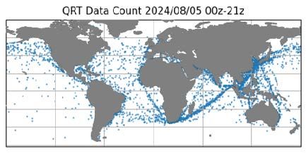
Figure 4. Top: Satellite observation data (data count: approximately 120,000 per day), Bottom: QRT data (data count: approximately 6,000 per day)
Table 1. Comparison of real-time observational data between types of marine observations
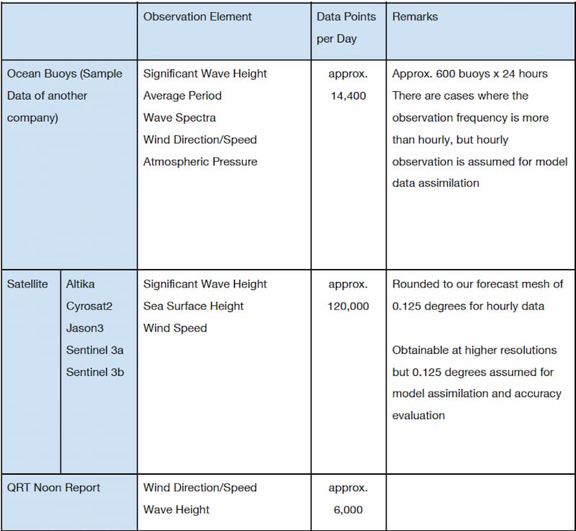
Moreover, as indicated in Table 1, the quantity of observational data, obtained from satellites, vastly exceeds the data available from ocean buoys. Our company leverages this, and validated proprietary vessel-reported data, allowing us to have an unparalleled data source that is both encompassing and nuanced, which we then use to increase forecast accuracy. Considering the above, it is clear that our company adopts a more effective approach when compared to others in terms of our data collection and assimilation methods.
3. Limitations of Initial Value Improvements in Wave Prediction and the Use of Probabilistic Forecasting
In the above section, we discussed the characteristics of various marine observation data sources and the approach of using them to improve forecast accuracy, there are limitations to enhancing initial conditions through such means. Figures 6 and 7 illustrate the differences between the initial value calculations of the 3-day and 4-day forecasts, respectively, where data assimilation was performed to improve the initial conditions and where it was not performed. As can be seen, the extent of these differences is minimal. In other words, while improved model initialization is effective for increasing the accuracy of short-term forecasts (within 3 days), beyond that range, the value of the improved initial accuracy is limited. Therefore, to achieve the optimal balance of safety, economic, and environmental factors for strategic route selection, an approach leveraging data and technologies from different perspectives is necessary.
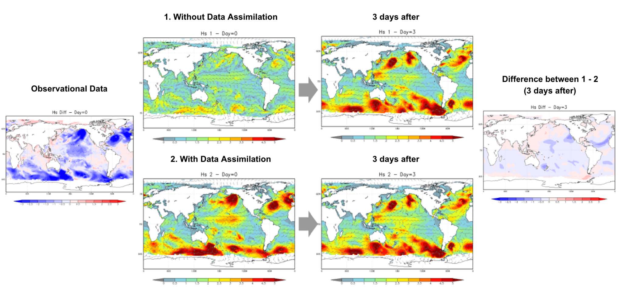
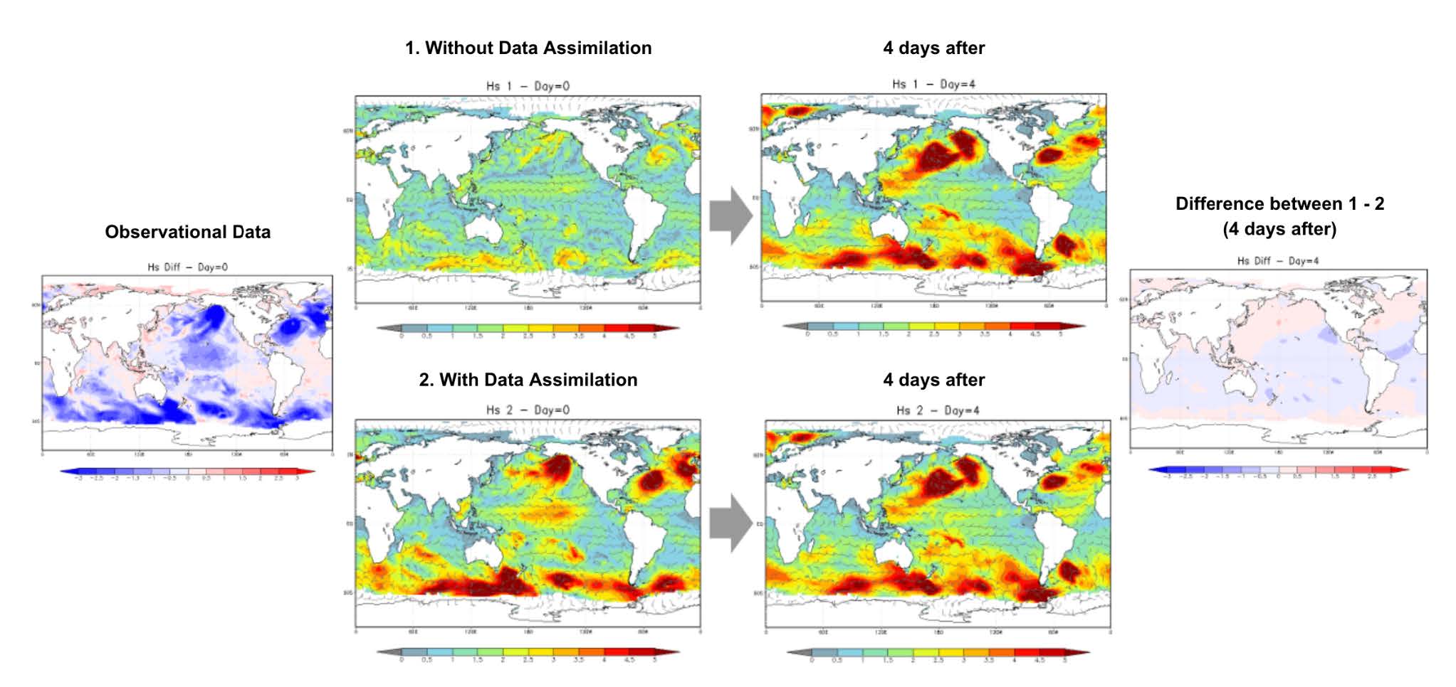
Figure 6. Difference between 4-day forecasts with and without initial condition improvements
As such, our company is currently developing a new approach by applying Wave Probabilistic Forecast Data. This technology utilizes ensemble forecasting and quantifies the range of forecast outcomes (the propagation range of waves in relation to the position and intensity development of low-pressure systems), primarily at medium-range forecasts (4-10 days ahead). A key feature of this approach is that while a deterministic forecast model allows for a single weather forecast scenario, utilising multiple weather scenarios (via ensemble forecasts) enables estimating the likelihood of particular outcomes, such as high wave occurrences - a probabilistic forecast.
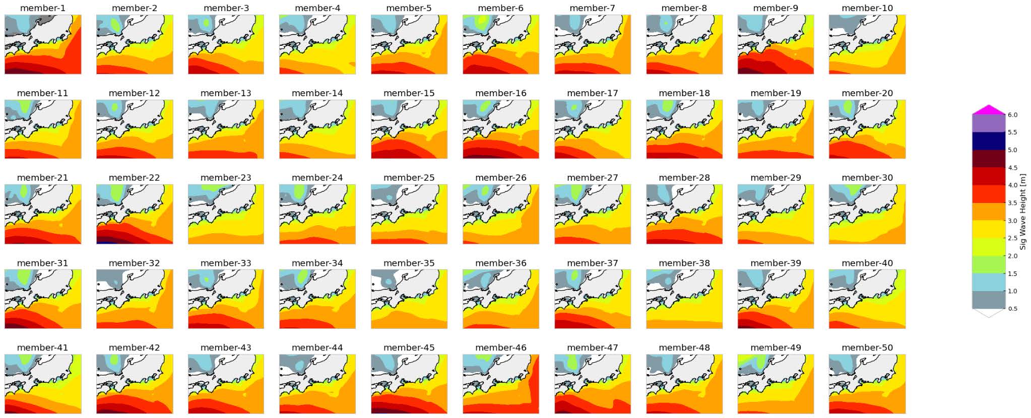
Figure 7. Ensemble Wave Forecast
When applied to routing, up until this point, routing has simply been avoiding high wave areas based on the single deterministic forecast, however, with probabilistic forecasts, this enables route selection that accounts for the probability of high wave areas in the surrounding regions. To illustrate this, Figure 9 presents the difference between the forecast outcomes; and as seen in the right image, with probabilistic forecasts, users can now choose the wave height thresholds they wish to avoid, and the likelihood of encountering those wave conditions.
Additionally, it is worth noting that a demerit of route selection based solely on single deterministic forecasts is that this tends to result in continuous and significant changes to the route and vessel speed every few hours in response to regular forecast updates and minor short-term forecast trend changes. This places a labor burden on crews and operators due to inconsistency and is also likely to increase voyage distances and fuel consumption, ultimately compromising overall voyage optimization.
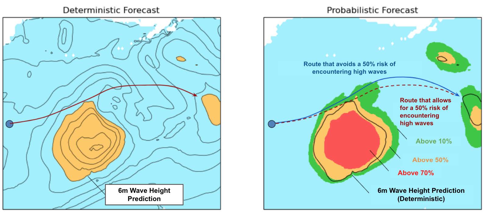
Figure 8. Comparison of Route Selection using Deterministic Forecast (Left) and Probabilistic Forecast (Right)
A strength that sets our company apart is our rich history of voyage support, which we make the most of through machine learning. One of the ways we do this is by utilizing machine learning to compare probabilistic forecast simulations against real data received from the voyages we’ve supported, allowing us to refine and improve our forecasts.
By employing probabilistic forecasts for voyage optimization, it becomes possible to consistently calculate numerous potential route options. The more route options there are, the more accurately we can recreate the actual situation of the vessel during that period. Therefore as the data allows for more potential outcomes that can be assessed, this enables us to continuously train and improve the models.
The following is a sample case study demonstrating the effectiveness of applying voyage optimization using Probabilistic Forecasting to an automobile carrier voyage where our company provided routing solutions (OSR: Optimum Ship Routing).
This voyage departed from the Port of Hueneme on February 22, 2024, and arrived at the Port of Hitachi on March 9th. As shown in Figure 10, three days after departure on February 25th, a decision was made to divert southward to avoid rough weather, resulting in a significantly longer voyage distance of 5,327 NM compared to the initial plan.
In contrast, Figure 11 displays the route generated (yellow line) based on a 30% probability of wave heights exceeding 5m as of February 23rd, the day after departure; along with the actual voyage route (blue line); and the route recommended by our OSR service at that time (orange line). According to this, if route selection using the probabilistic data had been performed on February 23rd based on avoiding a 30% probability of wave heights over 5m, the voyage distance would have been 4,995 NM, which is 332 NM shorter than the actual voyage route taken. In other words, route selection using the probabilistic data allowed for a more realistic route optimization strategy earlier in the voyage. (Note: Under our current weather solutions, route selection performed on February 22nd based on a 30% probability threshold did not offer the same route at the time)
Table 2. Case Study Summary

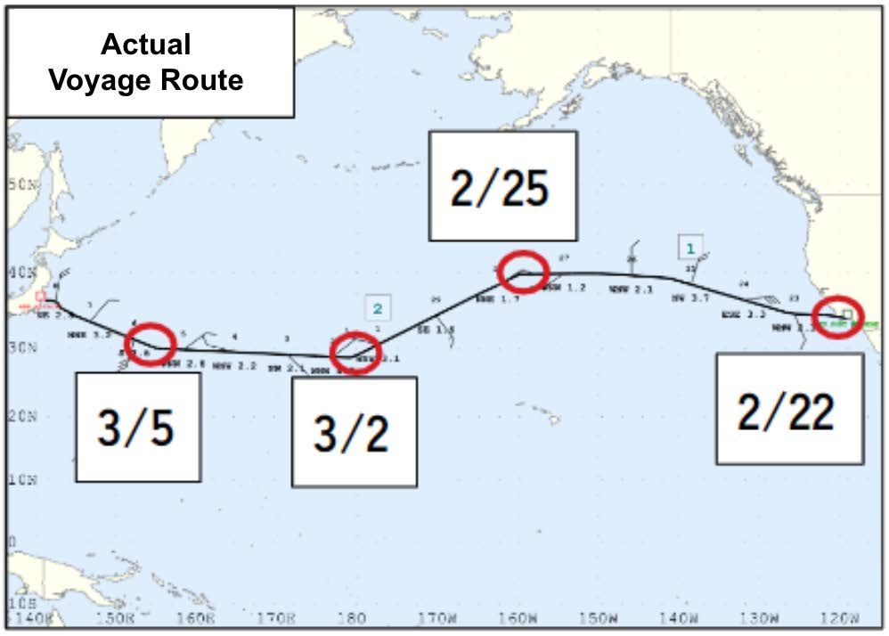
Figure 9. Actual route taken during the voyage
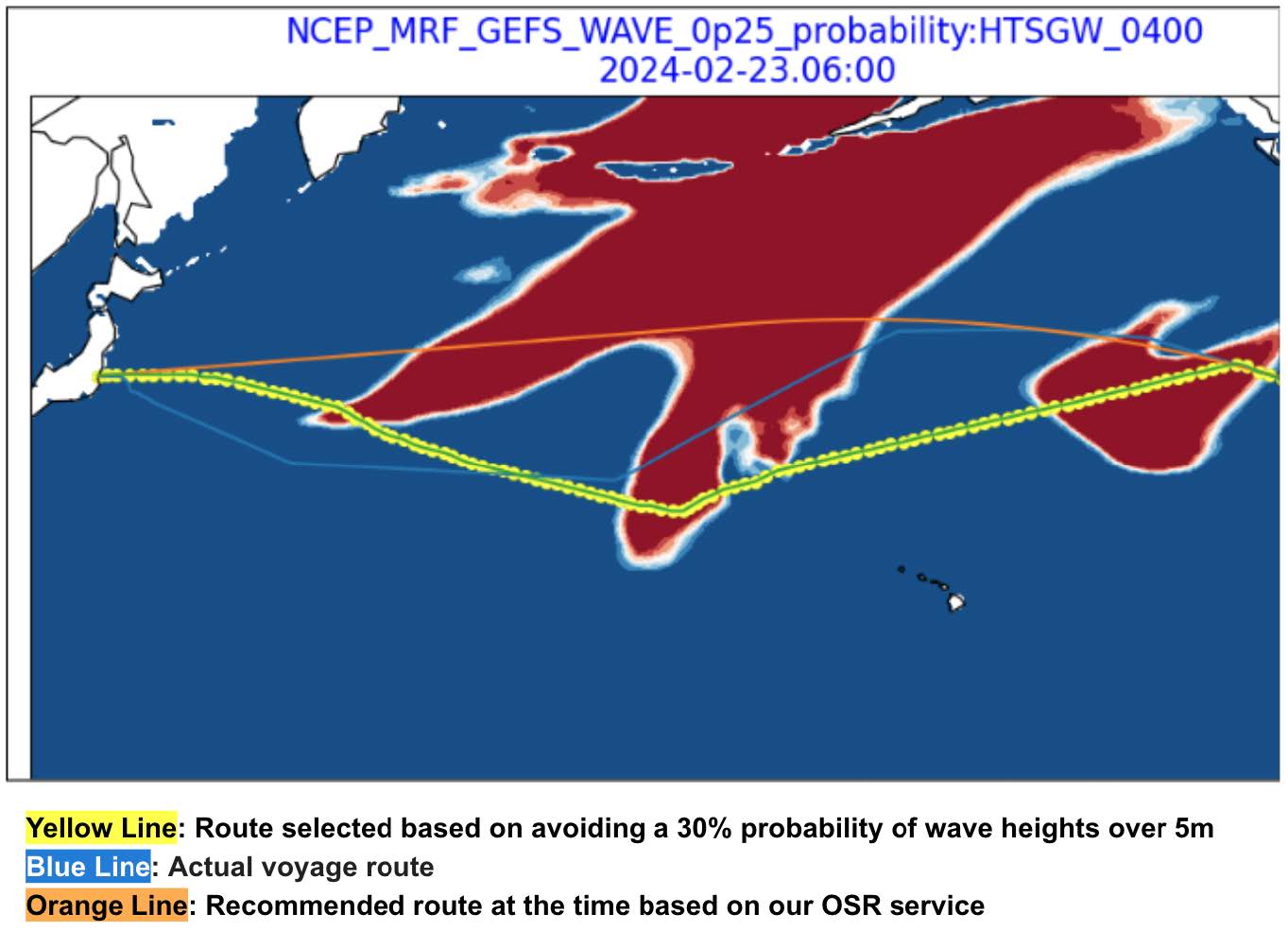
Figure 10. Comparison of various routes for the representative voyage (as of February 23)
Going forward, our company plans to release a new routing service option that provides access to our proprietary simulation engine utilizing the above-mentioned probabilistic forecasting. This will enable all users, both onboard and onshore, to independently explore route optimisation scenarios for themselves.
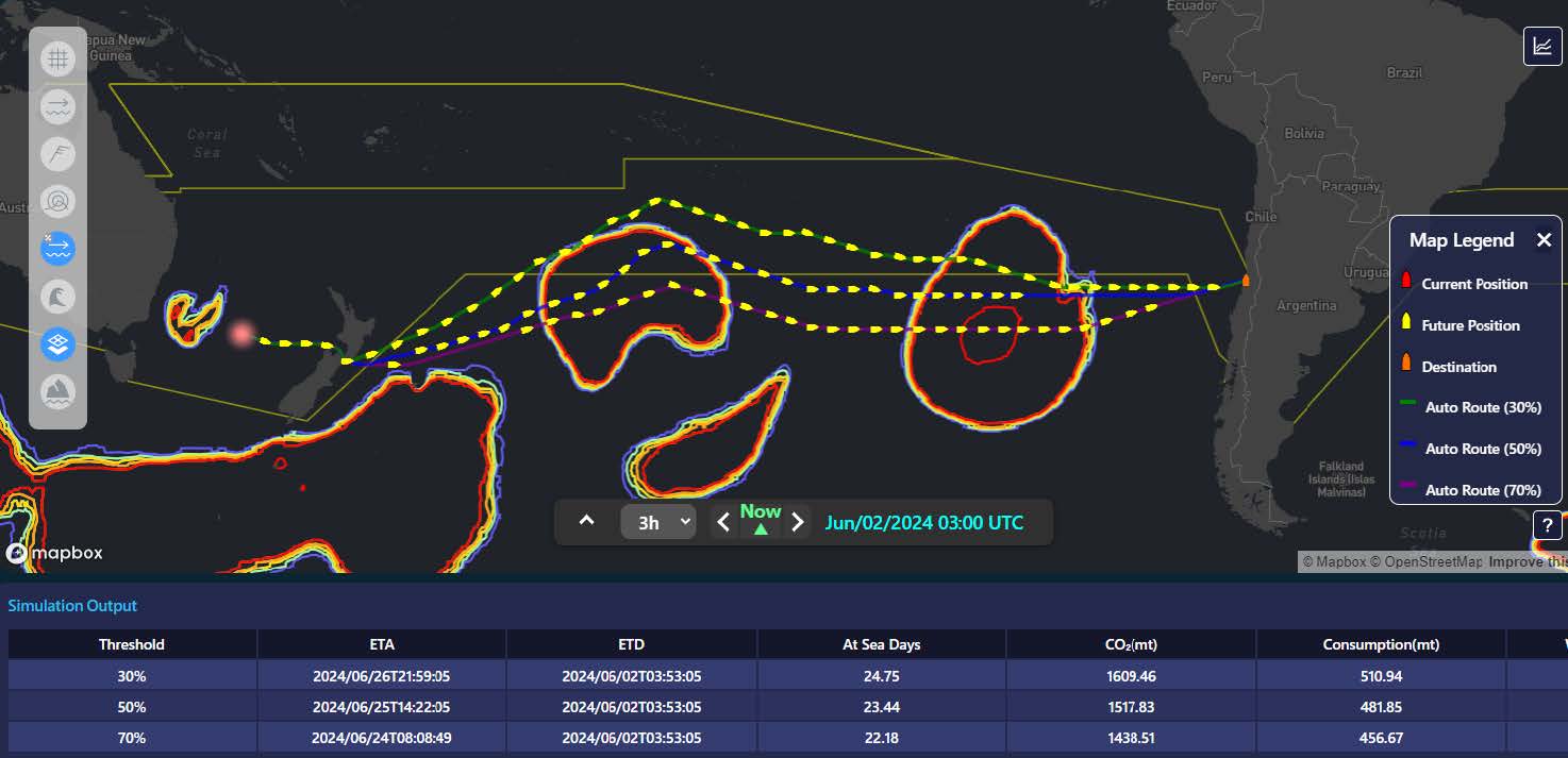
Figure 11. Product Image that is currently under development for onboard and onshore use
Point Summary
1. The process of generating initial conditions necessary for calculating forecasts using observation data is called data assimilation. Compared to localized wave observation data assimilation, wide-area data assimilation using satellite observations has exceptional advantages
2. While data assimilation contributes to improving forecast accuracy for forecasts 3 days ahead, it has minimal effect on enhancing forecast accuracy beyond 4 days ahead, which is necessary for selecting a strategic optimal route.
3. Localized point wave observations are the optimal solution for parameterizing regional weather characteristics over an extended period and then reflecting them in short-term, localized wave forecast models. Our company employs this data in our solutions to support berthing/unberthing at locations affected by seasonal long-period swells, such as oil rigs, offshore wind farms, and ports.
4. Route optimization using Probabilistic Forecasting is useful for risk management as it allows for a strategic route selection that achieves the optimal balance between the safety of crew, cargo, and vessel, while simultaneously considering schedules, operating costs, and environmental factors as well. This technology utilizes ensemble forecasting and quantifies the range of forecast trends (the propagation range of waves in relation to the position and intensity development of low-pressure systems), primarily at medium-range forecasts (4-10 days ahead).
5. In contrast, employing a single weather prediction model tends to lead to continuous and significant alterations in the voyage route and vessel speed every few hours in response to short-term forecast trend changes. This not only places a labor burden on crews and operators but is also likely to increase voyage distances and fuel consumption, potentially compromising overall voyage optimization.
Conclusion
In this paper, we have discussed the usefulness of employing various observation data sources to improve wave forecast accuracy, as well as the potential for developing new route optimization technologies based on probabilistic forecasting. Particularly regarding the latter and its prospective uses and how we will provide it as a service, we aim to pursue a co-creative and collaborative approach and welcome your valuable feedback, as we further its development and refinement.
Moving forward, our company is committed to developing next-generation weather routing solutions as well as continuously enhancing its qualities by leveraging our world-leading meteorological database and cutting-edge technologies. We kindly ask for your ongoing guidance and support in these endeavors. Thank you for your continued trust and partnership.
