Rapid Intensification From the Start
Typhoon Bavi formed as a tropical depression east of the Mariana Islands on July 2, rapidly intensifying to reach peak intensity within just three days. According to the Japan Meteorological Agency (JMA), the storm peaked on July 5–6 with a central pressure of 910 hPa and maximum sustained winds of 55 m/s (107 kt) — placing it at the top of JMA's intensity scale, equivalent to a Category 4–5 hurricane.
At its largest, Bavi's gale-force wind field extended 750 km (400 NM) from the center — large enough to blanket the entire Japanese mainland. Any vessel that assumed it was safely clear based on distance alone needed to reconsider.
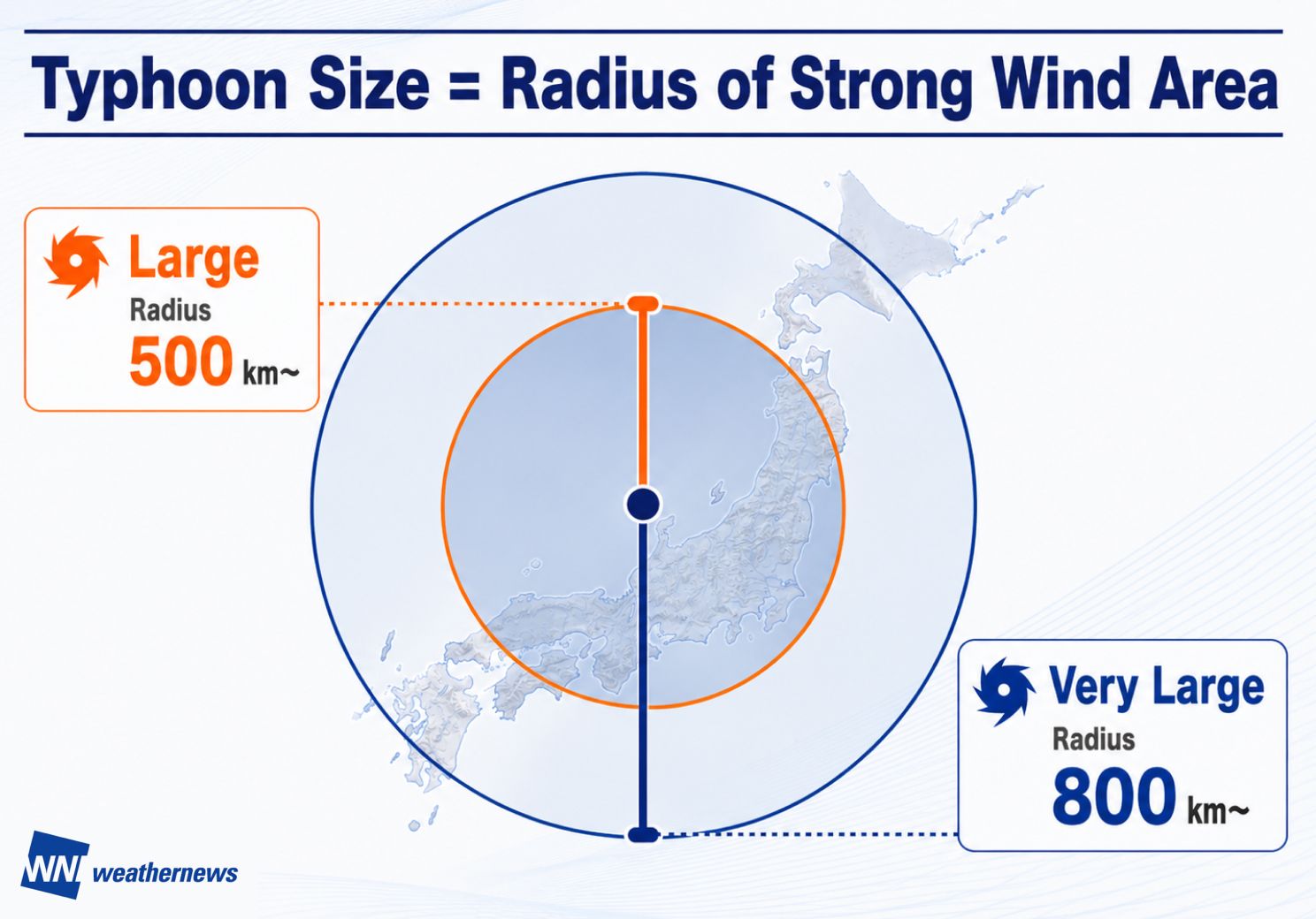
Under JMA's classification, a typhoon is considered "Large" when its gale-force wind radius reaches 500 km or more. At its peak, Typhoon Bavi's wind field extended 750 km — wide enough to cover the entire Japanese mainland. (Infographic: Weathernews)
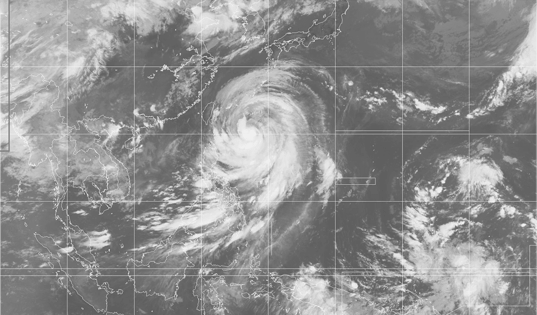
Typhoon Bavi at its largest, with gale-force winds extending 750 km (400 NM) from the center. Source: Japan Meteorological Agency (JMA). Composite satellite imagery, July 9, 2026 15:30 UTC.
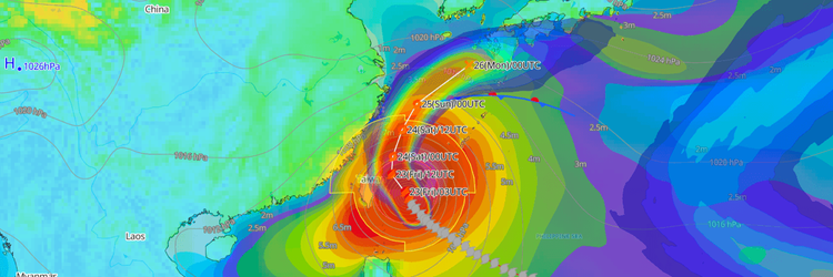
Bavi remained active for exactly 13 days, tracking westward across the Philippine Sea, through the Sakishima Islands corridor, making landfall near Yuhuan, Taizhou City, Zhejiang Province on July 12, before transitioning to an extratropical low over the Sea of Japan on July 15.
The Dangerous Semicircle in Action
Bavi offered a textbook demonstration of the dangerous semicircle effect. As the storm tracked northwestward through the Okinawa region, stations on the eastern semicircle recorded devastating gusts — 45.3 m/s (88 kt) at Kumejima Airport and 42.7 m/s (83 kt) at Miyakojima — both located more than 200 km from the typhoon's center. Stations on the western semicircle, by contrast, experienced comparatively lighter conditions at identical distances.
A post-storm survey conducted via the Weathernews consumer app found that 48% of respondents on Okinawa's main island — more than 200 km from the center — reported impacts worse than expected. Storm size and semicircle position matter as much as distance from the eye.
Regional Impact
Bavi did not tell one maritime story — it told three, each playing out differently depending on where a vessel happened to be.
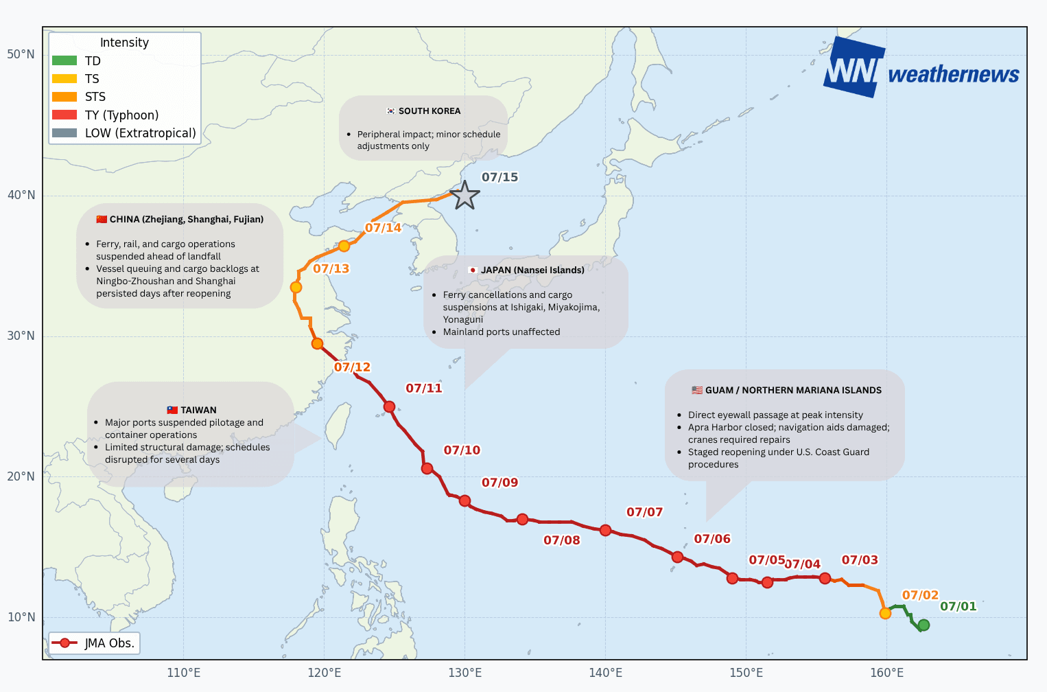
Mariana Islands — Direct Hit, Structural Damage
Guam, Rota, Saipan, and Tinian bore the brunt of Bavi's peak intensity as the eyewall passed directly overhead at violent typhoon strength. Apra Harbor in Guam was closed for channel inspections, with navigation aids displaced, marine communications damaged, and container cranes requiring repairs before resuming operations. The U.S. Coast Guard-led staged port reopening procedures, including daylight-only operations at Tinian while inspections continued.
Rota suffered the most severe damage — the island's mayor described virtually "every aspect" of infrastructure as damaged or destroyed. On shore, widespread power outages and infrastructure damage were reported, though major casualties remained limited.
“From the Operations Desk
On July 3, an iron ore carrier en route from Western Australia to Japan was transiting southeast of Mindanao when analysis revealed its original direct route would take it into Typhoon Bavi's projected weather zone. In consultation with the operator, Weathernews recommended a westward route deviation combined with a speed increase — securing a safe distance from the typhoon while keeping the voyage moving. The vessel completed the passage without any stoppage or sheltering, a direct result of acting on the forecast early enough to make a meaningful course change.”
Nansei Islands & Taiwan — Precautionary Shutdown, Limited Structural Damage
Japan's Nansei Islands — particularly Ishigaki, Miyakojima, and Yonaguni — experienced ferry cancellations, cargo operation suspensions, and power disruptions. Around 27,000 households lost power across Okinawa Prefecture, and over 200 flights were canceled. Mainland Japan ports including Yokohama, Nagoya, and Kobe were essentially unaffected.
In Taiwan, all major commercial ports — Keelung, Taichung, Kaohsiung, and Taipei Port — suspended pilotage and container operations as a precaution. Over 1,200 flights were canceled or delayed, mountain areas recorded over 700 mm of rainfall, and 134 people were injured. Despite the scale of disruption, Taiwan's modern port infrastructure sustained limited physical damage, with operations resuming progressively after the storm.
“From the Operations Desk
With Bavi approaching the Sakishima corridor, a vessel bound for the Tsushima Strait faced a critical timing decision. Weathernews advised a modest increase in engine output, allowing the ship to transit the strait approximately 6–7 hours earlier than originally scheduled — significantly reducing its exposure to typhoon swell. A small operational adjustment with a measurable safety payoff.”
Eastern China — The Logistics Ripple Effect
Bavi's landfall near Yuhuan, Taizhou City, Zhejiang on July 12 struck one of the world's busiest shipping corridors. Ports across Ningbo-Zhoushan, Shanghai, Wenzhou, and Fujian's coastline suspended ferry services, recalled fishing fleets, and halted container operations ahead of landfall. More than 1.8 million people were evacuated nationally, over 650 flights were canceled across Shanghai and Hangzhou, and rail and ferry services were widely suspended.
While major terminal infrastructure held up well, the greater impact was logistical: vessel queuing outside ports, export delays, and cargo backlogs that persisted for days after reopening. Given that Ningbo-Zhoushan and Shanghai rank among the world's busiest container ports, even brief disruptions carry significant supply chain consequences well beyond the immediate region.
“From the Operations Desk
Predicting when a port will reopen after a typhoon is as critical as the storm forecast itself. Residual swell — not wind — often determines the actual reopening window. For a container vessel bound for Kaohsiung, Weathernews provided a recommended time of arrival (RTA) precisely calibrated to post-typhoon swell conditions. Kaohsiung Port reopened on July 11 at 18:00 — and the vessel entered with the first group of ships after reopening, avoiding the backlog that accumulated for later arrivals. The decision was reached collaboratively between the shore team, the master, and Weathernews forecasters — all working from the same meteorological and oceanographic data in real time via a shared platform. With fuel costs under constant pressure, minimizing time at anchor translates directly to the bottom line.”
Philippines — An Indirect but Deadly Impact
Bavi never made landfall in the Philippines, but its interaction with the Southwest Monsoon (Habagat) amplified rainfall across multiple provinces — killing 18 people, leaving 12 missing, and displacing over 16,200 into evacuation centers. A typhoon's reach extends well beyond its track.
The Storm Wasn't Done After Landfall
Bavi's transition to an extratropical low on July 15 did not mark the end of its impact. Retaining significant moisture from its tropical origins, the system continued tracking northeastward — bringing heavy rainfall warnings to northeastern China, the Korean Peninsula and northern Japan. The lesson for operators: monitor the full lifecycle, not just the tropical phase.
Key Takeaways
Size and semicircle position matter. A 750 km gale-force wind radius puts vessels at risk far beyond where most expect danger — and the eastern semicircle consistently produced the most destructive conditions.
Port reopening is a forecast problem. Residual swell keeps ports closed long after winds ease — accurate swell forecasting is as critical as the storm forecast itself.
Act early. Over 400 consultation calls during Bavi reflect an industry that treats weather routing as an active, ongoing process — not a one-time pre-departure check.