About This Outlook
As part of our ongoing commitment to supporting mariners and helping stakeholders monitor significant weather conditions, Weathernews has been providing regular port weather highlights across the Arabian Sea and Indian Ocean during the Southwest Monsoon. With the monsoon season now winding down in these regions, we are shifting our focus to the North Pacific and North Atlantic — two key regions where developing weather systems and adverse sea conditions can significantly impact maritime operations.
This week’s outlook highlights notable weather systems and areas of concern across both regions, helping ship operators and other stakeholders anticipate potential challenges to maritime operations.
North Pacific Ocean
Weathernews Maritime Forecaster comment:
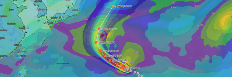
In the Northwest Pacific, Typhoon No. 29 (Koguma) is moving northeastward, accompanied by storm-force winds. While it is expected to transition into an extratropical cyclone tomorrow, the 14th, vessels should remain cautious of persistent high waves exceeding 6 meters through October 15th.
Additionally, between October 14th and 16th, a developing low-pressure system will track from south of the Aleutian Islands toward the Gulf of Alaska. This will generate strong winds and high waves of around 5 meters over a wide area in the Northeast Pacific.
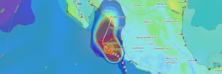
From the latter half of the week into the weekend, a tropical depression near the Mariana Islands is forecast to intensify as it moves westward. There is a risk that it could impact Taiwan and Japan as a typhoon next week. Meanwhile, south of Mexico, Hurricane Simon and a subsequent developing tropical depression are expected to approach the southern coast. Mariners are advised to remain on alert for intermittent severe winds and rough seas in this region.
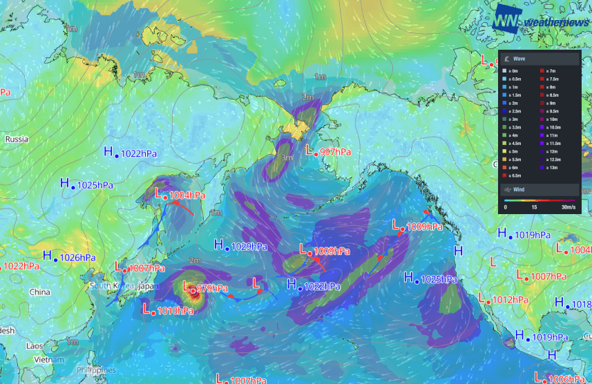
Surface pressure, wind and wave patterns over the North Pacific Ocean, valid October 13, 2026, 06:00UTC
■ Key heavy weather areas:
- Oct 13–15: Far east of Japan to south of the Aleutian Islands (Typhoon No. 29 Koguma)
- Oct 14–16: Gulf of Alaska (Developing low-pressure system)
- Oct 15–Next week: Waters east of the Philippines (Tropical depression)
- Oct 13–Next week: South of Mexico (Multiple tropical depressions)
North Atlantic Ocean
Weathernews Maritime Forecaster comment:
This week, heavy seas are expected in the North Atlantic, primarily in the higher latitudes. From October 13th to the 14th, a low-pressure system will intensely develop south of Greenland. On October 15th, it will pass over Iceland and advance into the Norwegian Sea, generating high waves exceeding 6 meters over a wide area through the latter half of the week.
Later in the week, there is a risk of low-pressure systems rapidly developing off the west coasts of Canada and the United States. While the peak wave heights are expected in the Labrador Sea and around Greenland, vessels must also remain cautious of a sudden intensification of winds off the East Coast of North America.
Additionally, in the eastern Mediterranean Sea, a low pressure system is expected to develop from today, October 13th, through the 14th. While wave heights are forecast at 3 to 4 meters, please remain alert for localized high waves and strong winds.
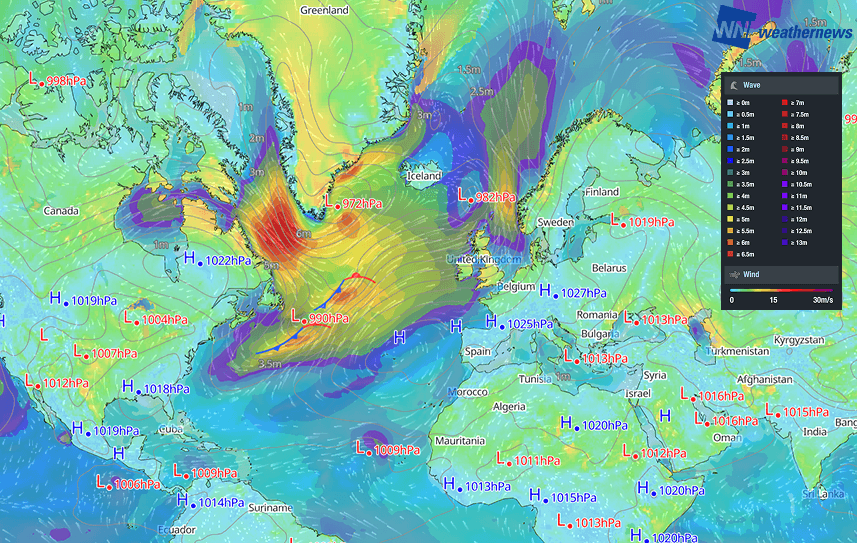
Surface pressure, wind and wave patterns over the North Atlantic Ocean, valid October 13, 2026, 06:00UTC
■ Key heavy weather areas:
- Oct 13–17: South of Greenland to the Norwegian Sea (Intensely developing low-pressure system)
- Oct 15–16: Around the Gulf of St. Lawrence (Rapidly developing low-pressure system)
- Oct 17–18: East Coast of North America (Rapidly developing low-pressure system)
- Oct 13–15: Eastern Mediterranean Sea (Low-pressure system)
Disclaimer: This outlook is provided for informational purposes only; our actionable, ship-specific advisories are exclusively available through our paid maritime solutions. Weathernews Inc. assumes no liability for navigational decisions, losses, or damages resulting from reliance on this general overview.