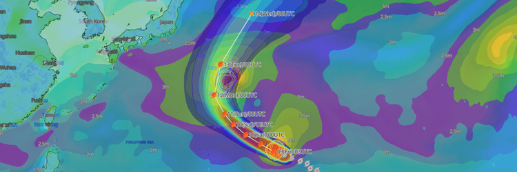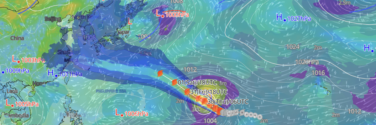
Classified as violent by the Japan Meteorological Agency (JMA)—the agency's highest intensity designation, Typhoon No. 13 (Dolphin) is currently tracking west-northwestward through the open Western Pacific near Wake Island, packing maximum sustained winds of 110 kt (204 km/h). Further intensification is expected over the next 24 hours before a gradual weakening trend begins from 3 August.
CURRENT STATUS
Based on the latest JMA observations on July 30, 2026 03:45 UTC
- Location: 16.7°N, 165.3°E — near Wake Island, Western Pacific
- Classification: Violent Typhoon
- Movement: West-northwest at 20 km/h (11 kt)
- Central pressure: 910 hPa
- Maximum sustained winds: 110 kt (204 km/h)
- Maximum gusts: 155 kt (287 km/h)
- ≥50-kt wind area: 150 km (80 NM) all directions
- ≥30-kt wind area: 330 km (180 NM) north, 220 km (120 NM) south
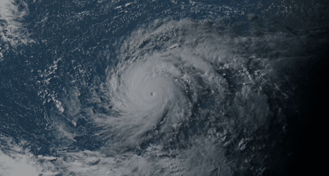
Himawari Satellite Image valid July 30, 2026 07:50 UTC
FORECAST TRACK SUMMARY
Typhoon No. 13 (Dolphin) is forecast to track west-northwestward across the Western Pacific before shifting westward, approaching the Ogasawara Islands region by 4 August.
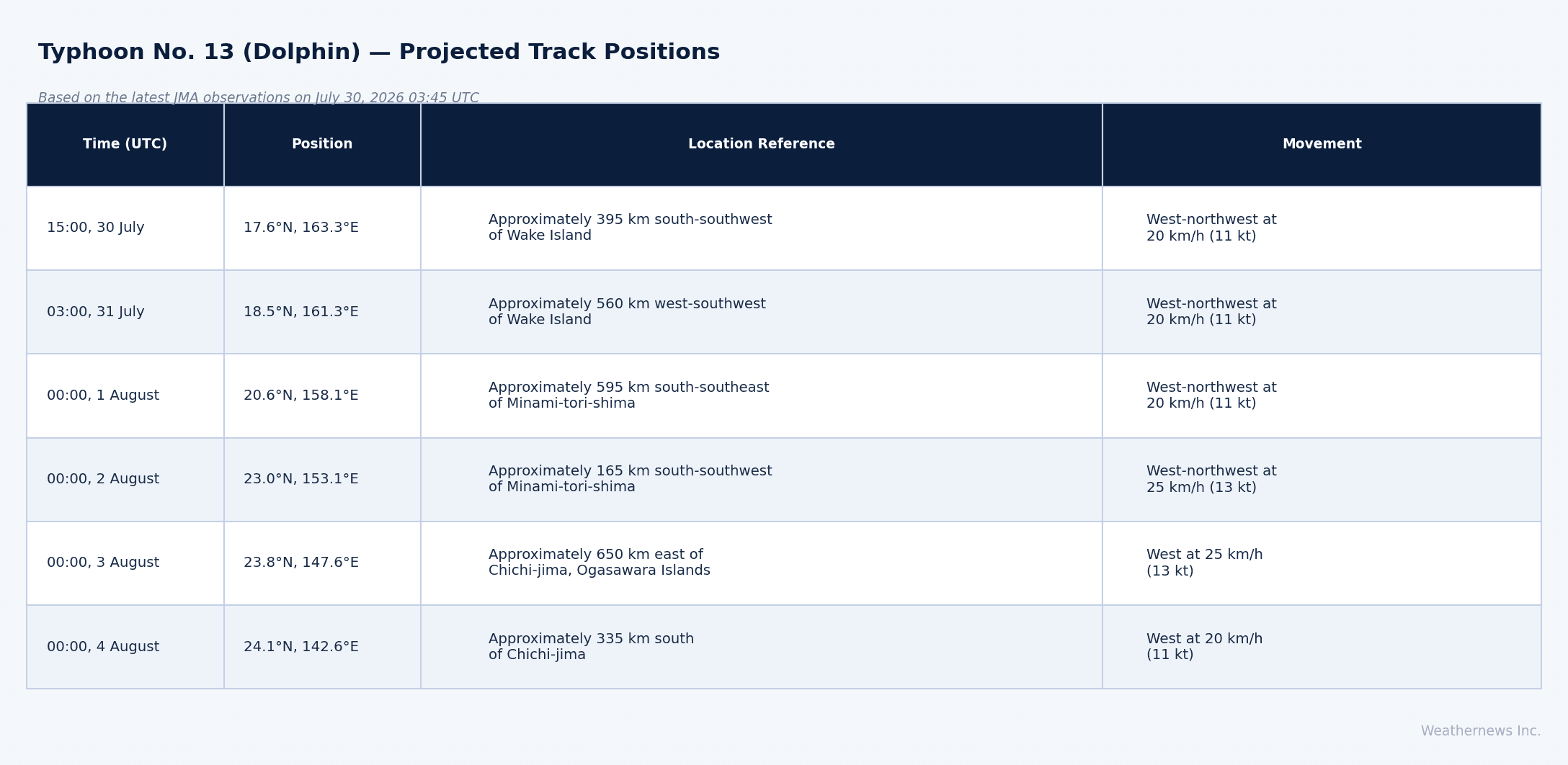
INTENSITY FORECAST
Further intensification is expected, with Typhoon No. 13 (Dolphin) forecast to reach peak intensity of 115 kt (213 km/h) sustained winds with gusts to 165 kt (306 km/h) and a minimum central pressure of 905 hPa by 15:00 UTC on 30 July, maintaining this peak through 03:00 UTC on 31 July. Gradual weakening then follows, with central pressure rising to 910 hPa and sustained winds easing to 110 kt (204 km/h) by 00:00 UTC on 1 August and 105 kt (194 km/h) by 00:00 UTC on 2 August. The system is expected to weaken from the violent category to very strong typhoon by 00:00 UTC on 3 August, with central pressure at 925 hPa and sustained winds of 100 kt (185 km/h). Further weakening continues to 90 kt (167 km/h) with a central pressure of 940 hPa by 00:00 UTC on 4 August.
IMPACTS & THREATS
Tracking west-northwestward across the open Western Pacific through 4 August, the storm presents severe hazards for maritime operations across a wide area near and ahead of its track. No coastal watches or warnings are currently in effect.
Wind: The ≥50-kt wind area currently extends 150 km (80 NM) in all directions from the typhoon's centre, expanding to 220 km (120 NM) by 15:00 UTC on 30 July and reaching 300 km (160 NM) by 00:00 UTC on 1 August. The ≥30-kt wind area currently extends 330 km (180 NM) to the north and 220 km (120 NM) to the south of the centre. Vessels operating within these zones face violent to extreme conditions.
Storm Warning Area: The zone within which storm-force winds are possible—accounting for track uncertainty, expands from 220 km (120 NM) at 15:00 UTC on 30 July to 480 km (260 NM) by 00:00 UTC on 4 August, reflecting the growing forecast uncertainty and increasing hazard footprint as the storm approaches the Ogasawara region.
Weathernews Inc. assumes no liability for navigational decisions, losses, or damages resulting from reliance on this general overview.
While official observations guide the general threat assessment, highly detailed, proprietary routing and port forecasts are essential for safe navigation. Weathernews services provide customers with 24/7 localized data to ensure your vessels remain safe and well-informed. Please consult our dedicated services for the most up-to-date, detailed predictions for your specific routes and operations.
Note on the storm's name: "Dolphin" is drawn from the Western North Pacific and South China Sea tropical cyclone name list, contributed by Hong Kong, China. The WMO and the ESCAP/WMO Typhoon Committee adopt these names sequentially to make tracking specific storms straightforward and to quickly communicate warnings. To learn more about how storms are named, please visit the World Meteorological Organization (WMO) website.