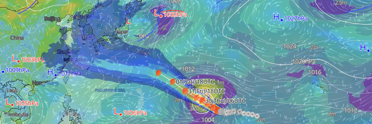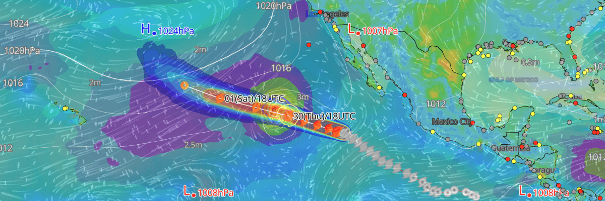
Tropical Storm Genevieve continued losing intensity on July 30, as it moved west-northwest across the open Eastern North Pacific, posing no direct threat to land. However, swells generated by the storm are already reaching the Baja California Peninsula and Southern California, producing life-threatening surf and rip current conditions expected to persist through August 2. As of 03:00 UTC July 31, maximum sustained winds stood at 60 kt (70 mph) with gusts to 75 kt (85 mph), and minimum central pressure was 989 mb.
CURRENT STATUS
Based on the latest NHC Public Advisory analysis on July 31, 2026 03:00 UTC
- Location: 21.3°N, 126.0°W—approximately 1,665 km (1,035 mi) W of the southern tip of Baja California
- Intensity: Tropical Storm
- Movement: West-northwest at 24 km/h (13 kt)
- Central pressure: 989 mb
- Maximum sustained winds: 70 mph (110 km/h / 60 kt)
- Gusts: 75 kt (139 km/h)
- 50-kt (storm-force) radius: up to 93 km (50 mi) from centre
- 34-kt (tropical-storm-force) radius: up to 205 km (110 mi) from centre
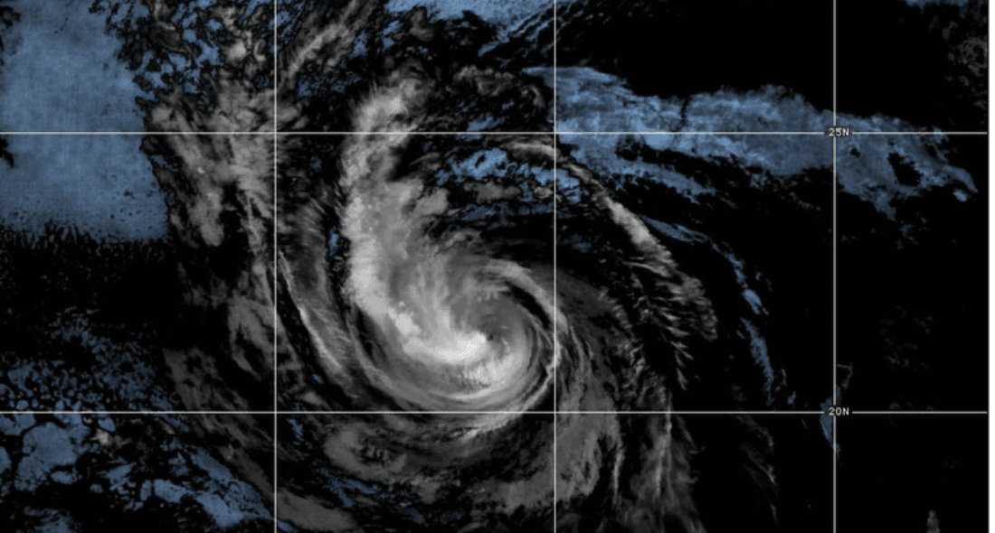
GOES Image Viewer (GeoColor) valid 31 July, 2026 04:10 UTC
FORECAST TRACK SUMMARY
Tracking west-northwestward across the open Eastern North Pacific, Tropical Storm Genevieve is steered by a strengthening ridge to its north and is forecast to continue on this general heading through August 2.
At 03:00 UTC July 31, the centre is located near 21.3°N, 126.0°W—approximately 1,665 km (1,035 mi) west of the southern tip of Baja California. By 12:00 UTC on July 31, the centre is projected near 21.8°N, 128.0°W, approximately 1,864 km (1,159 mi) west of the southern tip of Baja California and 2,824 km (1,755 mi) east of Hilo, Hawaii. By 12:00 UTC August 2 , the storm is forecast near 24.1°N, 136.4°W approximately 1,737 km (1,079 mi) ENE of Hilo, approaching the 140°W boundary between the Eastern and Central Pacific basins.
Tropical Storm Genevieve is forecast to cross into the Central Pacific basin and transition to a post-tropical system near 26.1°N, 141.5°W by 00:00 UTC on August 3—approximately 1,563 km (971 mi) ENE of Hilo. The post-tropical remnant low is then projected near 31.7°N, 146.8°W by 00:00 UTC on August 5, approximately 1,571 km (976 mi) NNE of Hilo, as it continues drifting northwestward into the open North Pacific.
Average track forecast errors are approximately 100 NM (185 km) by August 4 and 125 NM (232 km) by August 5, with intensity errors of approximately 15 kt per day across the extended period.
INTENSITY FORECAST
At 03:00 UTC on July 31, Tropical Storm Genevieve carries maximum sustained winds of 60 kt (110 km/h). The system is forecast to weaken gradually as it tracks over progressively cooler waters and into an increasingly unfavourable atmospheric environment. By 12: 00 UTC on July 31, sustained winds are expected to ease to 55 kt (100 km/h), declining further to 50 kt (95 km/h) by 00:00 UTC on August 1 and maintaining that intensity through 12:00 UTC on August 1. Winds are forecast to continue falling to 45 kt (85 km/h) by 00:00 UTC on August 2 and 40 kt (75 km/h) by 1200 UTC on August 2.
Genevieve is expected to lose tropical cyclone status and transition to a post-tropical system at approximately 35 kt (65 km/h) by 00:00 UTC on August 3, becoming a post-tropical remnant low at 30 kt (55 km/h) by 00:00 UTC on August 4, and weakening to 25 kt (45 km/h) by 00:00 UTC on August 5.
IMPACTS & THREATS
Tracking west-northwestward across the open Eastern North Pacific through August 5, Tropical Storm Genevieve presents hazards for maritime operations across a wide area while generating swells affecting the coastlines of Baja California and Southern California.
Surf: Swells generated by Tropical Storm Genevieve are currently affecting the Baja California Peninsula and Southern California coastlines, likely to cause life-threatening surf and rip current conditions through at least August 2.
Winds: Winds of 50 kt (93 km/h) or greater currently extend up to 50 NM (93 km) to the northeast, southeast, and northwest, and 40 NM (74 km) to the southwest of the storm's centre. The 34-kt (63 km/h) wind field extends up to 110 NM (204 km) to the northwest, its widest extent and 80 NM (148 km) to the southwest. As Tropical Storm Genevieve continues to weaken, both wind fields are forecast to contract progressively through August 3 as the system transitions to a post-tropical remnant low.
Waves: Significant wave heights of 4 meters or greater extend up to 210 NM (389 km) to the northeast and northwest, and 120 NM (222 km) to the southeast and southwest of Tropical Storm Genevieve's centre, posing a significant hazard for vessels operating in the Eastern North Pacific in the vicinity of the storm.
Advisories referenced are issued by the National Hurricane Center (NHC), a division of the National Oceanic and Atmospheric Administration (NOAA), providing official track, intensity, and hazard forecasts for tropical cyclones in the Atlantic and Eastern Pacific basins.
Weathernews Inc. assumes no liability for navigational decisions, losses, or damages resulting from reliance on this general overview.
While official observations guide the general threat assessment, highly detailed, proprietary routing and port forecasts are essential for safe navigation. Weathernews services provide customers with 24/7 localized data to ensure your vessels remain safe and well-informed. Please consult our dedicated services for the most up-to-date, detailed predictions for your specific routes and operations.
Note on the storm's name: "Genevieve" is drawn from the 2026 Eastern North Pacific tropical cyclone name list, the seventh name in the season's sequence. Eastern North Pacific tropical cyclone names are pre-selected from six rotating lists. To learn more about how storms are named, please visit the World Meteorological Organization (WMO) website.