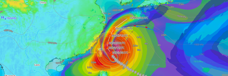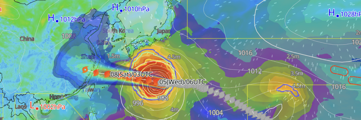
Now classified as a large and very strong typhoon, Typhoon No. 13 (Dolphin) is tracking steadily westward south of Japan, with a close approach to the Okinawa main island region forecast for 7 August before the system enters the East China Sea. Violent winds, extreme wave heights, heavy rainfall, and storm surge are forecast for the Okinawa and Amami regions through around 9 August, with conditions severe enough to partially collapse structures, according to the Japan Meteorological Agency (JMA).
CURRENT STATUS
Based on the latest JMA observations on August 5, 2026 03:45 UTC
- Location: 25.6°N, 137.8°E — approximately 1,010 km east-northeast of Naha, Okinawa (south of Japan)
- Classification: Large and Very Strong Typhoon
- Movement: West at 20 km/h (10 kt)
- Central pressure: 945 hPa
- Maximum sustained winds: 85 kt (157 km/h)
- Maximum gusts: 120 kt (222 km/h)
- ≥50-kt wind area: 185 km (100 NM) all directions
- ≥30-kt wind area: 700 km (375 NM) north, 560 km (300 NM) south

Himawari Satellite Image valid August 5, 2026 06:10 UTC
FORECAST TRACK SUMMARY
Tracking westward toward the Okinawa main island region, Typhoon No. 13 (Dolphin) is projected to pass near the Ryukyu Islands before entering the East China Sea. The storm is expected to slow considerably from 9 August, prolonging the hazard window.

INTENSITY FORECAST
Currently at Very Strong intensity, Typhoon No. 13 (Dolphin) is forecast to downgrade to the Strong category—sustained winds of 80 kt (148 km/h) with gusts to 115 kt (213 km/h) from 15:00 UTC on 5 August, maintaining this intensity through 00:00 UTC on 8 August as the storm passes through the Okinawa region. Gradual weakening follows as the system slows over the East China Sea, with sustained winds easing to 70 kt (130 km/h) and central pressure at 955 hPa by 00:00 UTC on 9 August, declining further to 65 kt (120 km/h) at 960 hPa by 00:00 UTC on 10 August.
IMPACTS & THREATS
Approaching the Okinawa and Amami regions before entering the East China Sea, the typhoon is forecast to bring violent winds, dangerous waves, heavy rainfall, and storm surge across a broad arc of southwest Japan.
Violent Winds: From 6 August onward, conditions will deteriorate sharply across Okinawa. Maximum sustained winds of 78 kt (144 km/h) with gusts to 117 kt (216 km/h) over the Okinawa region on both 6 and 7 August, described as capable of partially collapsing structures. The Amami region faces maximum sustained winds of 45 kt (83 km/h) with gusts to 68 kt (126 km/h) on 6 August, strengthening to 58 kt (108 km/h) sustained with gusts to 88 kt (162 km/h) on 7 August. The Ogasawara Islands and Okinawa region will experience maximum sustained winds of 39 kt (72 km/h) with gusts to 58 kt (108 km/h) on 5 August ahead of the storm's arrival.
Dangerous Waves: Seas will reach extreme heights across the Ogasawara Islands, Izu Islands, Okinawa, Amami, Southern Kyushu, and Shikoku regions as the typhoon approaches. On 5 August, wave heights of 9 metres with swells are forecast for both the Okinawa region and the Ogasawara Islands, with 6 metres expected across the Amami region and Izu Islands. Conditions intensify sharply from 6 August, with waves reaching 10 metres with swells across both Okinawa and Amami—levels sustained through 7 August. Southern Kyushu faces 8-metre seas with swells on 6 and 7 August, while Shikoku can expect 6 metres with swells over the same period.
Heavy Rainfall: Very heavy rainfall is forecast across Okinawa, Amami, and southern Kyushu as the typhoon approaches and stalls. In the 24 hours from 21:00 UTC on 5 August to 21:00 UTC on 6 August, accumulations are forecast to reach 120 mm over Okinawa, 100 mm over Amami, and 150 mm over southern Kyushu. Rainfall then intensifies in the following 24-hour period — from 21:00 UTC on 6 August to 21:00 UTC on 7 August — with 200 mm forecast across all three regions, significantly increasing the risk of flash flooding, landslides, and river overflow.
Storm Surge: Strict vigilance for storm surge along the Okinawa coast is warned on 7 August. Low-lying coastal areas and river mouths face a risk of inundation from combined storm surge and wave action.
Landslides and Flooding: Strict vigilance for landslides, flooding of low-lying areas, and river flooding across Okinawa on 7 and 8 August, driven by extreme rainfall accumulations over consecutive days.
OPERATIONAL PORT FORECASTS
The most acute operational risks are concentrated along the Okinawa and Amami coasts from 6 August through approximately 9 August, with hazards then extending into the East China Sea as the storm drifts slowly northwestward.
■NAHA, Okinawa Islands, Japan

■NAZE, Amami Oshima, Japan

■WENZHOU, Zhejiang, China

Weathernews Inc. assumes no liability for navigational decisions, losses, or damages resulting from reliance on this general overview.
While official observations guide the general threat assessment, highly detailed, proprietary routing and port forecasts are essential for safe navigation. Weathernews services provide customers with 24/7 localized data to ensure your vessels remain safe and well-informed. Please consult our dedicated services for the most up-to-date, detailed predictions for your specific routes and operations.
Note on the storm's name: "Dolphin" is drawn from the Western North Pacific and South China Sea tropical cyclone name list, contributed by Hong Kong, China. The WMO and the ESCAP/WMO Typhoon Committee adopt these names sequentially to make tracking specific storms straightforward and to quickly communicate warnings. To learn more about how storms are named, please visit the World Meteorological Organization (WMO) website.