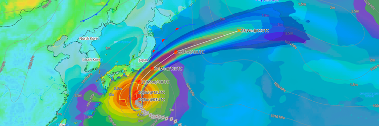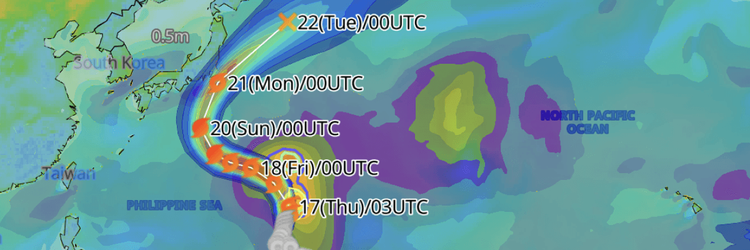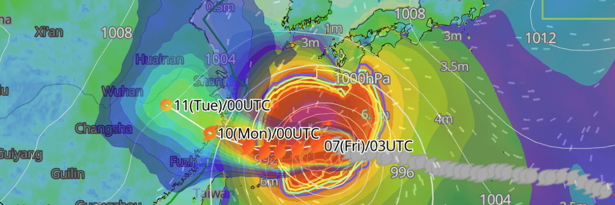
Violent winds are already occurring across the Okinawa and Amami regions as Typhoon No. 13 (Dolphin) passes near Yoron Island, tracking westward through the Ryukyu Islands. The storm is forecast to enter the East China Sea before making landfall in Central China around 10 August, according to the Japan Meteorological Agency (JMA).
CURRENT STATUS
Based on the latest JMA observations August 7, 2026 03:45 UTC
- Location: 27.0°N, 128.2°E — near Yoron Island, Okinawa Prefecture
- Classification: Large and Strong Typhoon
- Movement: West at 25 km/h (14 kt)
- Central pressure: 940 hPa
- Maximum sustained winds: 75 kt (139 km/h)
- Maximum gusts: 105 kt (195 km/h)
- ≥50-kt wind area: 330 km (180 NM) northeast, 185 km (100 NM) southwest
- ≥30-kt wind area: 650 km (350 NM) northeast, 560 km (300 NM) southwest

Himawari Satellite Image valid August 7, 2026 04:20 UTC
FORECAST TRACK SUMMARY
Passing through the Okinawa region, Typhoon No. 13 (Dolphin) is forecast to continue westward before entering the East China Sea and making landfall in Central China.

INTENSITY FORECAST
Maintaining a strong intensity of 75 kt (139 km/h) with gusts to 105 kt (195 km/h) through 00:00 UTC on 9 August, Typhoon No. 13 (Dolphin) is then forecast to weaken as it approaches the Chinese coast. By 00:00 UTC on 10 August, central pressure is forecast to rise to 980 hPa with sustained winds of 45 kt (83 km/h) as the storm makes landfall in Central China. Further weakening continues inland, with sustained winds of 35 kt (65 km/h) and central pressure at 990 hPa by 00:00 UTC on 11 August, and 35 kt (65 km/h) at 992 hPa by 00:00 UTC on 12 August.
IMPACTS & THREATS
Passing through the Okinawa and Amami regions with violent winds already occurring, the storm presents immediate and severe hazards across the Ryukyu Islands and adjacent maritime areas.
Violent Winds: Violent winds are already occurring across the Okinawa and Amami regions. Actual wind observations from Yoron Island recorded a maximum sustained wind of 62 kt (115 km/h) from the NNW at 01:15 UTC on 7 August and a maximum gust of 82 kt (152 km/h) from the north at 01:25 UTC on 7 August. Sustained winds of 78 kt (144 km/h) with gusts to 107 kt (198 km/h) forecast over both the Okinawa and Amami regions on 7 August—described as capable of partially collapsing structures. On 8 August, Okinawa faces 68 kt (126 km/h) sustained winds with gusts to 97 kt (180 km/h), while Amami faces 52 kt (97 km/h) sustained with gusts to 78 kt (144 km/h). Southern Kyushu faces 45 kt (83 km/h) sustained winds with gusts to 68 kt (126 km/h) on 7 August. Okinawa will continue to experience 49 kt (90 km/h) sustained winds with gusts to 68 kt (126 km/h) on 9 August.
Dangerous Waves: Seas are extremely rough across the Ryukyu Islands and adjacent regions. On 7 August, wave heights of 11 metres with swells are forecast for the Amami region, the highest in the region alongside 10 metres for Okinawa, 8 metres for southern Kyushu, and 6 metres for both northern Kyushu and Shikoku. Conditions ease on 8 August, with 8 metres forecast for both Okinawa and Amami, and 6 metres for southern Kyushu, northern Kyushu, and Shikoku. On 9 August, Okinawa faces 8 metres with swells while Amami eases to 6 metres.
Heavy Rainfall: Very heavy rainfall is forecast across Okinawa, Amami, and southern Kyushu. In the 24 hours from 03:00 UTC on 7 August to 03:00 UTC on 8 August, accumulations are forecast to reach 200 mm over Okinawa, 200 mm over Amami, and 180 mm over southern Kyushu. In the following 24-hour period from 03:00 UTC on 8 August to 03:00 UTC on 9 August, 120 mm is forecast over Okinawa and southern Kyushu. Linear precipitation bands may develop over Okinawa and Amami, potentially causing a sudden and rapid increase in heavy rain disaster risk with locally higher rainfall totals.
Storm Surge: Strict vigilance for storm surge along the Okinawa coast on 8 August. The Amami region should also be on guard for storm surge through 8 August.
Landslides and Flooding: Strict vigilance for landslides, flooding of low-lying areas, and river flooding across Okinawa through 8 August and across Amami on 7 August.
OPERATIONAL PORT FORECASTS
The most acute operational risks are concentrated across the Okinawa and Amami regions as the typhoon passes through, with hazards then extending into the East China Sea and toward the Chinese coas
■NAHA, Okinawa Islands, Japan

■NAZE, Amami Oshima, Japan

■WENZHOU, Zhejiang, China

■ZHOUSHAN, Zhejiang, China

Weathernews Inc. assumes no liability for navigational decisions, losses, or damages resulting from reliance on this general overview.
While official observations guide the general threat assessment, highly detailed, proprietary routing and port forecasts are essential for safe navigation. Weathernews services provide customers with 24/7 localized data to ensure your vessels remain safe and well-informed. Please consult our dedicated services for the most up-to-date, detailed predictions for your specific routes and operations.
Note on the storm's name: "Dolphin" is drawn from the Western North Pacific and South China Sea tropical cyclone name list, contributed by Hong Kong, China. The WMO and the ESCAP/WMO Typhoon Committee adopt these names sequentially to make tracking specific storms straightforward and to quickly communicate warnings. To learn more about how storms are named, please visit the World Meteorological Organization (WMO) website.