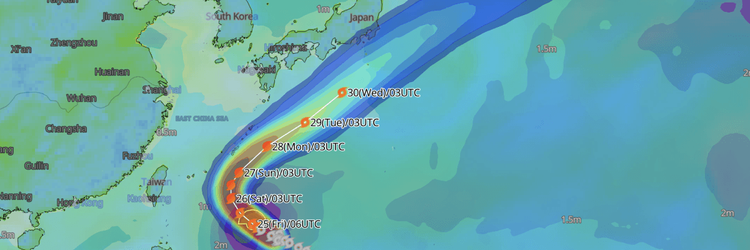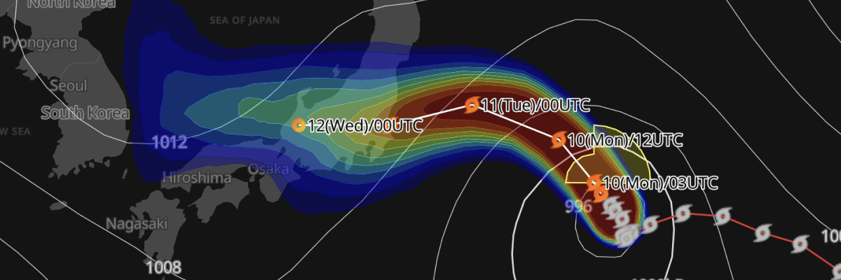
Typhoon No. 15 (Chan-hom) is tracking northwest toward Japan's Pacific coast and is forecast to move across Honshu into the Sea of Japan within the next two days, weakening steadily as it goes, according to the Japan Meteorological Agency (JMA).
CURRENT STATUS
Based on the latest JMA observations (As of 10 August 2026, 00:00 UTC | 09:00 JST)
- Location: 33.8°N, 149.7°E — east of Japan
- Classification: Typhoon
- Movement: Northwest at 9 kt (15 km/h)
- Central pressure: 990 hPa
- Maximum sustained winds: 40 kt (74 km/h)
- Maximum gusts: 60 kt (111 km/h)
- ≥30-kt wind area: 440 km (240 NM) northeast, 330 km (180 NM) southwest
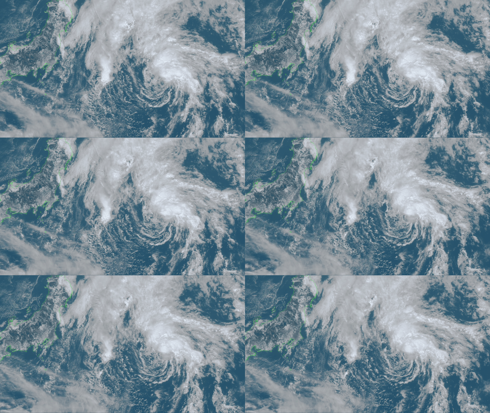
Himawari Satellite Image (Visible Color) valid August 10, 2026 03:30 UTC
FORECAST TRACK SUMMARY
Chan-hom is forecast to continue tracking northwest, reaching 35.6°N, 147.7°E by 12:00 UTC on 10 August (21:00 JST), still east of Japan. By 00:00 UTC on 11 August (09:00 JST), the storm is expected near 36.9°N, 144.0°E, moving west-northwest at 16 kt (30 km/h) — its closest approach to the Pacific coast before crossing over Honshu.
By 00:00 UTC on 12 August (09:00 JST), the system is forecast to have moved into the Sea of Japan, near 36.6°N, 135.6°E, having traversed the country. It is then forecast to continue west across the Sea of Japan, reaching 35.9°N, 130.1°E by 00:00 UTC on 13 August (09:00 JST).
INTENSITY FORECAST
Chan-hom is forecast to intensify slightly as it approaches Japan, with central pressure deepening from 990 hPa to 980 hPa and maximum sustained winds increasing to 50 kt (25 m/s) with gusts to 70 kt (35 m/s) by 00:00 UTC on 11 August.
As the storm crosses Honshu and enters the Sea of Japan, it is forecast to weaken markedly: central pressure is expected to rise to 996 hPa with maximum sustained winds easing to 35 kt (18 m/s) by 00:00 UTC on 12 August.
The system is forecast to weaken further to a tropical depression by 00:00 UTC on 13 August, with central pressure at 998 hPa, as it continues west across the Sea of Japan. Forecast confidence decreases with time, reflected in the growing forecast circle radius — from 45 km (25 NM) at 12 hours out to 185 km (100 NM) at 72 hours.
IMPACTS & THREATS
As Chan-hom tracks toward and across Honshu, its wind field — currently extending 440 km (240 NM) to the northeast and 330 km (180 NM) to the southwest — presents a hazard for vessels operating along Japan's Pacific coast and, as the storm crosses into the Sea of Japan, for shipping in that region as well. Mariners should monitor updated JMA advisories closely as the track firms up over the next 24–48 hours.
OPERATIONAL PORT FORECASTS
■KASHIMA, Ibaraki, Japan
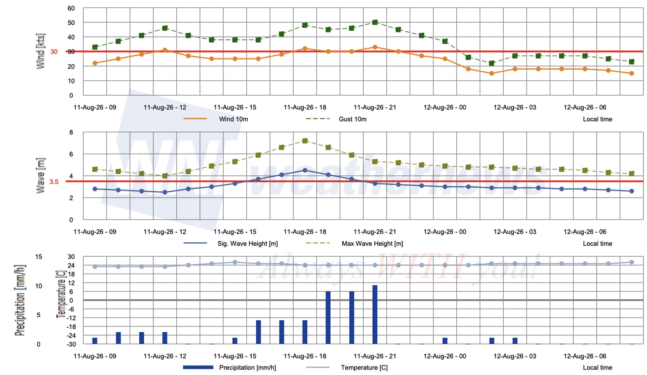
■HARAMACHI, Fukushima, Japan
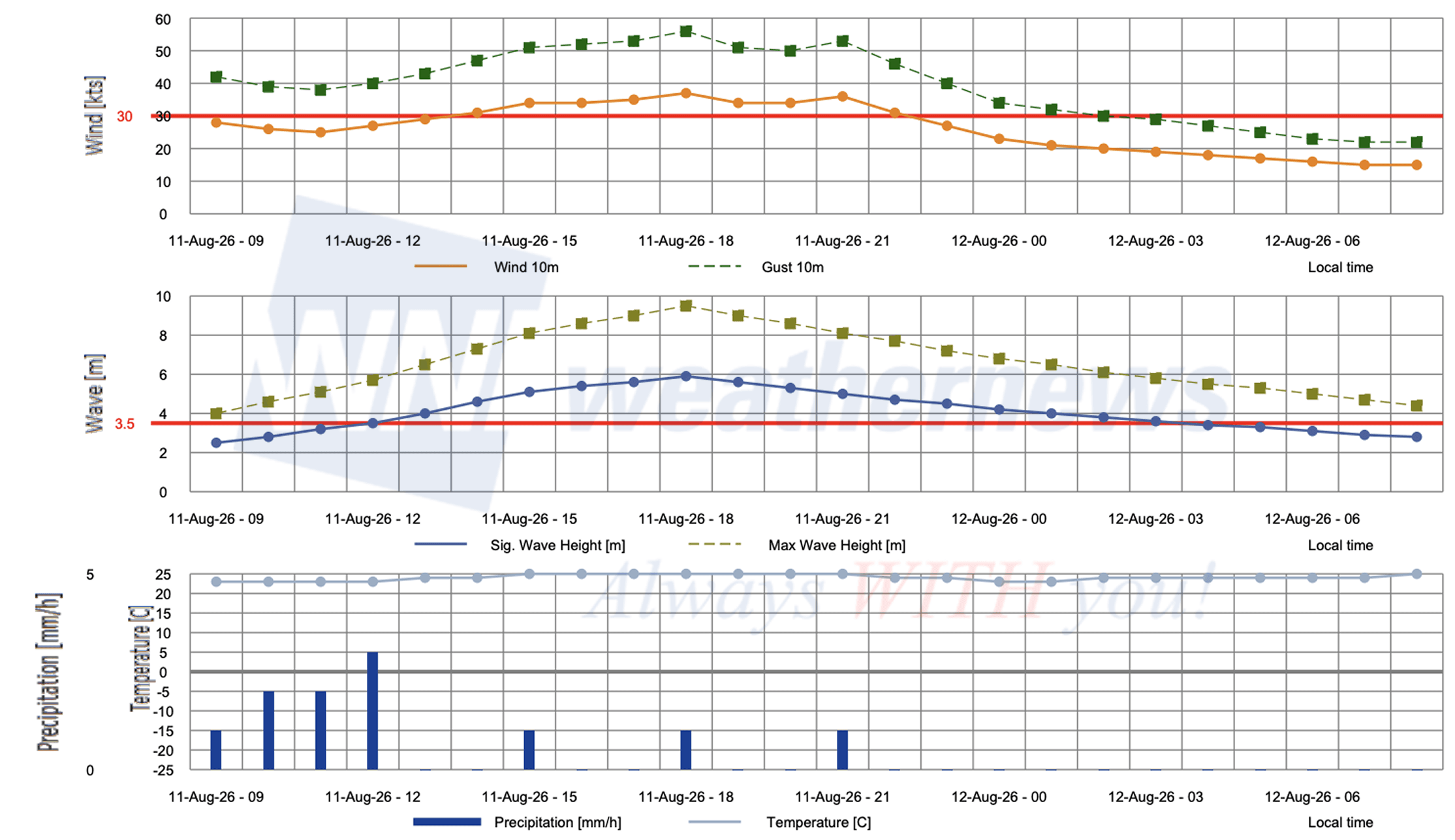
■ONAHAMA, Fukushima, Japan
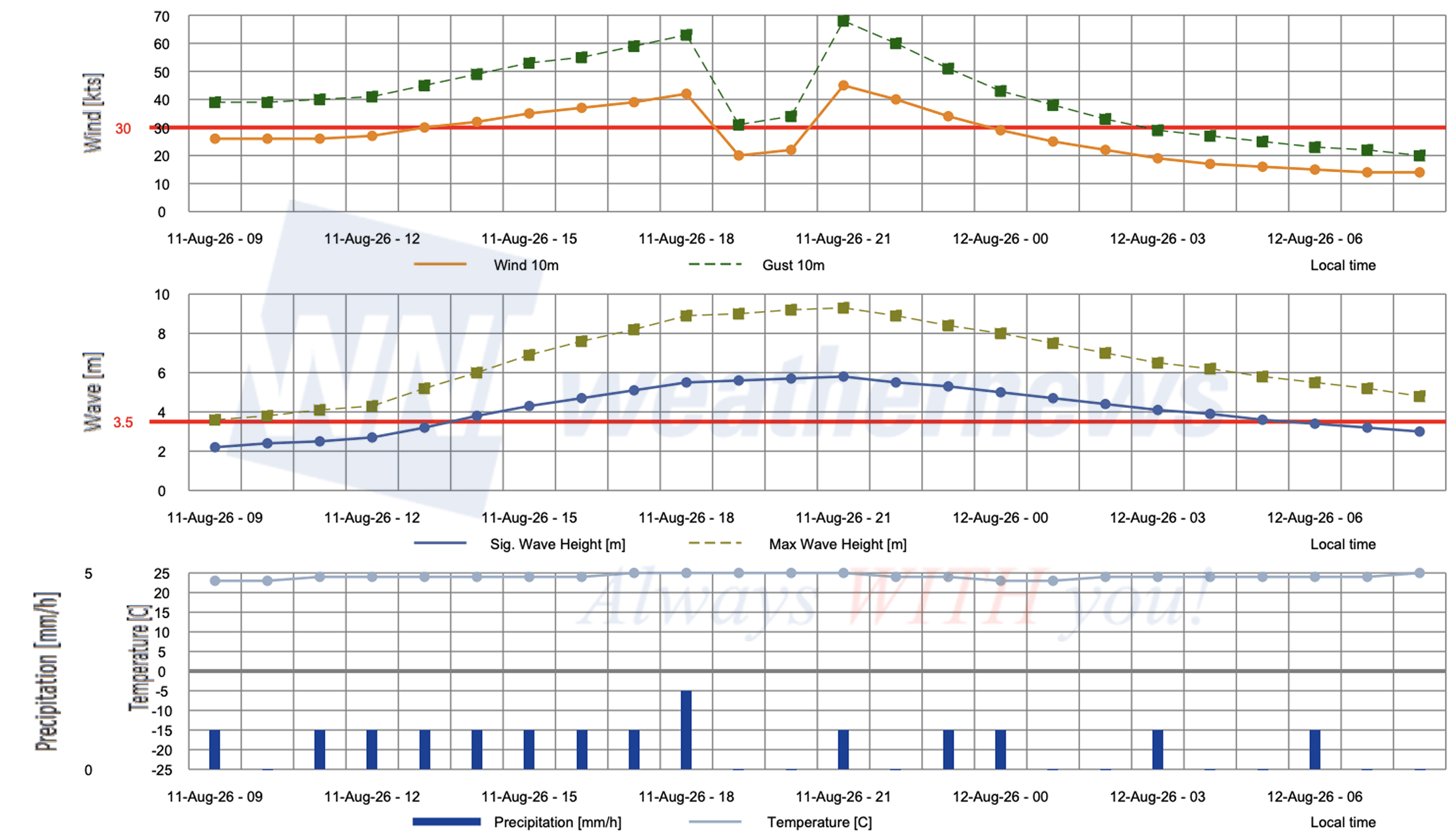
Weathernews Inc. assumes no liability for navigational decisions, losses, or damages resulting from reliance on this general overview.
While official observations guide the general threat assessment, highly detailed, proprietary routing and port forecasts are essential for safe navigation. Weathernews services provide customers with 24/7 localized data to ensure your vessels remain safe and well-informed. Please consult our dedicated services for the most up-to-date, detailed predictions for your specific routes and operations.
Note on the storm's name: "Chan-hom" is a Laotian name for a type of fragrant tree, contributed by Lao PDR to the Western North Pacific and South China Sea tropical cyclone name list. The WMO and the ESCAP/WMO Typhoon Committee adopt these names sequentially to make tracking specific storms straightforward and to quickly communicate warnings. To learn more about how storms are named, please visit the World Meteorological Organization (WMO) website.