Typhoon No. 18 (Saudel), downgraded to tropical storm intensity after an earlier landfall over mainland China, has re-emerged over the South China Sea and is forecast to curve east-northeastward before stalling southwest of Taiwan and weakening through the week, according to the Japan Meteorological Agency (JMA).
CURRENT STATUS
Based on the latest JMA observations issued on September 1, 2026 04:05 UTC
- Location: 19.8°N, 113.9°E, over the South China Sea south of Hainan Island, China
- Intensity: Tropical Storm (TS)
- Movement: ENE at 20 km/h (12 kt)
- Central pressure: 994 hPa
- Maximum sustained winds: 35 kt (65 km/h), with gusts to 50 kt (93 km/h)
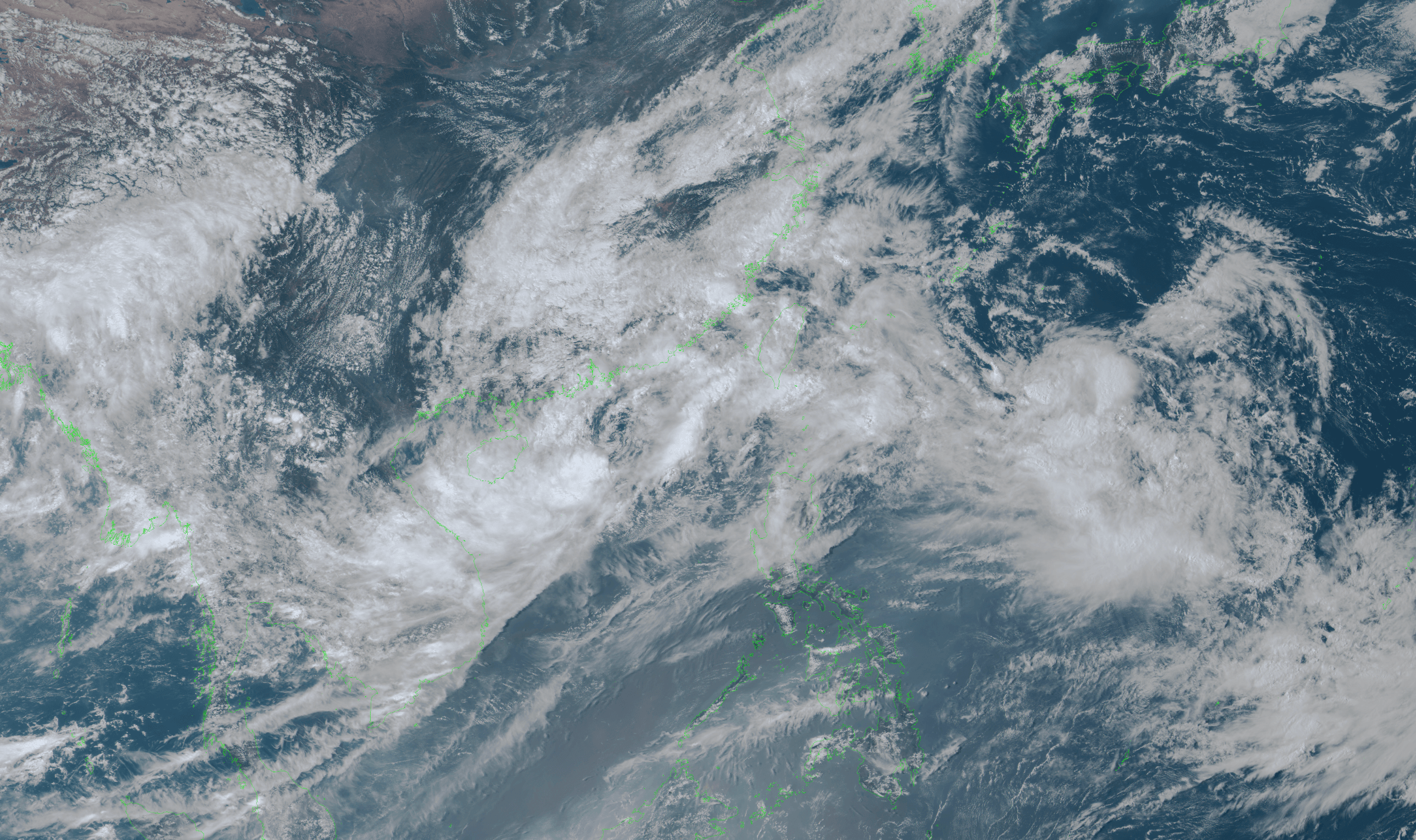
Himawari Satellite Imagery (Visible Color) valid September 1, 2026 06:00 UTC
FORECAST TRACK SUMMARY
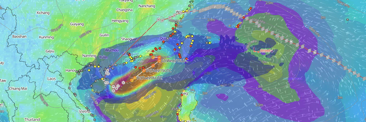
Saudel is tracking east-northeastward at 12 kt as of the 0300 UTC analysis. JMA's forecast has the storm continuing on this heading through 0300 UTC September 2 (1100 CST), reaching roughly 21.5°N, 116.9°E, before the system's forward speed drops sharply. By 0000 UTC September 3 (0800 CST), Saudel is expected to be moving slowly toward the northeast near 22.6°N, 118.0°E. The system is then forecast to become almost stationary and drift toward 22.4°N, 117.3°E by 0000 UTC September 4 (0800 CST) — placing it in the Taiwan Strait area, southwest of Taiwan. Track uncertainty grows considerably over this period, with the JMA probability circle expanding from 65 km (35 NM) at the first forecast point to 260 km (140 NM) by day three, reflecting low confidence in the exact position during the stalling phase.
INTENSITY FORECAST
Saudel is expected to hold steady as a tropical storm, with maximum sustained winds of 35 kt and a central pressure of 994 hPa, through at least 0000 UTC September 4. By 0000 UTC September 5 (0800 CST), JMA forecasts the system to weaken to a tropical depression, with central pressure rising slightly to 998 hPa. No further re-intensification is indicated in the current forecast, consistent with the storm's slowing movement and proximity to land.
IMPACTS & THREATS
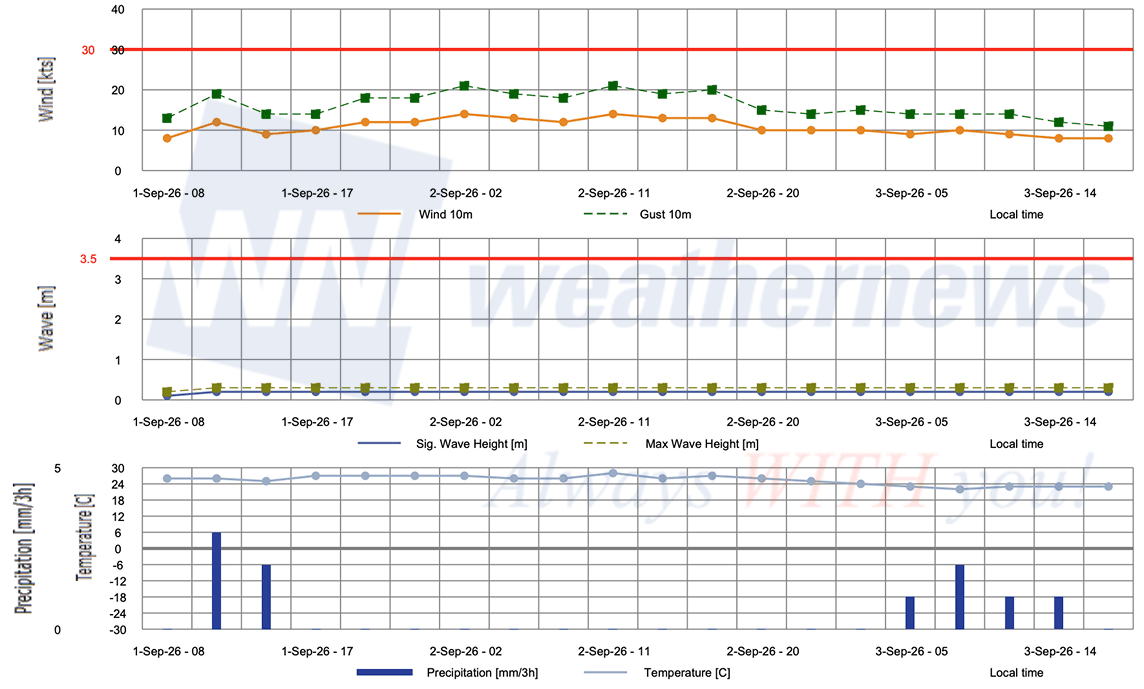
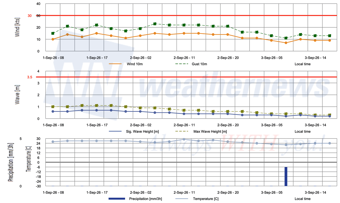
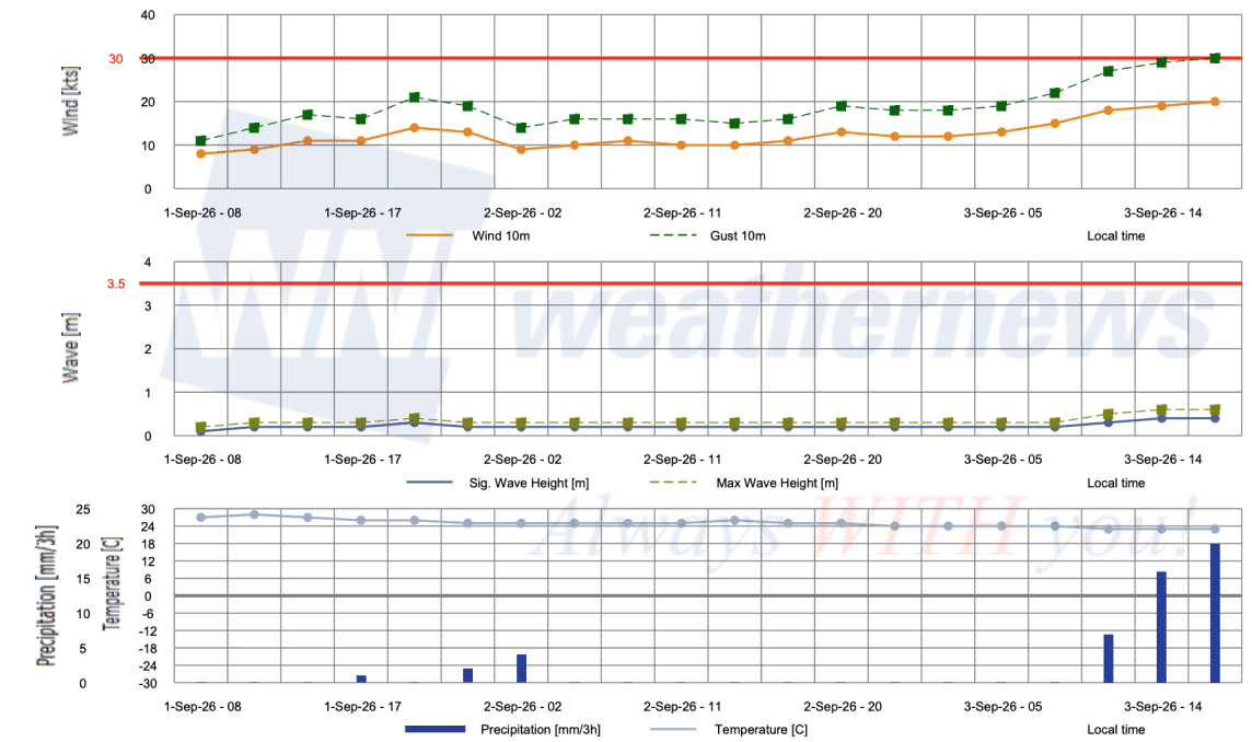
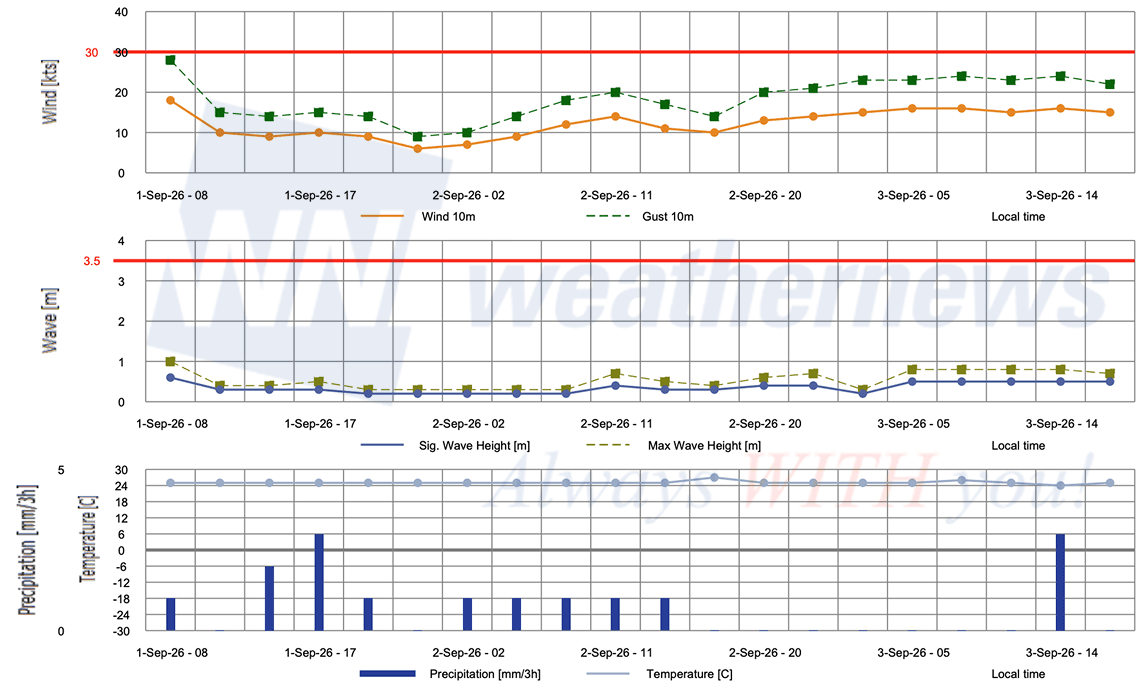
Given Saudel's stalling track near the Taiwan Strait, prolonged periods of gusty winds, rough seas, and heavy rainfall are possible for coastal Guangdong, the northern South China Sea, and waters near Taiwan into the weekend, though the exact area of heaviest impact remains uncertain given the wide forecast probability circles. Mariners operating in the northern South China Sea and Taiwan Strait should anticipate slow-moving conditions with elevated wind and wave activity through at least September 4.
BACKGROUND / CONTEXT
Saudel previously made landfall over mainland China before tracking southwestward across southern China, re-entering the South China Sea, and redeveloping into its current tropical storm state — an unusual reintensification pathway that keeps track and intensity confidence relatively low for the coming days.
OPERATIONAL PORT FORECASTS
■HONG KONG, China
■SHENZHEN, Guangdong, China
■SHANTOU, Guangdong, China
■XIAMEN, Fujian, China
Weathernews Inc. assumes no liability for navigational decisions, losses, or damages resulting from reliance on this general overview.
While official observations guide the general threat assessment, highly detailed, proprietary routing and port forecasts are essential for safe navigation. Weathernews services provide customers with 24/7 localized data to ensure your vessels remain safe and well-informed. Please consult our dedicated services for the most up-to-date, detailed predictions for your specific routes and operations.
Note on the storm's name: "Saudel" was contributed by the Federated States of Micronesia to the Western North Pacific and South China Sea tropical cyclone name list. In the Pohnpeian language, it refers to a trusted guard or soldier serving the Chief Saudeleur. The name replaced "Soudelor" after the 2015 storm caused significant damage in Taiwan and mainland China, leading to its retirement. The WMO and the ESCAP/WMO Typhoon Committee adopt these names sequentially to make tracking specific storms straightforward and to quickly communicate warnings. To learn more about how storms are named, please visit the World Meteorological Organization (WMO) website.