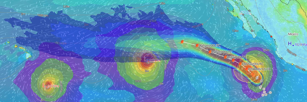
Tropical Storm Marie is continuing to organize approximately 435 miles south of the southern tip of Baja California, maintaining maximum sustained winds of 55 kt (65 mph) and a central pressure of 994 mb (994 hPa). Moving northwestward at 9 kt (10 mph) across the Eastern North Pacific, the cyclone is forecast to reach hurricane strength later today. While the core will remain offshore, large swells will impact coastal regions and major shipping lanes.
CURRENT STATUS
Based on the latest NHC Public Advisory analysis on September 2, 2026 09:00 UTC
- Location: 16.7°N, 111.0°W — approximately 700 km (435 mi) south of the southern tip of Baja California
- Intensity: Tropical Storm
- Movement: Northwest at 17 km/h (9 kt)
- Central pressure: 994 mb (994 hPa)
- Maximum sustained winds: 100 km/h (55 kt)
- Maximum Gusts: 120 km/h (65 kt)
- Tropical-storm-force winds (34 kt) radius: up to 295 km (185 mi) from center
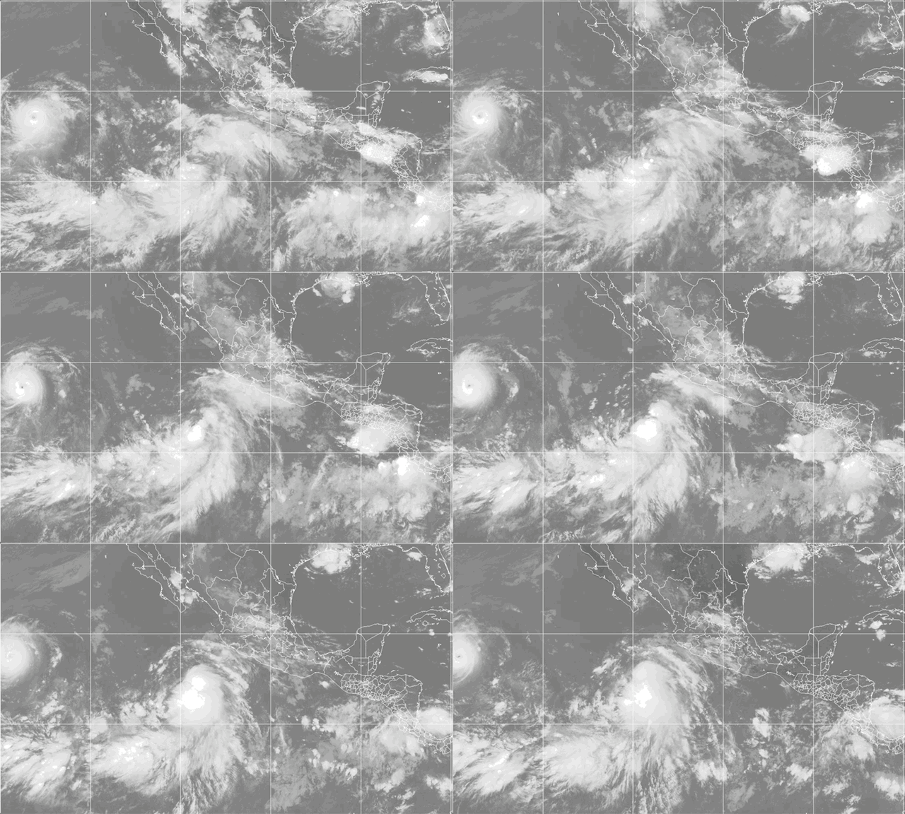
Weathernews Global Composite Satellite Imagery valid September 1, 2026 00:30 UTC to September 2, 2026 07:30 UTC
FORECAST TRACK SUMMARY
Marie is forecast to turn toward the west-northwest later today, maintaining this course through Friday as it is steered by an expanding ridge of high pressure. This trajectory keeps the core of the storm well away from mainland Mexico and south of the Baja California Peninsula. The system will track through the Revillagigedo Islands region, passing near or just south of Clarion Island on Thursday before continuing westward across open ocean waters.
INTENSITY FORECAST
NHC forecasts steady intensification over warm waters and low atmospheric shear, with Marie projected to reach hurricane status later today and peak in intensity on Friday. A gradual weakening trend is expected over the weekend as the cyclone encounters cooler ocean surface temperatures and a drier, more stable atmosphere.
IMPACTS & THREATS
Storm Surge: No significant coastal storm surge threat is anticipated for mainland Mexico or the Baja California Peninsula, as the center of the storm is forecast to remain well offshore.
Rainfall: Direct heavy rainfall threats to land are minimal due to the system's offshore trajectory, though localized outer convective bands may produce brief marine squalls.
Winds: Sustained tropical-storm-force winds (34 kt / 39 mph) extend outward up to 295 km (185 mi), with the highest wind threat concentrated over open shipping lanes and offshore islands such as Isla Socorro and Isla Clarion.
Waves & Swells: Large swells generated by Marie will impact the coasts of southwestern Mexico and the Baja California Peninsula, producing life-threatening surf and rip current conditions through the week before spreading toward southern California waters over the weekend; 4-meter (13-foot) seas extend up to 240 NM northeast of the center.
Tornadoes: No tornado threat is expected as the storm remains distant from land masses.
WIND PROBABILITY HIGHLIGHTS
Isla Socorro has a 70% cumulative probability of tropical-storm-force winds (34 kt / 39 mph), with the primary threat window occurring through Wednesday afternoon. Further west, Isla Clarion carries an 85% chance of tropical-storm-force winds, a 51% chance of 50-knot winds, and a 28% chance of hurricane-force winds (64 kt / 74 mph), peaking between Wednesday night and Thursday evening.
WHAT TO WATCH
Mariners should monitor future advisories for updates on the onset of hurricane-force winds and regional swell heights along shipping corridors. The next complete advisory from the National Hurricane Center will be issued at 1500 UTC Wednesday (8:00 AM MST).
Advisories referenced are issued by the National Hurricane Center (NHC), a division of the National Oceanic and Atmospheric Administration (NOAA), providing official track, intensity, and hazard forecasts for tropical cyclones in the Atlantic and Eastern Pacific basins.
Weathernews Inc. assumes no liability for navigational decisions, losses, or damages resulting from reliance on this general overview.
While official observations guide the general threat assessment, highly detailed, proprietary routing and port forecasts are essential for safe navigation. Weathernews services provide customers with 24/7 localized data to ensure your vessels remain safe and well-informed. Please consult our dedicated services for the most up-to-date, detailed predictions for your specific routes and operations.
Note on the storm's name: "Marie" is drawn from the 2026 Eastern North Pacific tropical cyclone name list, the thirteenth name in the season's sequence. Eastern North Pacific tropical cyclone names are pre-selected from twenty four rotating lists. To learn more about how storms are named, please visit the World Meteorological Organization (WMO) website.