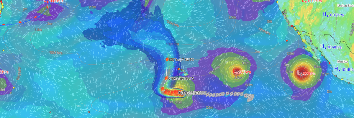
Hurricane Lowell, a powerful Category 4 storm with maximum sustained winds of 115 kt (130 mph) and a central pressure of 943 mb (943 hPa)), is tracking westward roughly 495 miles south-southwest of Hilo, Hawaii. According to the Central Pacific Hurricane Center (CPHC), Lowell is expected to turn north early next week, potentially bringing significant impacts to the westernmost Hawaiian Islands.
CURRENT STATUS
Based on the latest NHC Public Advisory analysis on September 4, 2026 03:00 UTC
- Location: 13.5°N, 158.9°W — approximately 800 km (495 mi) south-southwest of Hilo, Hawaii and 945 km (590 mi) south of Lihue, Hawaii
- Intensity: Category 4 Hurricane
- Movement: West at 15 km/h (8 kt)
- Central pressure: 943 mb (943 hPa)
- Maximum sustained winds: 215 km/h (115 kt)
- Maximum gusts: 260 km/h (140 kt)
- Hurricane-force winds (64 kt) radius: up to 75 km (45 mi) from center
- Tropical-storm-force winds (34 kt) radius: up to 220 km (140 mi) from center
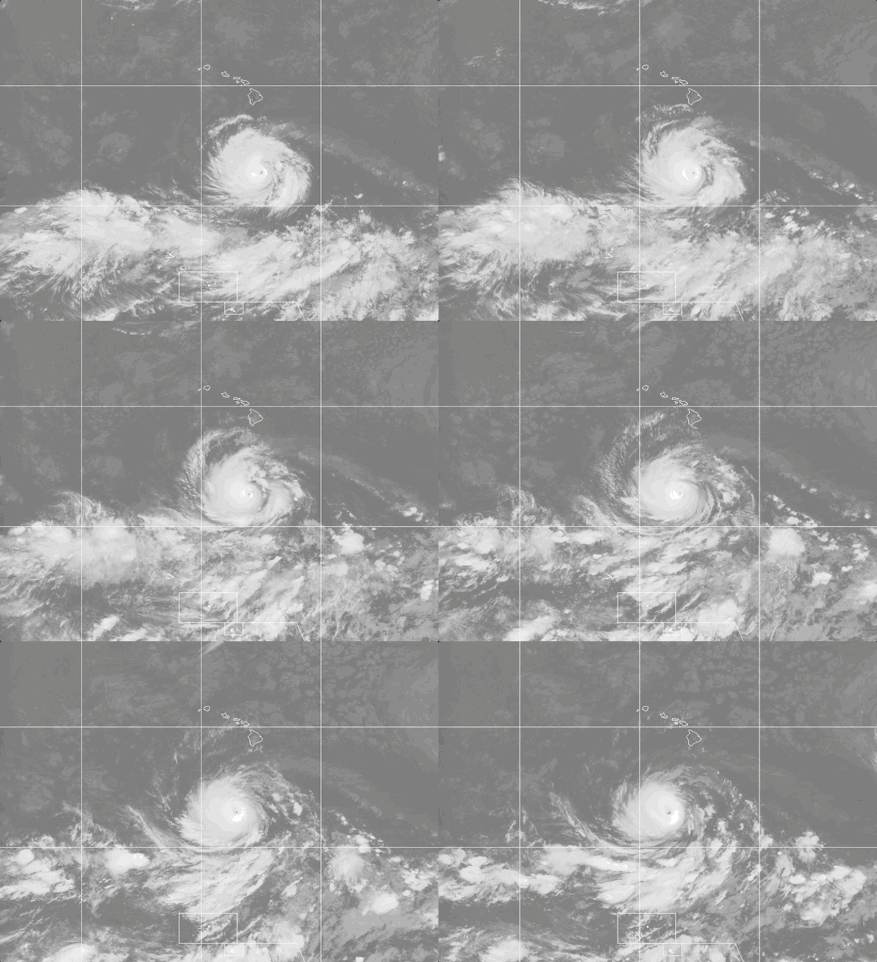
Weathernews Global Composite Satellite Imagery valid September 3, 2026 00:30 UTC to September 4, 2026 01:30 UTC
FORECAST TRACK SUMMARY
Lowell is forecast to slow its westward motion over the next two days before turning north, then accelerating north-northeastward. This track would bring the center near or just west of the westernmost main Hawaiian Islands late Monday into Monday night. Confidence in the near-term track has increased, though longer-range details remain uncertain.
INTENSITY FORECAST
Lowell is expected to strengthen modestly over the next two days, potentially reaching 120 kt, before increasing wind shear drives substantial weakening after 72 hours. Despite this weakening trend, Lowell is forecast to remain at or near major hurricane strength as it approaches the Hawaiian Islands.
IMPACTS & THREATS
Storm surge: Significant storm surge impacts are not anticipated for the Hawaiian Islands at this time, though this could change depending on Lowell's exact track next week.
Rainfall: Heavy rainfall is possible for portions of Hawaii beginning early next week if Lowell tracks close to the islands, potentially leading to localized flooding.
Winds: Damaging winds are possible for parts of Hawaii early next week, with the strongest impacts depending on how closely Lowell's center passes the islands.
Waves & swells: Swells from Lowell are already generating life-threatening surf and rip current conditions across portions of the Hawaiian Islands, with further increases likely early next week.
Tornadoes: No tornado threat has been identified for Hawaii in the current advisory products.
WIND PROBABILITY HIGHLIGHTS
There is a 72% chance of tropical-storm-force winds (34 kt / 39 mph) at Buoy 51101 by 0000 UTC Wednesday, with a 23% chance of hurricane-force winds (64 kt / 74 mph) at the same location. Niihau and Nihoa also carry notable wind risk, each with roughly a 1-in-2 to 3-in-4 chance of tropical-storm-force winds by the same period.
WHAT TO WATCH
The key uncertainty remains the exact timing and sharpness of Lowell's northward turn, which will determine which islands see the greatest impacts. The next complete advisory is scheduled for 1100 PM HST.
OPERATIONAL PORT FORECASTS
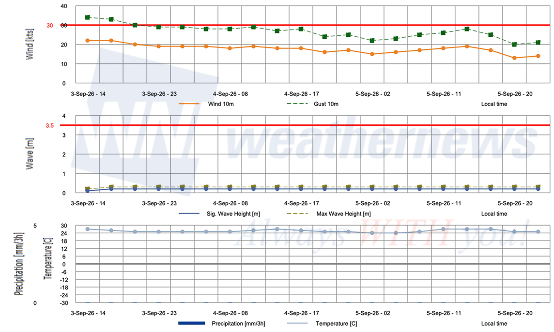
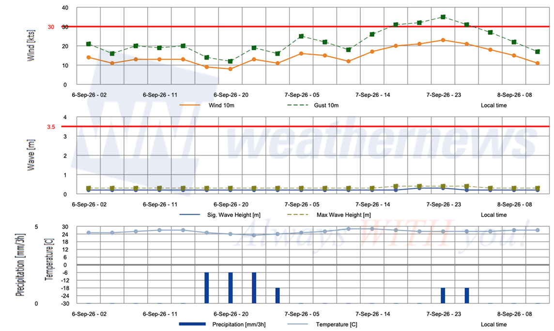
■ HONOLULU, Hawaii, United States
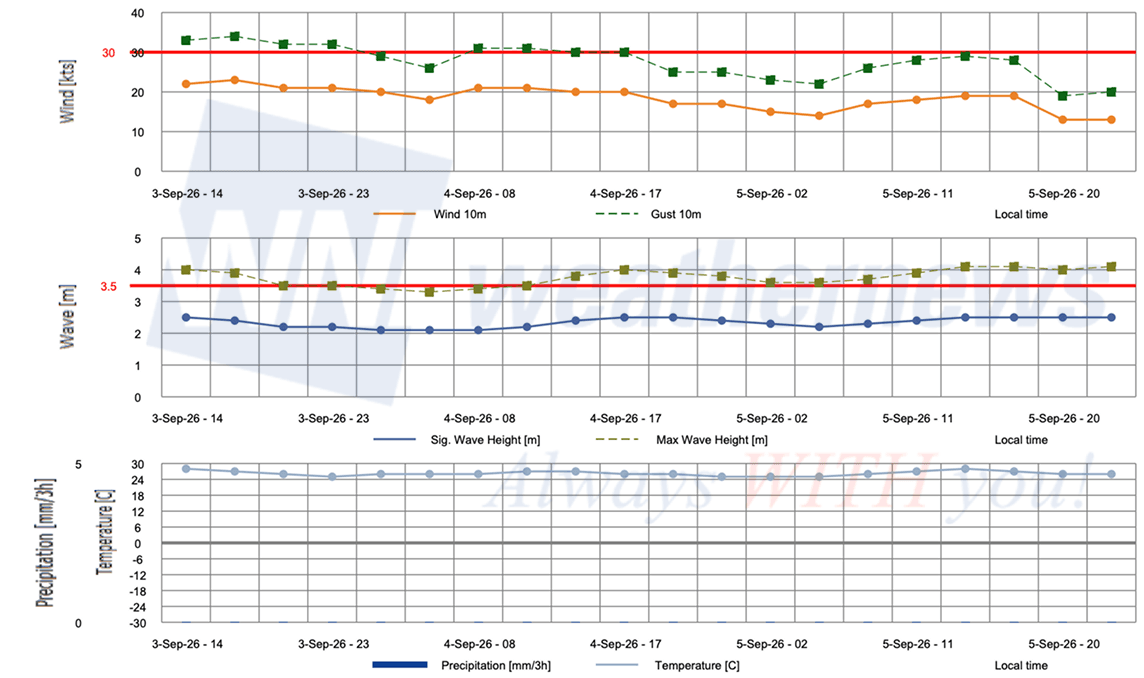
■ BARBERS POINT TERMINAL, Hawaii, United States
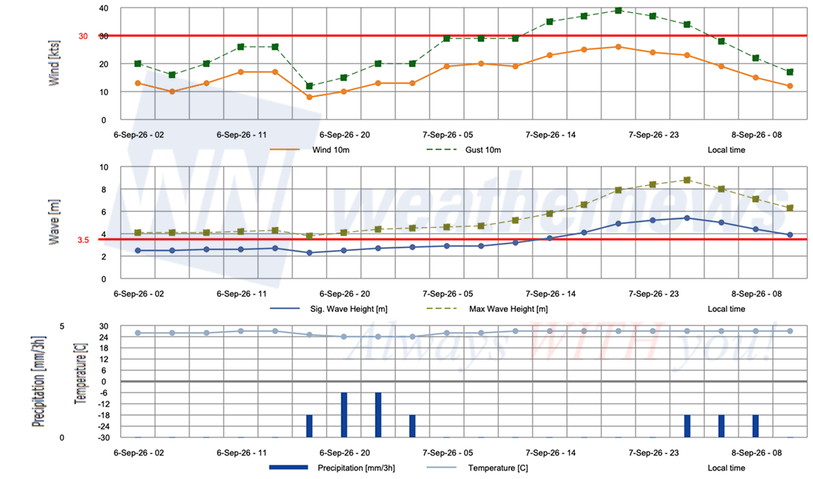
Advisories referenced are issued by the National Hurricane Center (NHC), a division of the National Oceanic and Atmospheric Administration (NOAA), providing official track, intensity, and hazard forecasts for tropical cyclones in the Atlantic and Eastern Pacific basins.
Weathernews Inc. assumes no liability for navigational decisions, losses, or damages resulting from reliance on this general overview.
While official observations guide the general threat assessment, highly detailed, proprietary routing and port forecasts are essential for safe navigation. Weathernews services provide customers with 24/7 localized data to ensure your vessels remain safe and well-informed. Please consult our dedicated services for the most up-to-date, detailed predictions for your specific routes and operations.
Note on the storm's name: "Lowell" is drawn from the 2026 Eastern North Pacific tropical cyclone name list, the twelfth name in the season's sequence. Eastern North Pacific tropical cyclone names are pre-selected from twenty four rotating lists. To learn more about how storms are named, please visit the World Meteorological Organization (WMO) website.