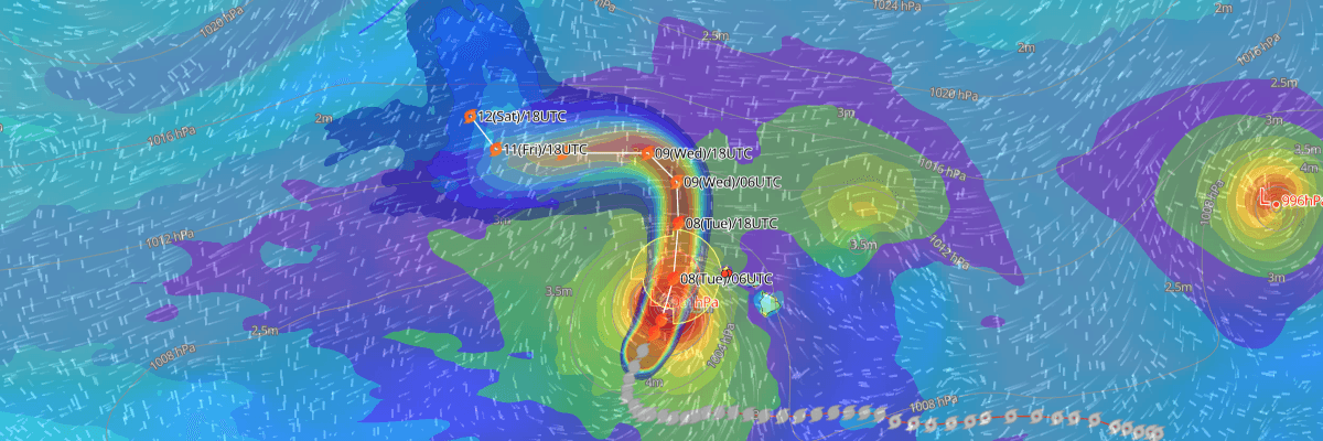
Hurricane Lowell, packing maximum sustained winds of 95 kt (110 mph), is making its closest approach to the Hawaiian Islands tonight into early Tuesday. According to the Central Pacific Hurricane Center (CPHC), a Hurricane Warning is in effect for Kauai County and Niihau, with a Tropical Storm Warning in effect for Oahu, as dangerous winds, flooding rain, and damaging surf threaten the islands.
CURRENT STATUS
Based on the latest NHC Public Advisory analysis on September 8, 2026 03:00 UTC
- Location: 20.3°N, 161.3°W — approximately 275 km (170 mi) southwest of Lihue, Hawaii and 370 km (230 mi) west-southwest of Honolulu, Hawaii
- Intensity: Hurricane
- Movement: North-northeast at 30 km/h (16 kt)
- Central pressure: 956 mb (956 hPa)
- Maximum sustained winds: 175 km/h (95 kt)
- Maximum gusts: 215 km/h (115 kt)
- Hurricane-force winds (64 kt) radius: up to 110 km (60 mi) from center
- Tropical-storm-force winds (34 kt) radius: up to 280 km (150 mi) from center
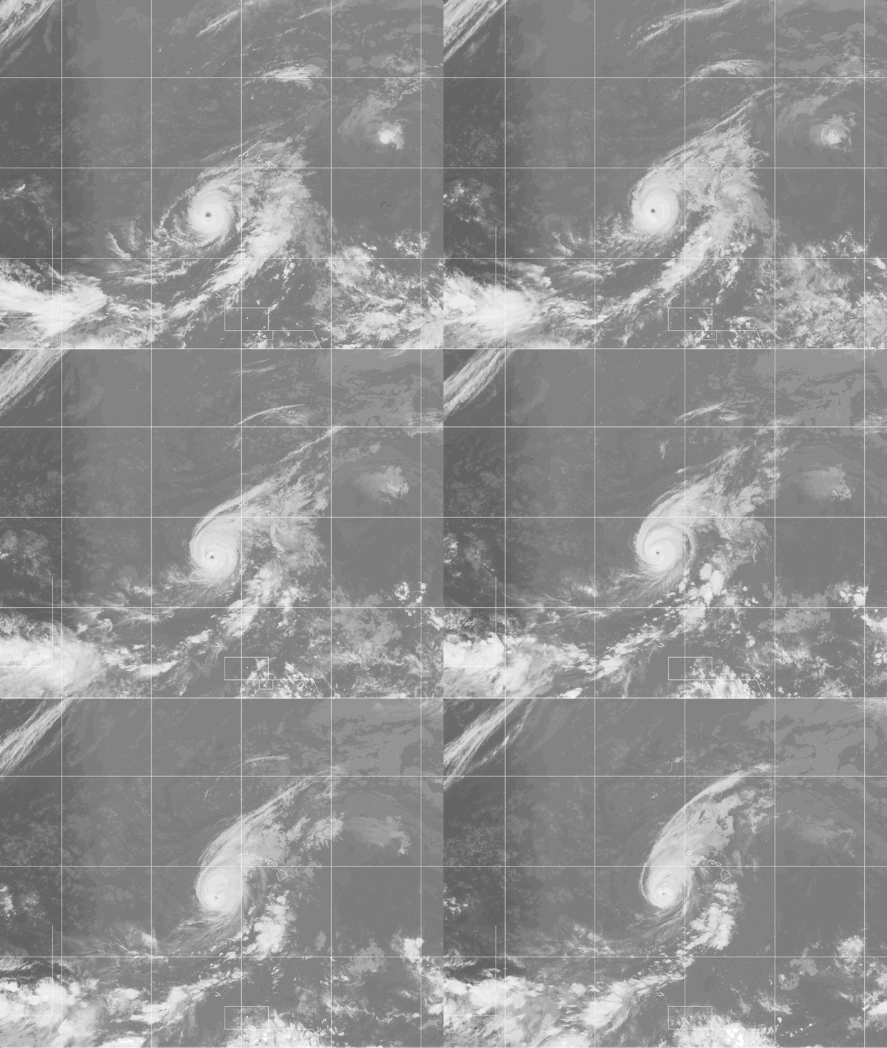
Weathernews Global Composite Satellite Imagery valid September 7, 2026 00:30 UTC to September 8, 2026 01:30 UTC
FORECAST TRACK SUMMARY
Lowell is forecast to pass near or just west of Niihau tonight and early Tuesday before turning northwest and slowing down by early Wednesday. NHC forecasts the storm to later bend back toward the northwest at longer range, though confidence in that portion of the track remains low.
INTENSITY FORECAST
Lowell is expected to weaken below hurricane strength by Tuesday afternoon as increasing wind shear and cooler waters erode the storm's structure, with more gradual weakening thereafter. NHC forecasts Lowell to remain a hurricane through its closest approach to the islands tonight.
IMPACTS & THREATS
Storm surge: Storm surge combined with tide could raise water levels 2–4 feet above ground in Kauai County, highest along the south coast of Kauai and Niihau, with up to 1 foot possible on Oahu.
Rainfall: Kauai is expected to see an additional 6–10 inches of rain, with isolated totals up to 16 inches; the Big Island 4–8 inches; Oahu and Maui County 4–8 inches. Significant flash flooding and mudslides are possible, especially on Kauai and the Big Island.
Winds: Hurricane conditions are expected across Kauai County beginning this evening, with winds up to 30% stronger atop and along mountain slopes. Tropical storm conditions are expected on Oahu beginning tonight.
Waves & swells: Large, damaging waves will strike exposed coastlines, and swells from Lowell are producing life-threatening surf and rip current conditions across many of the islands.
Tornadoes: Several tornadoes are possible near Kauai and Niihau this evening through overnight, with a few also possible across the remaining islands.
WIND PROBABILITY HIGHLIGHTS
Kauai locations face extreme wind risk in the next 12 hours — Barking Sands carries a 99% chance of tropical-storm-force winds and an 18% chance of hurricane-force winds, while Niihau carries a 99% chance of tropical-storm-force winds and 60% chance of hurricane-force winds. Oahu's risk is lower, with an 8% chance of tropical-storm-force winds at Honolulu.
WHAT TO WATCH
The key uncertainty is how sharply Lowell bends northwest after passing the islands and how its weakening circulation will behave at long range. An intermediate advisory is scheduled for 800 PM HST, with the next complete advisory at 1100 PM HST.
OPERATIONAL PORT FORECASTS
■ HONOLULU, Hawaii, United States
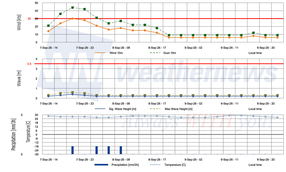
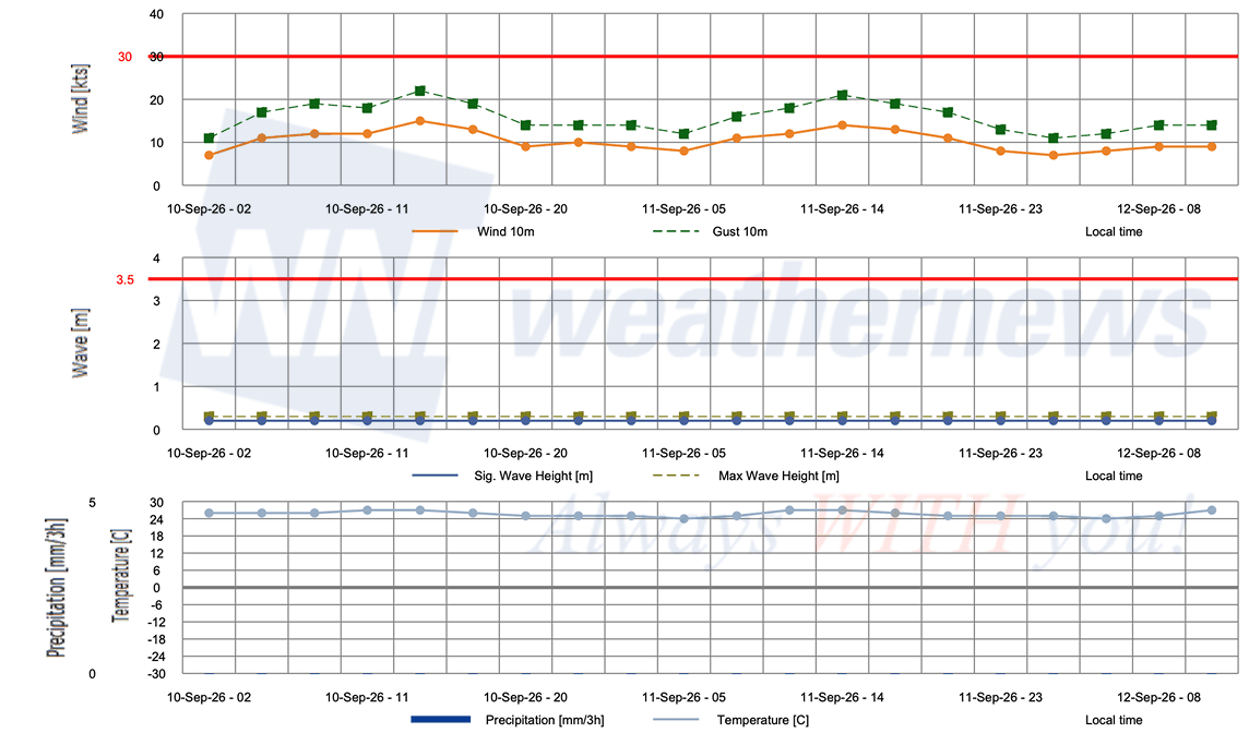
■ BARBERS POINT TERMINAL, Hawaii, United States
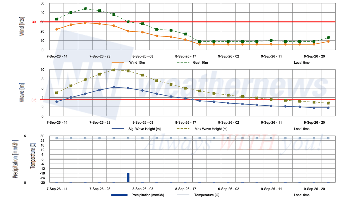
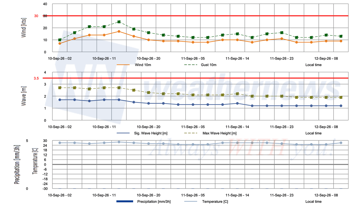
Advisories referenced are issued by the National Hurricane Center (NHC), a division of the National Oceanic and Atmospheric Administration (NOAA), providing official track, intensity, and hazard forecasts for tropical cyclones in the Atlantic and Eastern Pacific basins.
Weathernews Inc. assumes no liability for navigational decisions, losses, or damages resulting from reliance on this general overview.
While official observations guide the general threat assessment, highly detailed, proprietary routing and port forecasts are essential for safe navigation. Weathernews services provide customers with 24/7 localized data to ensure your vessels remain safe and well-informed. Please consult our dedicated services for the most up-to-date, detailed predictions for your specific routes and operations.
Note on the storm's name: "Lowell" is drawn from the 2026 Eastern North Pacific tropical cyclone name list, the twelfth name in the season's sequence. Eastern North Pacific tropical cyclone names are pre-selected from twenty four rotating lists. To learn more about how storms are named, please visit the World Meteorological Organization (WMO) website.