Hurricane Polo has intensified into an extremely dangerous Category 5 hurricane while moving slowly off the coast of southwestern Mexico. The storm carries maximum sustained winds of 140 kt (160 mph) and a central pressure of 923 mb (923 hPa), and is forecast to remain a powerful major hurricane for the next several days while tracking well offshore.
CURRENT STATUS
Based on the latest NHC Public Advisory analysis on September 24, 2026 03:00 UTC
- Location: 16.0°N, 102.4°W — approximately 210 km (130 mi) south-southwest of Zihuatanejo, Mexico and 390 km (240 mi) south-southeast of Manzanillo, Mexico
- Intensity: Category 5 Hurricane
- Movement: Northwest at 9 km/h (5 kt)
- Central pressure: 923 mb (923 hPa)
- Maximum sustained winds: 260 km/h (140 kt)
- Maximum gusts: 315 km/h (170 kt)
- Hurricane-force winds (64 kt) radius: up to 65 km (40 mi) from center
- Tropical-storm-force winds (34 kt) radius: up to 185 km (115 mi) from center
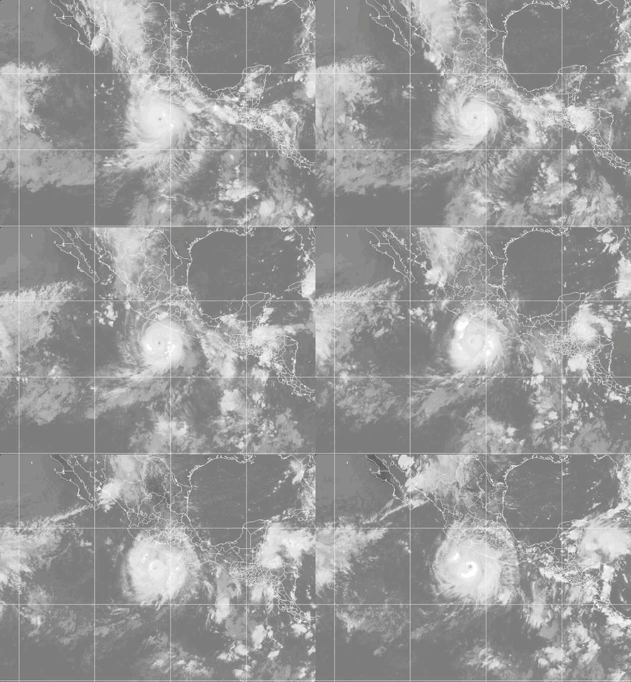
Weathernews Global Composite Satellite Imagery valid September 23, 2026 01:30 UTC to September 24, 2026 01:30 UTC
FORECAST TRACK SUMMARY
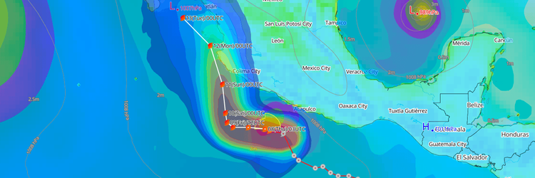
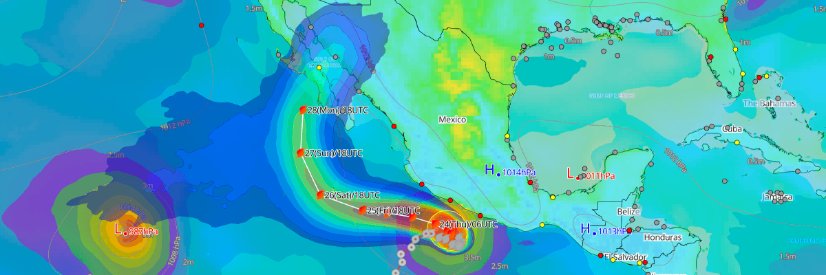
Polo is expected to turn west-northwest through Friday, keeping its core offshore of southwestern Mexico, before curving north and northwest this weekend on a track that brings it toward Baja California Sur early next week. Some uncertainty remains in the timing and sharpness of that turn.
INTENSITY FORECAST
Some additional near-term strengthening is possible after Polo completed an eyewall replacement cycle, and the hurricane is expected to stay at major strength for the next few days. A gradual weakening trend is forecast to begin by this weekend as increasing atmospheric disruption affects the storm.
WIND PROBABILITY & HIGHLIGHTS
Isla Socorro carries the greatest risk in the probability table, with roughly a two-in-three chance of tropical-storm-force winds developing Friday night into Saturday and a cumulative chance approaching 90% through the weekend; hurricane-force winds are also possible there. Communities along Baja California Sur, including Cabo San Lucas, La Paz, and Loreto, face smaller but rising chances of tropical-storm-force winds late in the five-day period as Polo's track nears the peninsula.
IMPACTS & THREATS
Rainfall: Coastal Guerrero can expect 4 to 6 inches of rain, with isolated totals to 8 inches, through Thursday — enough to trigger life-threatening flooding and mudslides in areas of steep terrain. Coastal Michoacan, Colima, and Jalisco face lighter totals of 2 to 4 inches.
Swells & Surf: Polo is generating swells affecting the coast of southwestern Mexico now, spreading northward along west-central Mexico and toward Baja California Sur on Friday into the weekend. These swells will produce life-threatening surf, dangerous rip currents, and coastal flooding along the affected shorelines. Vessels and operators along the southwestern Mexico coast and approaches to Baja California Sur should anticipate hazardous sea conditions building through the weekend and monitor local weather office products for updates.
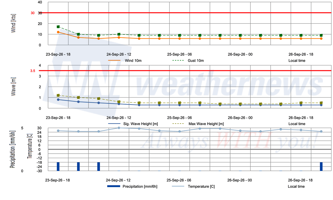
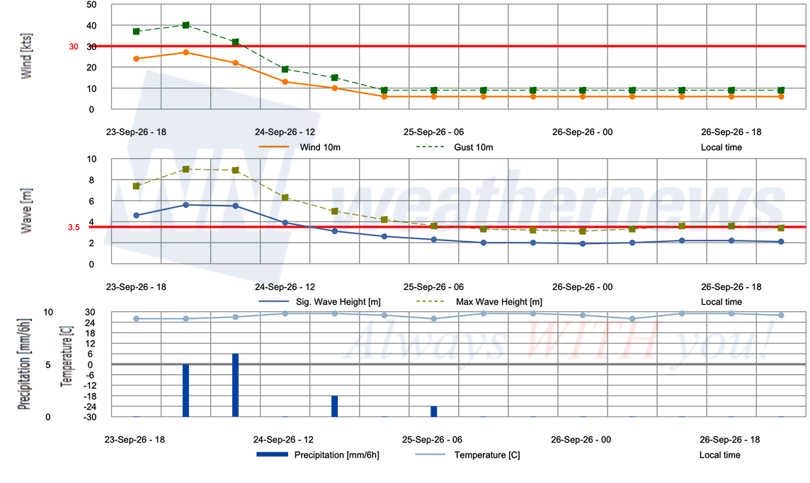
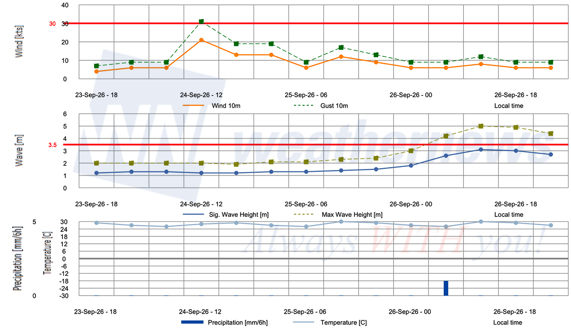
OPERATIONAL PORT FORECASTS
■ ACAPULCO, Guerrero, Mexico
■ LAZARO CARDENAS, Michoacán, Mexico
■ MANZANILLO, Colima, Mexico
Weathernews Inc. assumes no liability for navigational decisions, losses, or damages resulting from reliance on this general overview.
While official observations guide the general threat assessment, highly detailed, proprietary routing and port forecasts are essential for safe navigation. Weathernews services provide customers with 24/7 localized data to ensure your vessels remain safe and well-informed. Please consult our dedicated services for the most up-to-date, detailed predictions for your specific routes and operations.
Note on the storm's name: "Polo" is drawn from the 2026 Eastern North Pacific tropical cyclone name list, the sixteenth name in the season's sequence. Eastern North Pacific tropical cyclone names are pre-selected from twenty four rotating lists. To learn more about how storms are named, please visit the World Meteorological Organization (WMO) website.