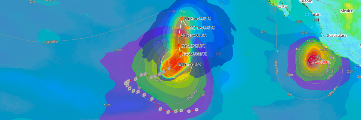
Hurricane Odalys intensified to 95 kt (110 mph) Thursday night, tracking east-northeast roughly 1,010 miles southwest of the southern tip of Baja California, Mexico. Central pressure fell to 966 mb (966 hPa) as the storm churns over open Eastern Pacific waters. NHC forecasts a turn toward the northeast, followed by weakening through the weekend, with no coastal watches or warnings currently in effect.
CURRENT STATUS
Based on the latest NHC Public Advisory analysis on September 25, 2026 03:00 UTC
- Location: 17.1°N, 124.2°W — approximately 1,625 km (1,010 mi) west-southwest of the southern tip of Baja California, Mexico
- Intensity: Category 2 Hurricane
- Movement: East-northeast at 13 km/h (7 kt)
- Central pressure: 966 mb (966 hPa)
- Maximum sustained winds: 175 km/h (95 kt)
- Maximum gusts: 213 km/h (115 kt)
- Hurricane-force winds (64 kt) radius: up to 55 km (35 mi) from center
- Tropical-storm-force winds (34 kt) radius: up to 220 km (140 mi) from center
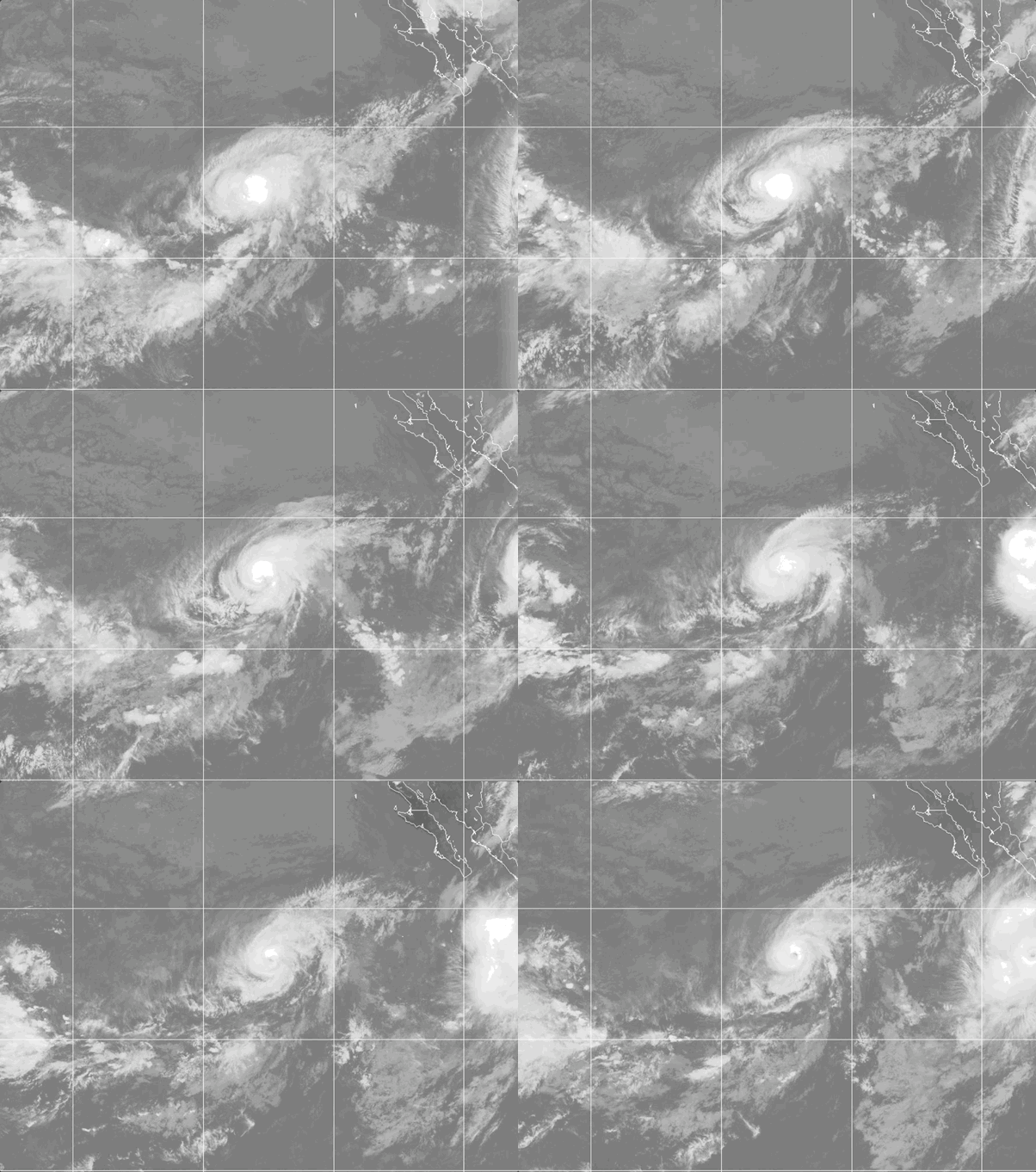
Weathernews Global Composite Satellite Imagery valid September 24, 2026 04:30 UTC to September 25, 2026 04:30 UTC
FORECAST TRACK SUMMARY
NHC expects Odalys to continue east-northeast today before curving northeast Friday and turning north over the weekend, remaining well offshore of the Baja California Peninsula and mainland Mexico. Forecast confidence decreases as the storm begins its northward turn and interacts with the circulation of nearby Hurricane Polo. Odalys is forecast to become a post-tropical remnant low by early Monday.
INTENSITY FORECAST
NHC expects little additional strengthening followed by steady weakening, with Odalys dropping below hurricane strength by Sunday and losing tropical characteristics by Monday as increasing wind shear, drier air, and cooler waters erode the storm's structure.
WIND PROBABILITY & HIGHLIGHTS
Open-ocean waters several hundred miles southwest of the Baja California Peninsula carry a low but non-negligible chance of tropical-storm-force winds, peaking near 8 percent by early Monday before leveling off through the remainder of the forecast period. No meaningful probability of hurricane-force winds is indicated for any location at this time.
IMPACTS & THREATS
Odalys remains far from land, and no hazards affecting coastal areas are expected. Seas of up to 4 meters extend as far as 240 miles from the center, mainly northeast and northwest of the storm, posing a hazard to vessels transiting the open Eastern Pacific. Moisture drawn northward from Odalys and Polo may contribute to heavy rainfall and flash flooding across the southwestern United States this weekend. No significant impacts are anticipated for coastal Mexico or the Baja California Peninsula.
Weathernews Inc. assumes no liability for navigational decisions, losses, or damages resulting from reliance on this general overview.
While official observations guide the general threat assessment, highly detailed, proprietary routing and port forecasts are essential for safe navigation. Weathernews services provide customers with 24/7 localized data to ensure your vessels remain safe and well-informed. Please consult our dedicated services for the most up-to-date, detailed predictions for your specific routes and operations.
Note on the storm's name: "Odalys" is drawn from the 2026 Eastern North Pacific tropical cyclone name list, the fifteenth name in the season's sequence. Eastern North Pacific tropical cyclone names are pre-selected from twenty four rotating lists. To learn more about how storms are named, please visit the World Meteorological Organization (WMO) website.