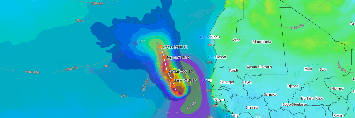
Tropical Storm Gonzalo is tracking north-northwest toward the Cabo Verde Islands, packing maximum sustained winds of 40 kt (45 mph) with higher gusts. The storm is centered roughly 160 miles east-southeast of the southernmost Cabo Verde Islands and is expected to pass near or over the island chain later today and tonight. A Tropical Storm Warning is in effect for all of the Cabo Verde Islands, with tropical storm conditions expected to arrive later this morning.
CURRENT STATUS
Based on the latest NHC Public Advisory analysis on September 25, 2026 03:00 UTC:
- Location: Approximately 160 mi (257 km) east-southeast of the southernmost Cabo Verde Islands
- Intensity: Tropical Storm
- Movement: North-northwest at 13 km/h (8 mph / 7 kt)
- Central pressure: 1004 mb (1004 hPa)
- Maximum sustained winds: 75 km/h (45 mph / 40 kt)
- Maximum gusts: 93 km/h (58 mph / 50 kt)
- Tropical-storm-force winds (34 kt) radius: up to 280 km (175 mi) from center
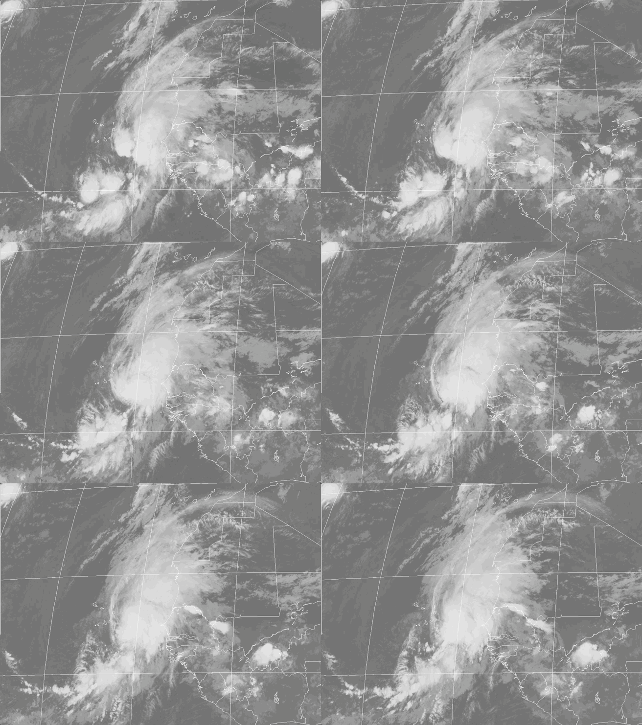
Meteosat Satellite Imagery Compiled by Weathernews, valid September 24, 2026 22:00 UTC to September 25, 2026 05:00 UTC
FORECAST TRACK SUMMARY
Gonzalo will track north-northwestward, passing near or over portions of the Cabo Verde Islands through tonight before continuing away from the islands into the open eastern Atlantic. As the storm clears the steering flow currently guiding it, forward motion will slow considerably this weekend, leaving Gonzalo drifting over open water with no threat to additional land areas through the forecast period.
INTENSITY FORECAST
Slight strengthening is possible today, but NHC forecasts a gradual weakening trend to begin this weekend as increasing wind shear, cooling waters, and drier air erode the storm's structure. Gonzalo is expected to weaken to a post-tropical remnant low by early Monday and remain a remnant low through the following several days.
WIND PROBABILITY & HIGHLIGHTS
Santa Maria, in the Cabo Verde Islands, carries the highest risk in the region, with roughly an 81% chance of tropical-storm-force winds (34 kt / 39 mph) by early Saturday, including an 11% chance of winds reaching 50 kt (58 mph). Praia carries about a 43% chance of tropical-storm-force winds over the same period.
IMPACTS & THREATS
Tropical storm conditions, including damaging winds, are expected across the Cabo Verde Islands later today into tonight. Rainfall of 1 to 3 inches is forecast for the eastern islands of Cabo Verde through Saturday, with lesser totals in the west; the West African coast from Guinea-Bissau to Senegal faces heavier totals of 2 to 4 inches, isolated higher, raising flash flood concerns. Life-threatening surf and rip currents will affect the Cabo Verde Islands through Saturday.
OPERATIONAL PORT FORECASTS
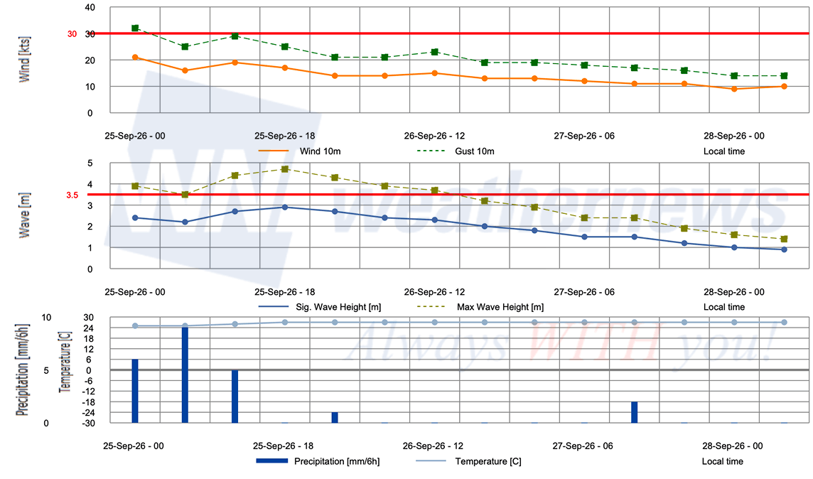
■ DAKAR, Senegal
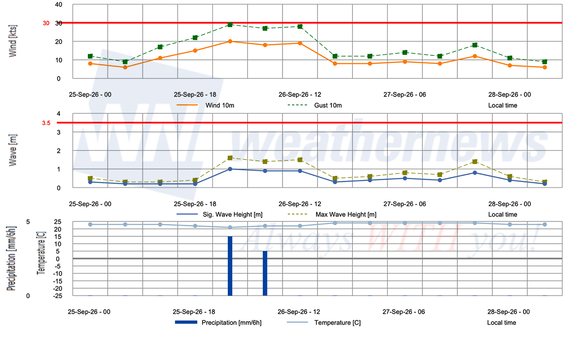
■ NOUADHIBOU, Mauritania
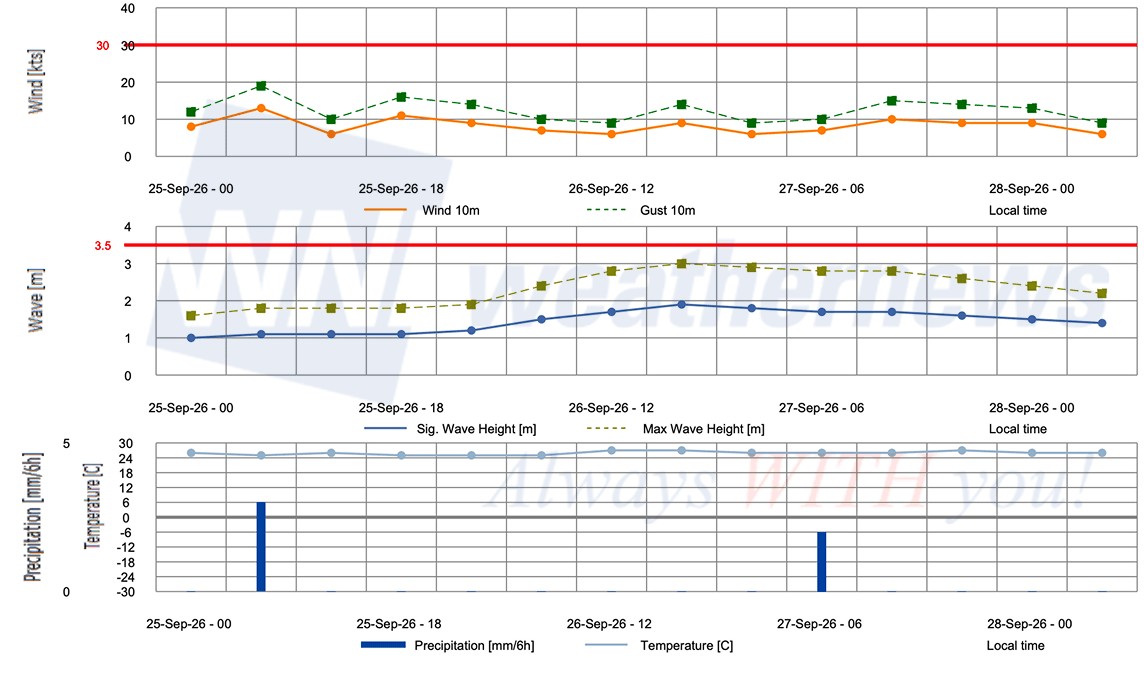
■ NOUAKCHOTT, Mauritania
Weathernews Inc. assumes no liability for navigational decisions, losses, or damages resulting from reliance on this general overview.
While official observations guide the general threat assessment, highly detailed, proprietary routing and port forecasts are essential for safe navigation. Weathernews services provide customers with 24/7 localized data to ensure your vessels remain safe and well-informed. Please consult our dedicated services for the most up-to-date, detailed predictions for your specific routes and operations.
Note on the storm's name: "Gonzalo" is drawn from the 2026 Caribbean Sea, Gulf of Mexico and the North Atlantic tropical cyclone name list, the seventh name in the season's sequence. Caribbean Sea, Gulf of Mexico and the North Atlantic tropical cyclone names are pre-selected from twenty one rotating lists. To learn more about how storms are named, please visit the World Meteorological Organization (WMO) website.