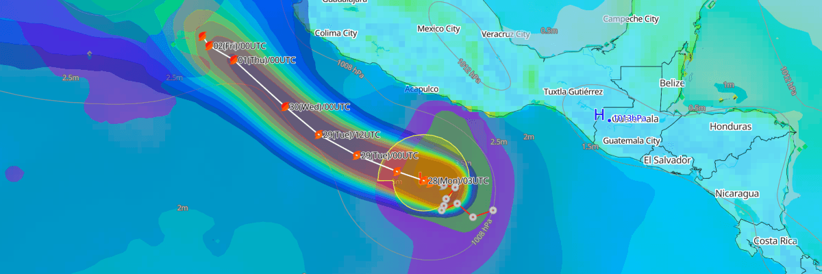
Tropical Storm Rachel, located about 275 miles south of Acapulco, Mexico, is forecast to strengthen into a hurricane by Tuesday as it moves west-northwest off Mexico's southwestern coast. Rachel currently has maximum sustained winds of 35 kt (40 mph) and a central pressure of 1003 mb (1003 hPa), moving west at 6 kt (7 mph). The storm's core is expected to stay offshore, but tropical storm conditions are possible along a coastal watch area by Tuesday.
CURRENT STATUS
Based on the latest NHC Public Advisory analysis on September 28, 2026 03:00 UTC
- Location: 12.9°N, 99.8°W — approximately 445 km (275 mi) south of Acapulco, Mexico and 830 km (515 mi) southeast of Manzanillo, Mexico
- Intensity: Tropical Storm
- Movement: West at 11 km/h (6 kt)
- Central pressure: 1003 mb (1003 hPa)
- Maximum sustained winds: 65 km/h (35 kt)
- Maximum gusts: 85 km/h (45 kt)
- Tropical-storm-force winds (34 kt) radius: up to 220 km (140 mi) from center
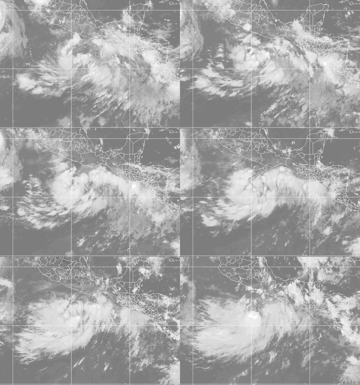
Weathernews Global Composite Satellite Imagery valid September 27, 2026 04:30 UTC to September 28, 2026 04:30 UTC
FORECAST TRACK SUMMARY
According to NHC, Rachel will accelerate west-northwestward through midweek, tracking well offshore of southwestern Mexico and later paralleling the Baja California Peninsula. By Thursday, a weakening steering pattern is expected to slow the storm's forward speed while it holds a similar heading, keeping it over open Pacific waters through the weekend.
INTENSITY FORECAST
NHC forecasts steady strengthening, with Rachel becoming a hurricane on Tuesday and reaching winds near 85 kt (100 mph) by midweek, as wind shear diminishes and ocean conditions grow more favorable for intensification.
WIND PROBABILITY & HIGHLIGHTS
There is up to a 65% chance of tropical-storm-force winds (34 kt / 39 mph) in open waters near 20°N, 110°W by Friday, with a 16% chance of hurricane-force winds (64 kt / 74 mph) there over the same period. Isla Socorro and the southern Baja California coast, including Cabo San Lucas, carry lower but rising chances of tropical-storm-force winds later this week.
IMPACTS & THREATS
Tropical storm conditions remain possible along the Mexican coast within the watch area by Tuesday. Large swells generated by Rachel will bring life-threatening surf and rip current conditions to the southwestern Mexico coast over the next several days. As Rachel strengthens, mariners in shipping lanes off Mexico's Pacific coast and near the southern Baja California Peninsula should expect rough seas and building swells later this week.
OPERATIONAL PORT FORECASTS
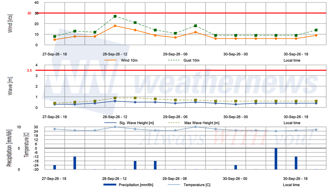
■ ACAPULCO, Guerrero, Mexico
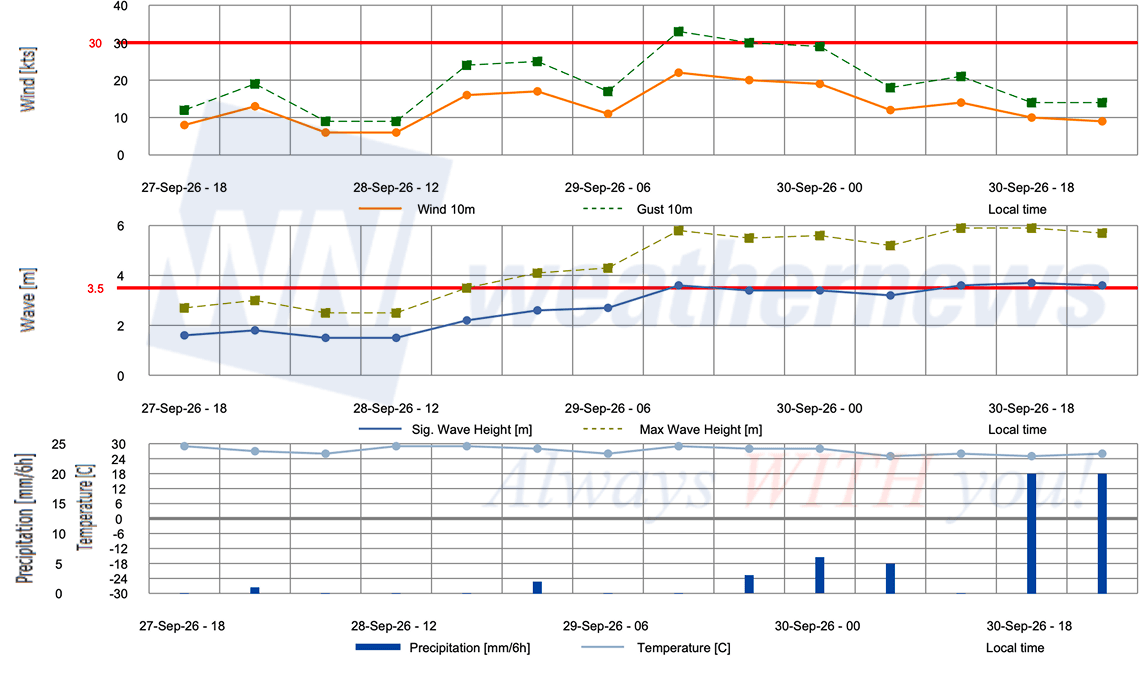
■ LAZARO CARDENAS, Michoacán, Mexico
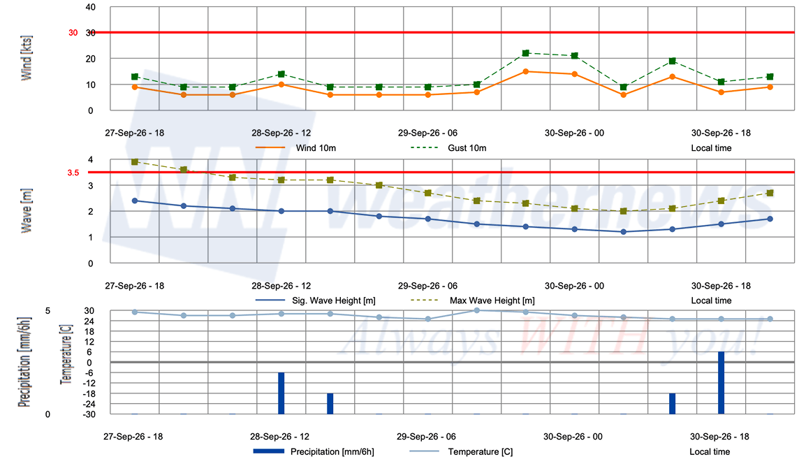
■ MANZANILLO, Colima, Mexico
Weathernews Inc. assumes no liability for navigational decisions, losses, or damages resulting from reliance on this general overview.
While official observations guide the general threat assessment, highly detailed, proprietary routing and port forecasts are essential for safe navigation. Weathernews services provide customers with 24/7 localized data to ensure your vessels remain safe and well-informed. Please consult our dedicated services for the most up-to-date, detailed predictions for your specific routes and operations.
Note on the storm's name: "Rachel" is drawn from the 2026 Eastern North Pacific tropical cyclone name list, the seventeenth name in the season's sequence. Eastern North Pacific tropical cyclone names are pre-selected from twenty four rotating lists. To learn more about how storms are named, please visit the World Meteorological Organization (WMO) website.