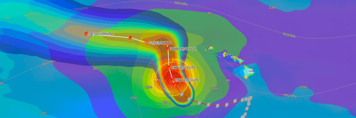
Hurricane Nolo is a Category 3 storm with maximum sustained winds of 110 kt (125 mph) and a minimum central pressure of 945 mb (945 hPa). The center is about 415 miles west-southwest of Honolulu and 390 miles south-southeast of French Frigate Shoals. It is moving northwest at 11 kt (13 mph). A Hurricane Warning is in effect for the Papahanaumokuakea Marine National Monument, and the center is forecast to stay well southwest and west of the main Hawaiian Islands.
CURRENT STATUS
Based on the latest NHC Public Advisory analysis on September 29, 2026 03:00 UTC
- Location: 18.8°N, 163.7°W, about 625 km (390 mi) south-southeast of French Frigate Shoals and 665 km (415 mi) west-southwest of Honolulu, Hawaii
- Intensity: Category 3 hurricane
- Movement: Northwest at 20 km/h (11 kt)
- Central pressure: 945 mb (945 hPa)
- Maximum sustained winds: 205 km/h (110 kt / 125 mph)
- Maximum gusts: 280 km/h (150 kt / 175 mph)
- Hurricane-force winds (64 kt) radius: up to 55 km (35 mi / 30 nm) from center
- Tropical-storm-force winds (34 kt) radius: up to 240 km (150 mi / 130 nm) from center
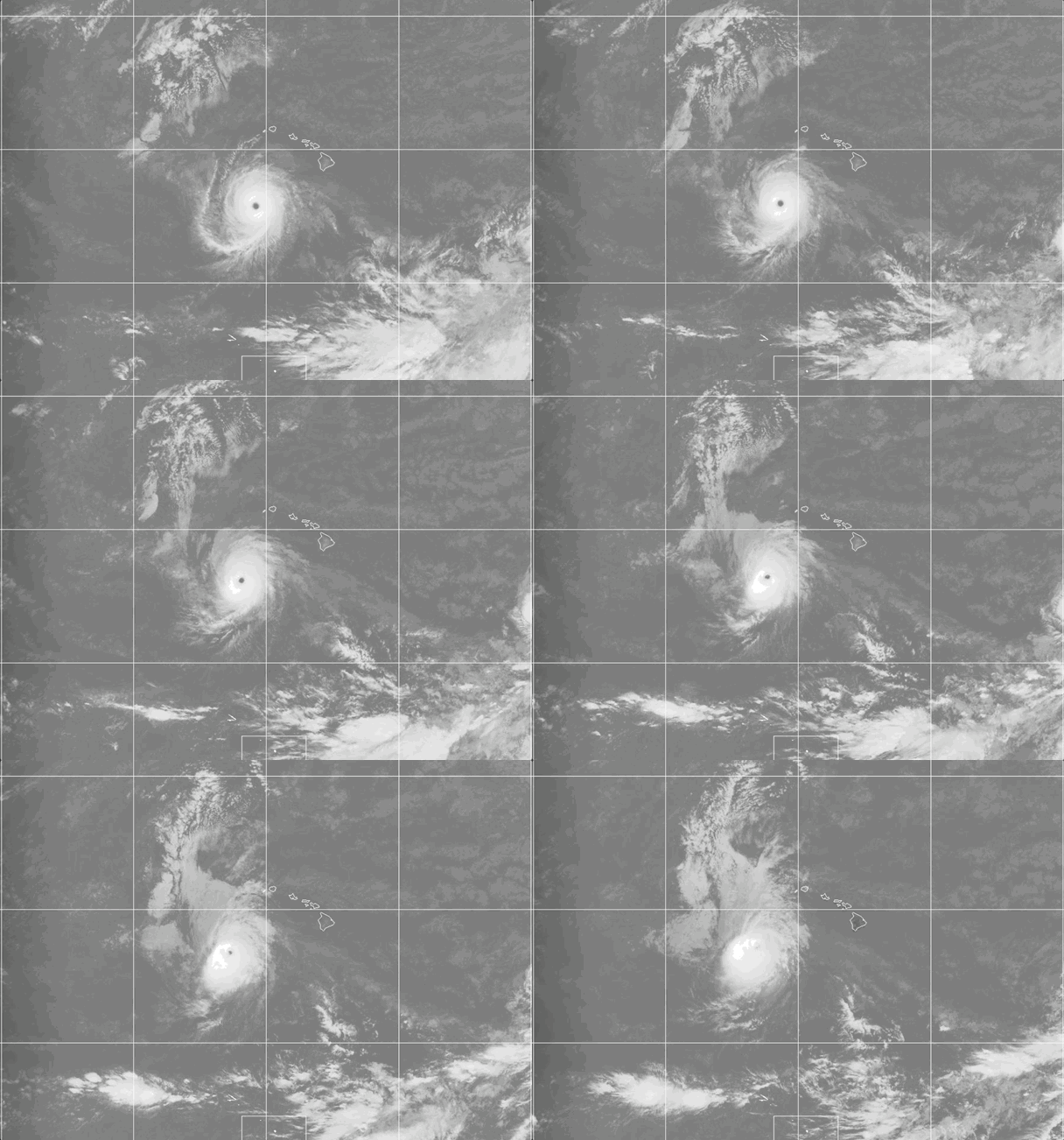
Weathernews Global Composite Satellite Imagery valid September 28, 2026 05:30 UTC to September 29, 2026 05:30 UTC
FORECAST TRACK SUMMARY
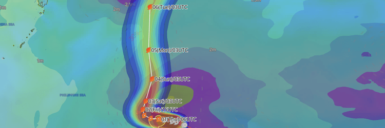
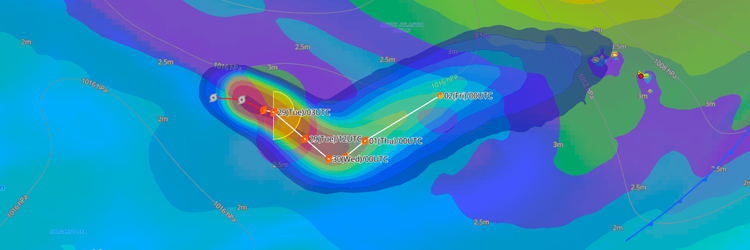
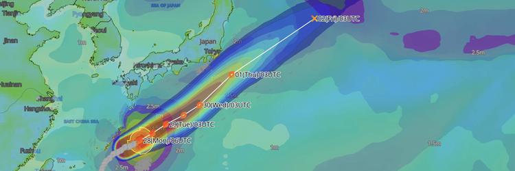
NHC forecasts a turn toward the north on Tuesday. Nolo then slows sharply as it approaches the monument. Later this week a building ridge is forecast to steer Nolo westward, nearly parallel to the northwestern Hawaiian Islands. Nolo will stay well west of the main islands throughout.
INTENSITY FORECAST
NHC expects steady weakening. Nolo is forecast to fall below major hurricane strength Wednesday and reach tropical storm strength by Thursday, as strong upper-level winds and dry air disrupt the storm's core. Some gradual re-intensification is possible late this week and into the weekend, when those winds ease.
WIND PROBABILITY & HIGHLIGHTS
Necker Island has an 86% chance of tropical-storm-force winds (34 kt / 39 mph) and a 15% chance of hurricane-force winds (64 kt / 74 mph) over the next five days. French Frigate Shoals has a 76% chance of tropical-storm-force winds, with the greatest likelihood from 0000 UTC Thursday to 0000 UTC Friday (2 PM HST Wednesday to 2 PM HST Thursday), and Maro Reef and Laysan face 36–44% chances by Saturday night.
IMPACTS & THREATS
Rainfall: Outer bands east of Nolo's track will bring 3 to 6 inches of rain to Kauai and Niihau from Tuesday through Thursday. Flooding and mudslides are possible on steep terrain.
Storm Surge: No storm surge forecast though NHC noted large waves will likely inundate low-lying atolls in the monument, especially from French Frigate Shoals to Nihoa.
Swells & Surf: Large surf begins affecting the monument later today. Swells will bring life-threatening surf and rip currents to south- and west-facing shores of the main Hawaiian Islands over the next few days.
OPERATIONAL PORT FORECASTS
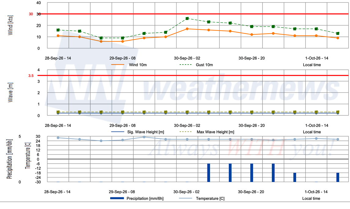
■ PORT OF HONOLULU, Hawaii, United States
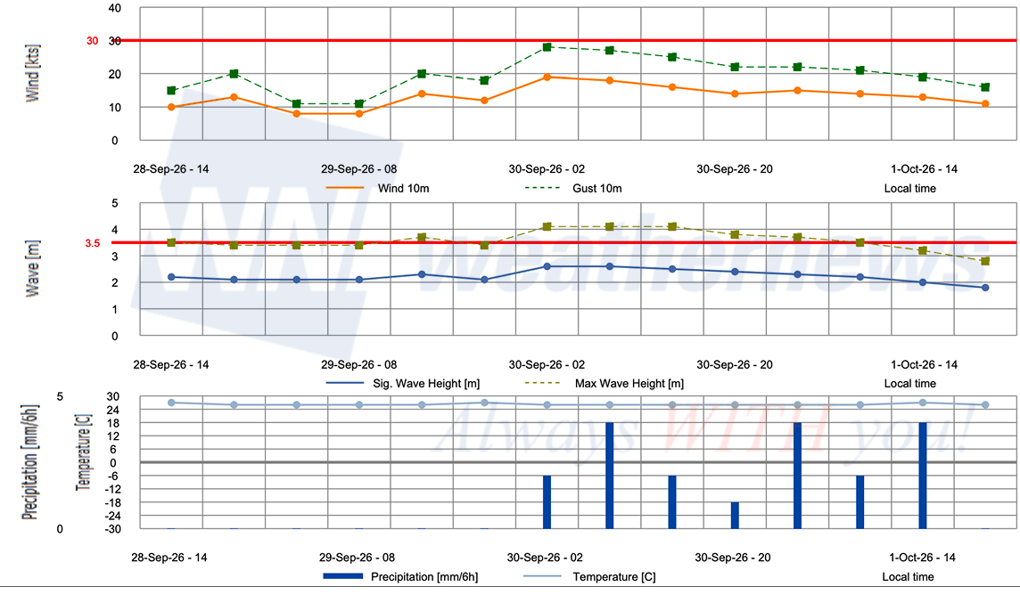
■ BARBERS POINT TERMINAL, Hawaii, United States
Weathernews Inc. assumes no liability for navigational decisions, losses, or damages resulting from reliance on this general overview.
While official observations guide the general threat assessment, highly detailed, proprietary routing and port forecasts are essential for safe navigation. Weathernews services provide customers with 24/7 localized data to ensure your vessels remain safe and well-informed. Please consult our dedicated services for the most up-to-date, detailed predictions for your specific routes and operations.
Note on the storm's name: "Nolo" is drawn from the Central North Pacific tropical cyclone name list maintained by the World Meteorological Organization (WMO). Central North Pacific tropical cyclone names are pre-selected Hawaiian names that rotate continuously across four lists. To learn more about how storms are named, please visit the World Meteorological Organization (WMO).