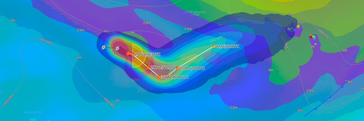
Tropical Storm Hanna is moving east-southeastward over the open central Atlantic, about 1,010 miles east-northeast of Bermuda and 1,145 miles west of the Azores. Maximum sustained winds are 40 kt (45 mph), and the minimum central pressure is 1002 mb (1002 hPa). Hanna poses no threat to land, but it brings rough seas to a small area of the open ocean.
CURRENT STATUS
Based on the latest NHC Public Advisory analysis on September 29, 2026 03:00 UTC
- Location: 36.0°N, 47.7°W, approximately 1,625 km (1,010 mi) east-northeast of Bermuda and 1,845 km (1,145 mi) west of the Azores
- Intensity: Tropical Storm
- Movement: East-southeast at 22 km/h (12 kt / 14 mph)
- Central pressure: 1002 mb (1002 hPa)
- Maximum sustained winds: 75 km/h (40 kt / 45 mph)
- Maximum gusts: 102 km/h (55 kt / 63 mph)
- Tropical-storm-force winds (34 kt) radius: Up to 150 km (90 mi / 80 nm) from the center
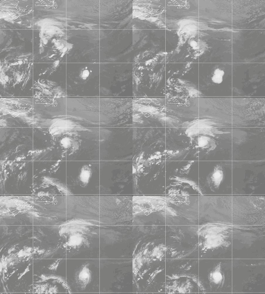
Weathernews Global Composite Satellite Imagery valid September 28, 2026 05:30 UTC to September 29, 2026 05:30 UTC
FORECAST TRACK SUMMARY
NHC forecasts Hanna to keep moving east-southeast through Wednesday while slowing. It then turns slowly east-northeast, staying well west of the Azores. Hanna is forecast to become a post-tropical remnant low by Thursday (1200 UTC Oct 1) and dissipate by Saturday (0000 UTC Oct 3).
INTENSITY FORECAST
NHC expects small fluctuations, with Hanna possibly strengthening slightly to 45 kt (52 mph) on Tuesday. Weakening should then begin. Strong upper-level winds and dry air will keep the storm disorganized, and it is expected to drop below tropical-storm strength on Thursday.
WIND PROBABILITY & HIGHLIGHTS
No significant probability of tropical-storm-force or hurricane-force winds is forecast for any monitored location over the next five days. Open-ocean areas near Hanna's track carry the only meaningful wind risk, and it is confined to the storm's immediate vicinity.
IMPACTS & THREATS
No land hazards are expected. The main concern is rough seas near the center, with the highest waves south of the track. Vessels crossing the central Atlantic between Bermuda and the Azores should allow extra distance from Hanna. NHC has asked ships within 300 miles of the storm to send reports every three hours.
Weathernews Inc. assumes no liability for navigational decisions, losses, or damages resulting from reliance on this general overview.
While official observations guide the general threat assessment, highly detailed, proprietary routing and port forecasts are essential for safe navigation. Weathernews services provide customers with 24/7 localized data to ensure your vessels remain safe and well-informed. Please consult our dedicated services for the most up-to-date, detailed predictions for your specific routes and operations.
Note on the storm's name: "Hanna" is drawn from the 2026 Caribbean Sea, Gulf of Mexico and the North Atlantic tropical cyclone name list, the eighth name in the season's sequence. Caribbean Sea, Gulf of Mexico and the North Atlantic tropical cyclone names are pre-selected from twenty one rotating lists. To learn more about how storms are named, please visit the World Meteorological Organization (WMO).