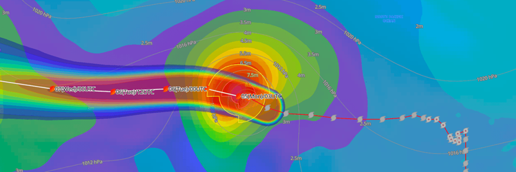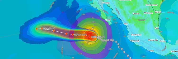
Typhoon No. 27 (Choi-wan) has intensified into a "large and very strong" system over the waters east of the Ogasawara archipelago, generating hazardous 8-meter waves and packing maximum sustained winds of 95 kt as it tracks northward across the open Northwest Pacific.
CURRENT STATUS
Based on the latest JMA observations on October 5, 2026 04:05 UTC
- Location: 25.6°N, 146.4°E— approximately 450 km east-southeast of Chichijima, Ogasawara Islands
- Classification / Intensity / Scale: Typhoon (TY) / Very Strong / Large
- Movement: North-northwest at 9 kt (15 km/h)
- Central pressure: 925 hPa
- Maximum sustained winds: 95 kt (185 km/h)
- Maximum gusts: 135 kt (250 km/h)
- ≥30-kt wind area: 850 km (450 NM) to the east, 560 km (300 NM) to the west
- ≥50-kt wind area: 220 km (120 NM) to the east, 165 km (90 NM) to the west
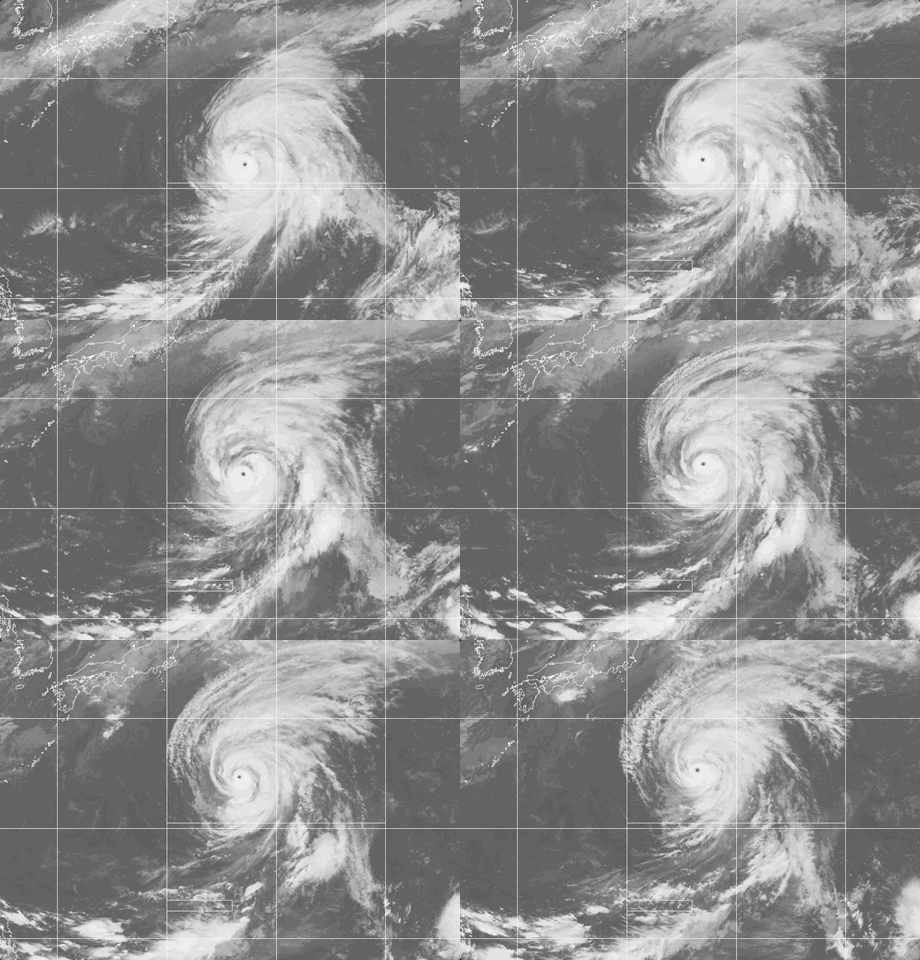
Weathernews Global Composite Satellite Imagery valid October 4, 2026 04:30 UTC to October 5, 2026 04:30 UTC
FORECAST TRACK SUMMARY
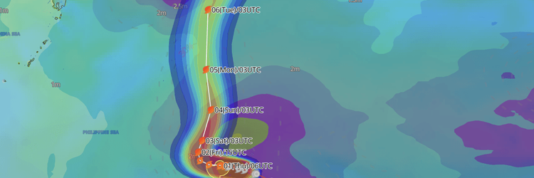
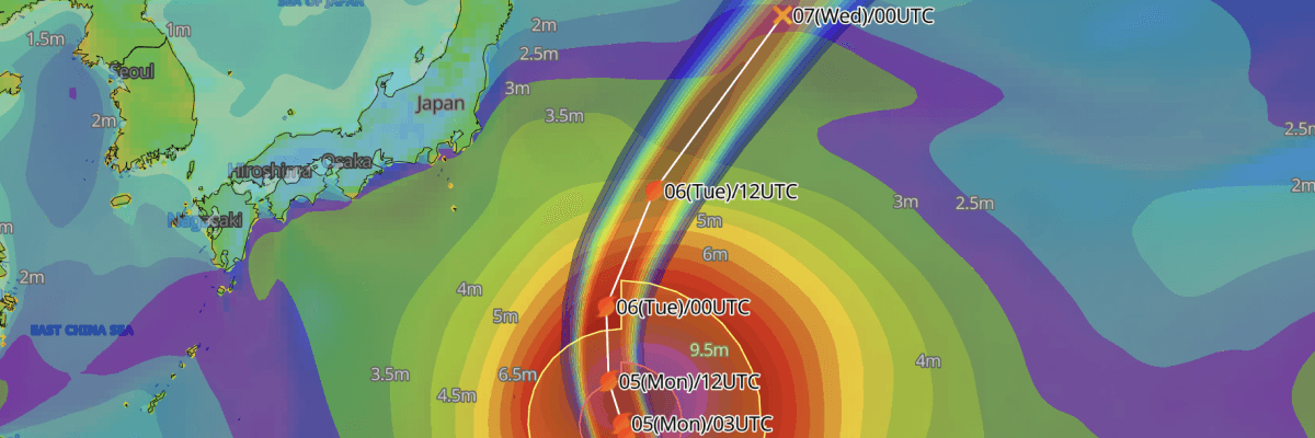
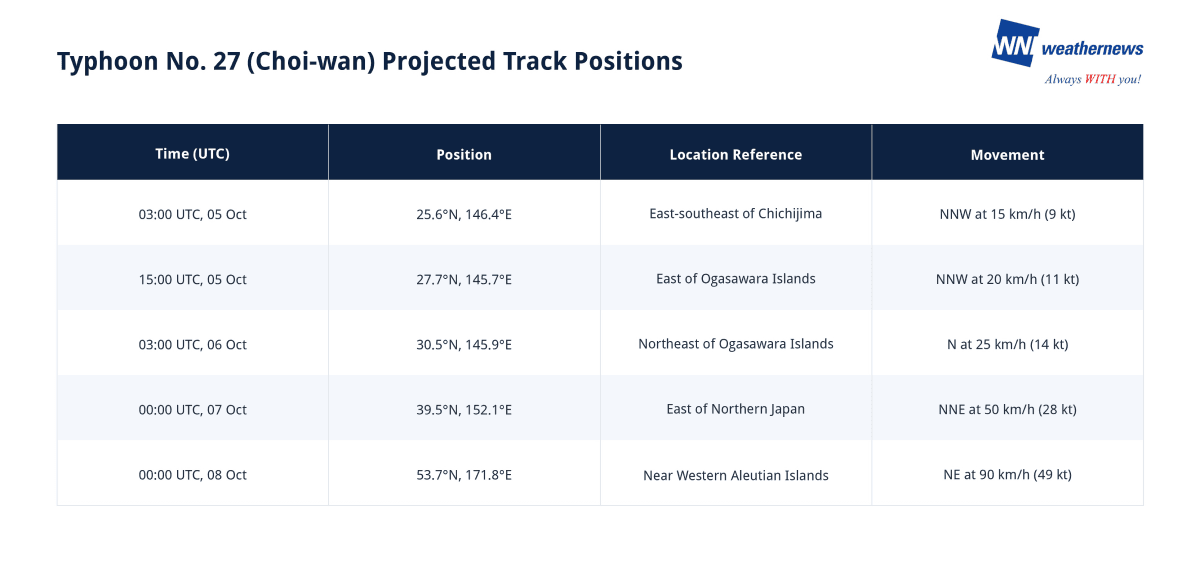
Typhoon No. 27 (Choi-wan) is forecast to track north-northwestward past the Ogasawara archipelago through Tuesday while maintaining "very strong" intensity. The expansive cyclone is forecast to curve northward and accelerate rapidly northeastward into the open North Pacific from Wednesday, completing its transition into an extratropical low over the subarctic Pacific by 8 October.
INTENSITY FORECAST
Typhoon No. 27 (Choi-wan) is currently near its peak intensity with a deep central pressure of 925 hPa and core sustained winds of 95 kt (185 km/h). While the cyclone will begin a gradual weakening trend as it tracks into higher latitudes, it is forecast to remain a "very strong" typhoon, maintaining sustained winds of 90 kt (167 km/h) at 15:00 UTC on 5 October and 85 kt (157 km/h) at 03:00 UTC on 6 October.
As the storm moves over cooler waters east of northern Japan on 7 October, central pressure will rise to 960 hPa with sustained winds easing to 75 kt (140 km/h). By 00:00 UTC on 8 October, Choi-wan will transition into an extratropical cyclone with a central barometric pressure of 964 hPa and sustained winds of 60 kt (110 km/h).
IMPACTS & THREATS
Navigating north-northwestward past the Ogasawara Islands with an exceptionally expansive circulation and intense core winds, Typhoon No. 27 (Choi-wan) poses critical maritime hazards across central and northern Pacific shipping routes through 7 October.
Dangerous Waves: Severe ocean swells and towering seas represent the primary hazard for island communities and regional shipping. Wave heights across the Ogasawara archipelago are expected to reach 8 meters with heavy swells on both 5 and 6 October. Marine operators, inter-island transportation, and coastal facilities are advised to exercise extreme caution against rough, breaking surf and swell inundation.
Strong Winds: Storm-force winds cover an extensive zone surrounding the typhoon. Choi-wan currently sustains 50-kt storm-force winds up to 220 km (120 NM) east and 165 km (90 NM) west of its center, while an extraordinarily broad gale wind field (≥30 kt) extends 850 km (450 NM) to the east and 560 km (300 NM) to the west. A storm warning area of 310 km (165 NM) east and 230 km (125 NM) west will persist as the system tracks east of Chichijima on 6 October.
Violent Gusts: Destructive wind gusts near the core are currently reaching 135 kt (250 km/h). Peak gusts will remain severe between 120 and 130 kt (220 and 240 km/h) through 6 October, before decreasing to 105 kt (195 km/h) as the typhoon accelerates offshore of Tohoku on 7 October.
Weathernews Inc. assumes no liability for navigational decisions, losses, or damages resulting from reliance on this general overview.
While official observations guide the general threat assessment, highly detailed, proprietary routing and port forecasts are essential for safe navigation. Weathernews services provide customers with 24/7 localized data to ensure your vessels remain safe and well-informed. Please consult our dedicated services for the most up-to-date, detailed predictions for your specific routes and operations.
Note on the storm's name: "Choi-wan" is drawn from the Western North Pacific and South China Sea tropical cyclone name list, contributed by Hong Kong, and means "colorful cloud" in Cantonese. The WMO and the ESCAP/WMO Typhoon Committee adopt these names sequentially to make tracking specific storms straightforward and to quickly communicate warnings. To learn more about how storms are named, please visit the World Meteorological Organization (WMO) website.