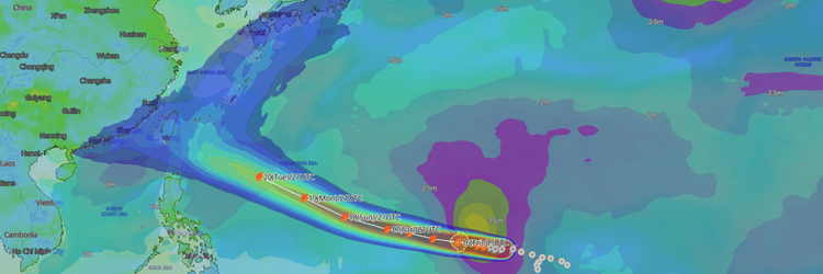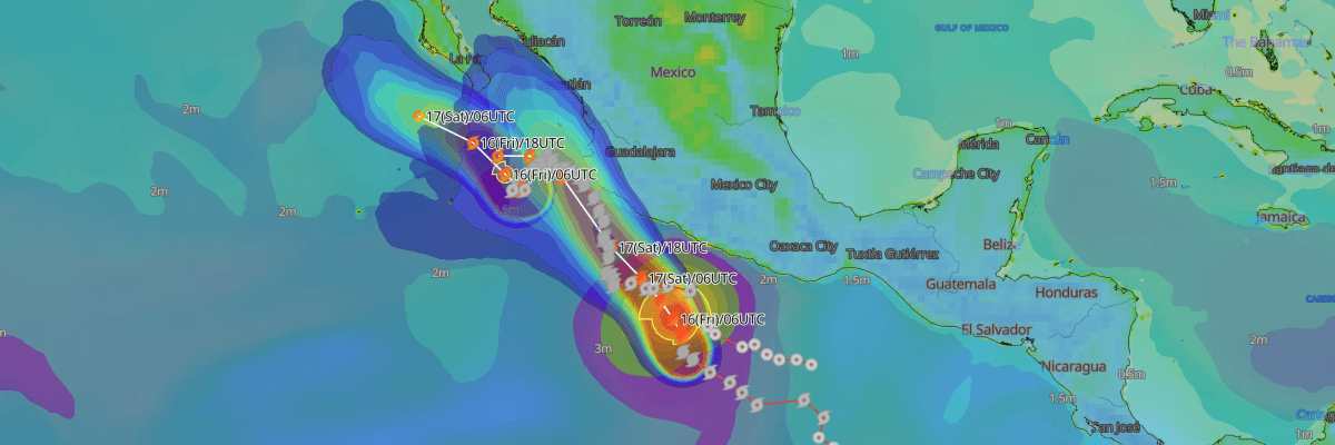
Hurricane Trudy is forecast to resume rapid intensification into a major hurricane as it heads north-northwestward toward the southwestern coast of Mexico. The system currently packs maximum sustained winds of 80 kt (150 km/h) and is expected to bring dangerous storm surge, damaging hurricane-force winds, and torrential rainfall to coastal states by October 17.
CURRENT STATUS
Based on the latest NHC Public Advisory analysis on October 16, 2026 00:00 UTC
- Location: 14.0°N, 101.8°W — approximately 380 km (235 mi) south-southwest of Acapulco and 615 km (385 mi) s south-southeast of Manzanillo, Mexico
- Intensity: Hurricane (Category 1)
- Movement: North-northwest at 5 kt (9 km/h)
- Central pressure: 978 hPa
- Maximum sustained winds: 80 kt (150 km/h)
- Maximum gusts: 100 kt (185 km/h)
- ≥34-kt wind area: 165 km (90 NM) northeast, 150 km (80 NM) northwest, 95 km (50 NM) southeast, 75 km (40 NM) southwest
- ≥64-kt wind area: 35 km (20 NM) northeast and northwest, 30 km (15 NM) southeast and southwest
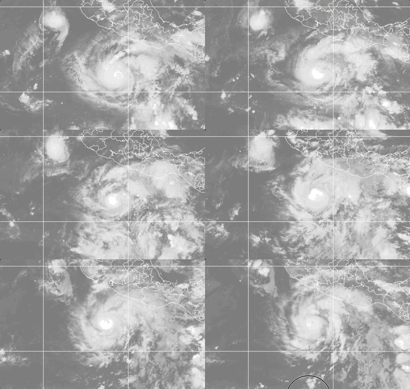
Weathernews Global Composite Satellite Imagery valid October 15, 2026 05:30 UTC to October 16, 2026 05:15 UTC
FORECAST TRACK SUMMARY
Hurricane Trudy is forecast to track north-northwestward through October 16, then turn northwestward overnight into October 17. On this track, the core of the hurricane will approach the southwestern and west-central coasts of Mexico on October 17, tracking roughly parallel to and near the shoreline through October 18.
INTENSITY FORECAST
Hurricane Trudy is expected to rapidly intensify into a major hurricane by October 16, potentially peaking near 125 kt (230 km/h) early October 17 as low vertical wind shear and high ocean heat content promote strengthening. The cyclone should begin weakening late October 17 and October 18 as it interacts with the coastal terrain of Mexico and encounters increasing upper-level wind shear.
IMPACTS & THREATS
Tracking north-northwestward toward the southwestern coast of Mexico before turning parallel to the shoreline, Hurricane Trudy presents severe hazards of damaging winds, life-threatening surf, coastal storm surge, and torrential rainfall across coastal states and adjacent shipping routes through October 17-18.
Damaging Winds: Hurricane-force winds extend outward up to 35 km (20 NM) from the center, with tropical-storm-force winds reaching up to 165 km (90 NM). Tropical storm conditions are expected within the tropical storm warning area by early October 17, spreading into the hurricane watch area later in the day. Manzanillo faces an 85% probability of tropical-storm-force winds (34 kt) and a 35% probability of hurricane-force winds (64 kt) through October 17. Barra de Navidad carries a 69% probability of tropical-storm-force winds and a 21% probability of hurricane-force winds over the same period, while Lazaro Cardenas carries a 56% probability of tropical-storm-force winds.
Violent Gusts: Destructive wind gusts pose extreme hazards to vessels and coastal infrastructure. Peak gusts near the center are currently reaching 100 kt (185 km/h). Wind gusts are forecast to intensify rapidly to 115 kt (215 km/h) by early October 16, peaking near 150 kt (280 km/h) on October 17 as Hurricane Trudy nears peak major hurricane intensity, before gradually decreasing to 130 kt (240 km/h) on October 18.
Torrential Rainfall & Mudslides: Through October 17-18, Hurricane Trudy is expected to produce 100-200 mm (4-8 in) of rain with isolated totals up to 300 mm (12 in) along the southwest Mexican coast in Michoacan, Colima, and Jalisco. This rainfall may produce life-threatening flash flooding and mudslides, particularly across steep terrain. In Guerrero, outer rain bands are forecast to bring 50-100 mm (2-4 in) with isolated amounts up to 150 mm (6 in), may lead to localized flash flooding.
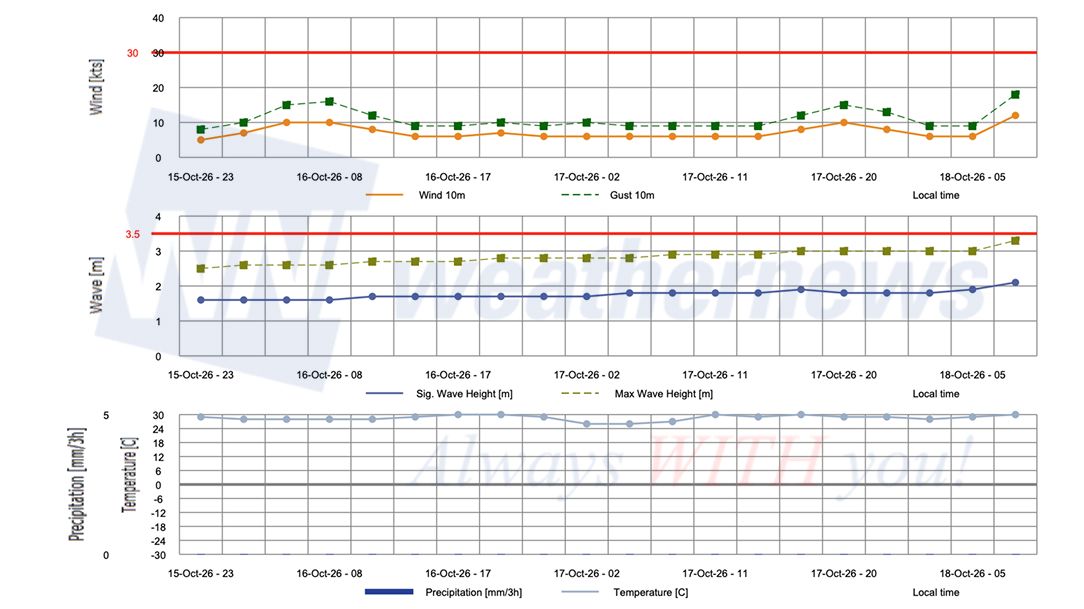
Storm Surge & Hazardous Seas: Coastal flooding from storm surge is possible in areas of onshore winds, where the surge will be accompanied by large, destructive waves along the immediate shoreline. Life-threatening surf and dangerous rip currents generated by Hurricane Trudy will affect the coast of southwestern Mexico over October 16-18. Marine operators and vessels transiting the region should prepare for severely deteriorating sea conditions with 4 m (13 ft) seas extending up to 220 km (120 NM) from the cyclone.
OPERATIONAL PORT FORECASTS
■ LÁZARO CÁRDENAS, Michoacán, Mexico
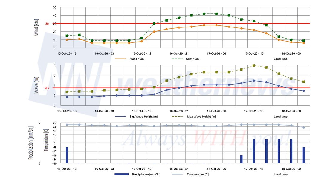
■ MANZANILLO, Colima, Mexico
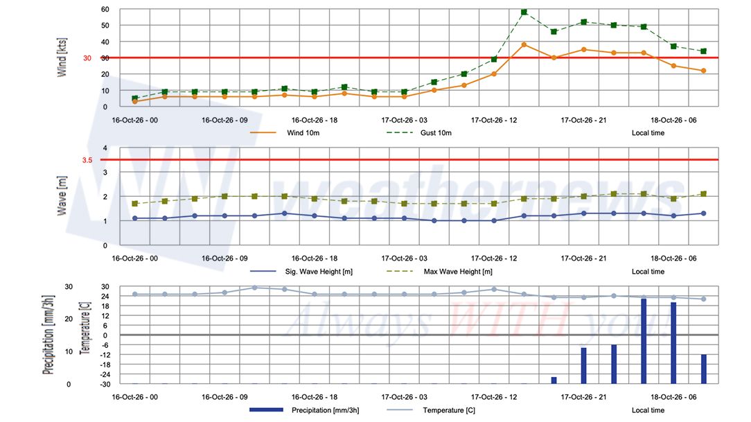
■ MAZATLÁN, Sinaloa, Mexico
Weathernews Inc. assumes no liability for navigational decisions, losses, or damages resulting from reliance on this general overview.
While official observations guide the general threat assessment, highly detailed, proprietary routing and port forecasts are essential for safe navigation. Weathernews services provide customers with 24/7 localized data to ensure your vessels remain safe and well-informed. Please consult our dedicated services for the most up-to-date, detailed predictions for your specific routes and operations.
Note on the storm's name: "Trudy" is drawn from the 2026 Eastern North Pacific tropical cyclone name list, the twentieth name in the season's sequence. Eastern North Pacific tropical cyclone names are pre-selected from twenty four rotating lists. To learn more about how storms are named, please visit the World Meteorological Organization (WMO) website.