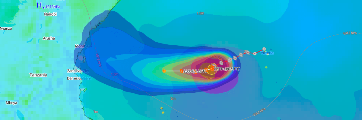
Tropical Storm Agueda is nearly stationary over the open Southwest Indian Ocean and is forecast to weaken over the coming days without threatening major land areas, according to Météo-France (La Réunion), Météo-Madagascar and the Joint Typhoon Warning Center (JTWC).
CURRENT STATUS
Based on the latest Météo-France advisory analysis on October 22, 2026 00:00 UTC, Joint Warning Typhoon Center (JTWC) on October 21, 2026 21:00 UTC and Météo-Madagascar on October 20, 2026 13:00 UTC.
- Location: 5.7°S 51.2°E, just over 200 km northwest of the Alphonse archipelago in the Seychelles
- Intensity: Moderate tropical storm
- Movement: Quasi-stationary, with a slow west-southwestward drift
- Central pressure: 1000 hPa
- Maximum sustained winds: approximately 40 kt (75 km/h), 10-minute average; gusts to 100 km/h (about 54 kt)
For comparison, JTWC (Tropical Cyclone 02S) estimated 1-minute sustained winds of 50 kt (93 km/h) at 1800 UTC on Oct 21. The two agencies use different averaging periods, so their wind figures are not directly comparable.
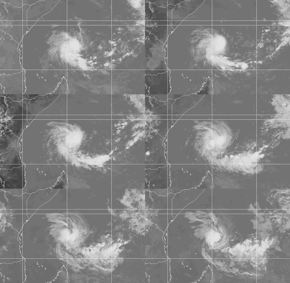
Weathernews Global Composite Satellite Imagery valid October 21, 2026 03:30 UTC to October 22, 2026 02:30 UTC
FORECAST TRACK SUMMARY
Agueda is expected to continue drifting west-southwestward before veering west and then northwest, Météo-France said. Its forecast center positions, all at 0000 UTC:
- 23 Oct: 6.2°S 49.5°E, moderate tropical storm
- 24 Oct: 6.0°S 46.8°E, tropical depression
- 25 Oct: 4.8°S 43.6°E, tropical disturbance
JTWC's track runs close to this, from 6.3°S 50.2°E at 0600 UTC on Oct 22 to 6.5°S 45.3°E at 0600 UTC on Oct 24, then 6.0°S 43.7°E at 1800 UTC on Oct 24. JTWC rates its track confidence as medium. Météo-France urges that its forecast be treated "with extreme caution" because of inherent uncertainty.
INTENSITY FORECAST
Agueda weakened early on Oct 22, according to Météo-France. It is forecast to hold its intensity through the daytime on Oct 22 and weaken toward the end of the week, passing through tropical depression and tropical disturbance stages.
JTWC forecasts 1-minute sustained winds holding at 50 kt (93 km/h) through 0600 UTC on Oct 22, then easing to 45 kt (83 km/h) by 1800 UTC on Oct 22, 40 kt (74 km/h) by 1800 UTC on Oct 23, and 35 kt (65 km/h) by 0600 UTC on Oct 24. It expects Agueda to dissipate over water by 1800 UTC on Oct 24, with winds near 30 kt (56 km/h). Increasing mid-level wind shear and dry air are expected to drive the weakening, and JTWC rates its intensity confidence as high.
IMPACTS & THREATS
Agueda is forecast to remain over open water. Météo-France said the main islands of the Seychelles are no longer affected by adverse weather. No cyclone alerts are in effect for Réunion or Mayotte, and no influence is expected there over the next five days. Météo-Madagascar reported no direct effect on Madagascar and no cyclone warning. It advised mariners in the north to stay informed.
The main hazards are for shipping. JTWC's 1800 UTC position on Oct 21 showed winds of 34 kt or more extending only 25–35 nm from the center, with maximum significant wave heights of 16 ft (about 4.9 m). Vessels transiting the area may encounter rough seas near the center.
Weathernews Inc. assumes no liability for navigational decisions, losses, or damages resulting from reliance on this general overview.
While official observations guide the general threat assessment, highly detailed, proprietary routing and port forecasts are essential for safe navigation. Weathernews services provide customers with 24/7 localized data to ensure your vessels remain safe and well-informed. Please consult our dedicated services for the most up-to-date, detailed predictions for your specific routes and operations.
Note on the storm's name: "Agueda" is drawn from the 2026 Southwest Indian Ocean tropical cyclone name list, the first name in the season's sequence. Southwest Indian Ocean tropical cyclone names are pre-selected from twenty six rotating lists. To learn more about how storms are named, please visit the World Meteorological Organization (WMO).