North Pacific Storm Trend Outlook (November 2026 – January 2027)
Weathernews' expert meteorologists have analyzed pressure patterns across the North Pacific, providing insights into expected storm activity for the coming months. This outlook aims to inform operators about potential weather challenges this winter.
Summary
November 2026
- Lower-than-average pressure extends from the Bering Sea through the Aleutian Islands to the Gulf of Alaska.
- Low-pressure systems are likely to develop from the Aleutians to the Gulf of Alaska.
- The Siberian High is expected to extend southeastward less than normal, and pressure over China is forecast to be below average. Pressure is higher than average from the South China Sea to the Philippines, so the Northeast monsoon over the East and South China Seas is likely to be weaker than usual.
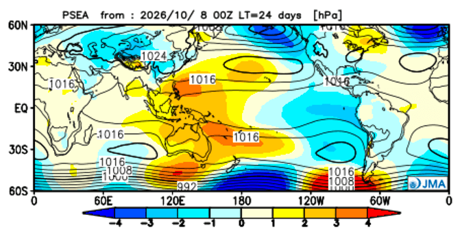
Fig. 1 Monthly sea level pressure anomaly simulation for Nov. 2026 (JMA) ※Yellow indicates higher pressure, and blue indicates lower pressure compared with the normal year. Unit: hPa
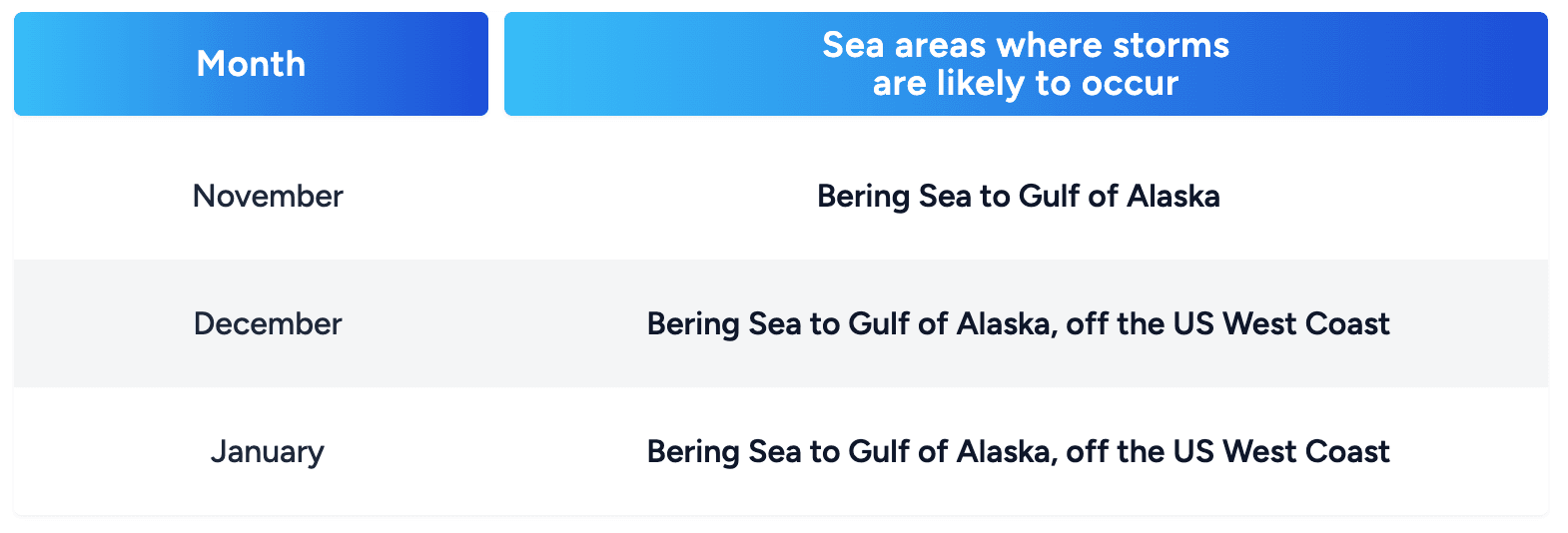
Industry Insights: Conditions favor severe weather from the Bering Sea to the Gulf of Alaska. The Northeast monsoon over the East and South China Seas is expected to be weaker than normal.
December 2026
- Pressure is significantly lower than average from the Gulf of Alaska to the waters off the West Coast of North America, and over the eastern Aleutians.
- Low-pressure systems are expected to develop across this region.
- Pressure near Japan and the Kuril Islands is near or slightly above average.
- The Northeast monsoon is expected to be weaker than average, with lower-than-normal pressure over China and higher-than-average pressure from the South China Sea toward the western Pacific.
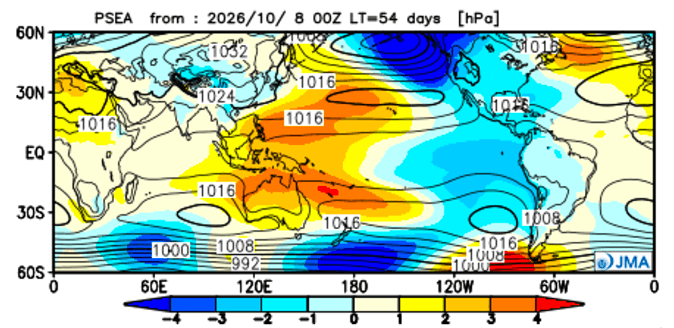
Fig. 2 Monthly sea level pressure anomaly simulation for Dec. 2026 (JMA) Unit: hPa
Industry Insights: The Bering Sea to Gulf of Alaska, and the waters off the US West Coast, are the areas where storms are most likely. The Northeast monsoon over the East and South China Seas is again expected to be weaker than average.
January 2027
- Pressure remains significantly lower than average from the Gulf of Alaska to the West Coast of North America and over the eastern Aleutians.
- Low-pressure systems are likely to develop from the eastern Aleutians through the Gulf of Alaska to the US West Coast.
- Pressure is higher than average east of Japan, in the mid-latitudes of the central Pacific and near the Kuril Islands.
- Pressure over the South China Sea is significantly higher than average, so the Northeast monsoon over the East and South China Seas is likely to be weaker than normal.
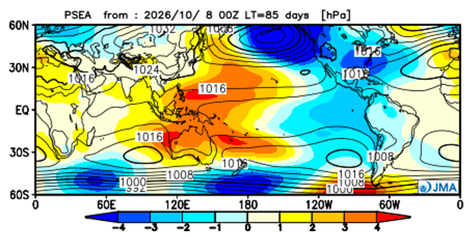
Fig. 3 Monthly sea level pressure anomaly simulation for Jan. 2027 (JMA) Unit: hPa
Industry Insights: Storm-prone conditions continue from the eastern Aleutians to the US West Coast. Monsoon winds over the East and South China Seas are expected to be weaker than normal.
Normal Year Conditions in North Pacific

Fig. 4 The mean significant wave height of the past five years (WNI analysis) Unit: m (Left) November, 2020-2025 / (Middle) December, 2020-2025 / (Right) January, 2021-2026