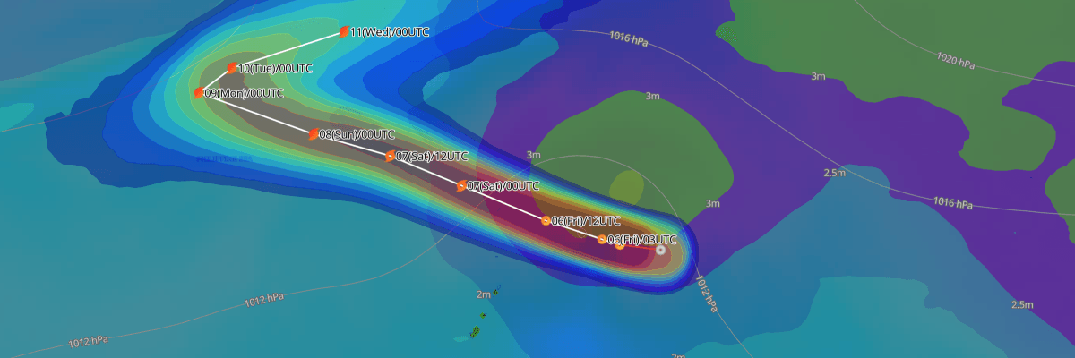
Tropical Depression 99W has formed in the western North Pacific. The Japan Meteorological Agency (JMA) forecasts it to reach tropical storm intensity within 12 hours and to strengthen to typhoon intensity by 06 UTC on 10 November. If it reaches tropical storm intensity, it would be named and numbered as Typhoon No. 32. Until then, it carries only a designated number.
CURRENT STATUS
Based on the latest JMA observations on November 6, 2026 06:50 UTC
- Location: N18.0°, E149.2°, approximately 260 NM (480 km) northeast of Saipan, Mariana Islands
- Intensity: Tropical Depression (TD)
- Movement: Northwest at 25 km/h (14 kt)
- Central pressure: 1004 hPa
- Maximum sustained winds: 30 kt (56 km/h), with gusts to 45 kt (83 km/h)
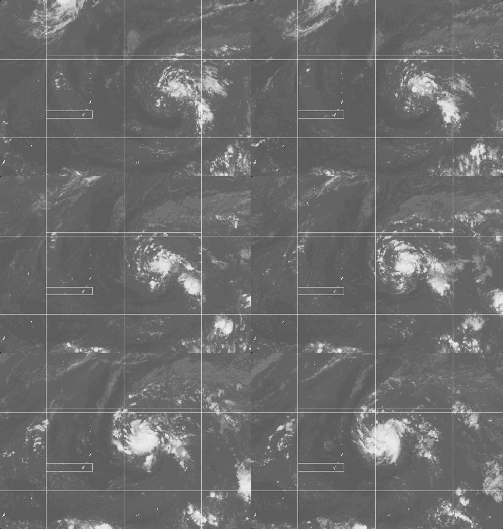
Weathernews Global Composite Satellite Imagery valid November 5, 2026 03:30 UTC to November 6, 2026 03:30 UTC
FORECAST TRACK SUMMARY
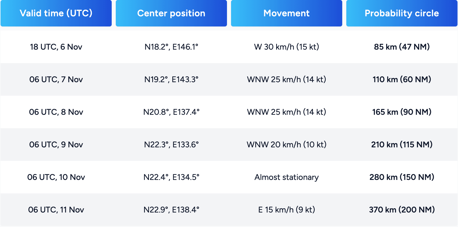
According to JMA, Tropical Depression 99W is forecast to turn west and then west-northwest. It should cross the western North Pacific at 25–30 km/h (14–15 kt) through 8 November. Its forecast center at 18 UTC on 6 November lies close to the northern Mariana Islands, within the 85 km (47 NM) probability circle. The system is then forecast to slow, become almost stationary near N22.4°, E134.5° on 10 November, and turn east on 11 November. The probability circle widens from 85 km (47 NM) to 370 km (200 NM), so track confidence is expected to decrease with time.
INTENSITY FORECAST
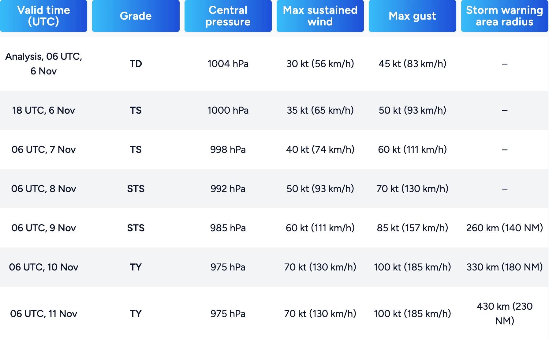
JMA forecasts steady strengthening over the next five days. The system is expected to reach tropical storm intensity by 18 UTC on 6 November and severe tropical storm intensity by 06 UTC on 8 November. It is then forecast to reach typhoon intensity by 06 UTC on 10 November, with winds of 70 kt (130 km/h). Central pressure is forecast to fall from 1004 hPa to 975 hPa.
IMPACTS & THREATS
A storm warning area is forecast for 06 UTC on 9 November, with a radius of 260 km (140 NM). It is forecast to grow to 330 km (180 NM) on 10 November and 430 km (230 NM) on 11 November. Vessels operating in the Philippine Sea and the surrounding waters should expect worsening wind and sea conditions as the system strengthens. A slow-moving typhoon can affect the same waters for an extended period, so conditions may deteriorate for longer than they would with a faster storm.
For the Mariana Islands, Weathernews' proprietary port forecasts as of 6 November 06UTC for Saipan and Guam, valid from 10 UTC on 6 November to 10 UTC on 9 November, indicate that winds and gusts at 10 m are expected to remain below 30 kt (56 km/h). They also indicate that significant wave height is expected to remain below 3.5 m (11.5 ft). This outlook may change if the track or intensity forecast shifts, particularly given the close approach of the forecast center to the northern Mariana Islands on 6–7 November. Port users are encouraged to monitor updated forecasts.
Weathernews Inc. assumes no liability for navigational decisions, losses, or damages resulting from reliance on this general overview.
While official observations guide the general threat assessment, highly detailed, proprietary routing and port forecasts are essential for safe navigation. Weathernews services provide customers with 24/7 localized data to ensure your vessels remain safe and well-informed. Please consult our dedicated services for the most up-to-date, detailed predictions for your specific routes and operations.