The Japan Meteorological Agency (JMA) has released the latest observation data for Typhoon Mekkhala (Typhoon No. 7). Packing maximum sustained winds of 50 m/s (95 kts), Mekkhala has developed into a significantly more intense system than Tropical Storm Jangmi, which affected the region earlier this month.
Current Situation
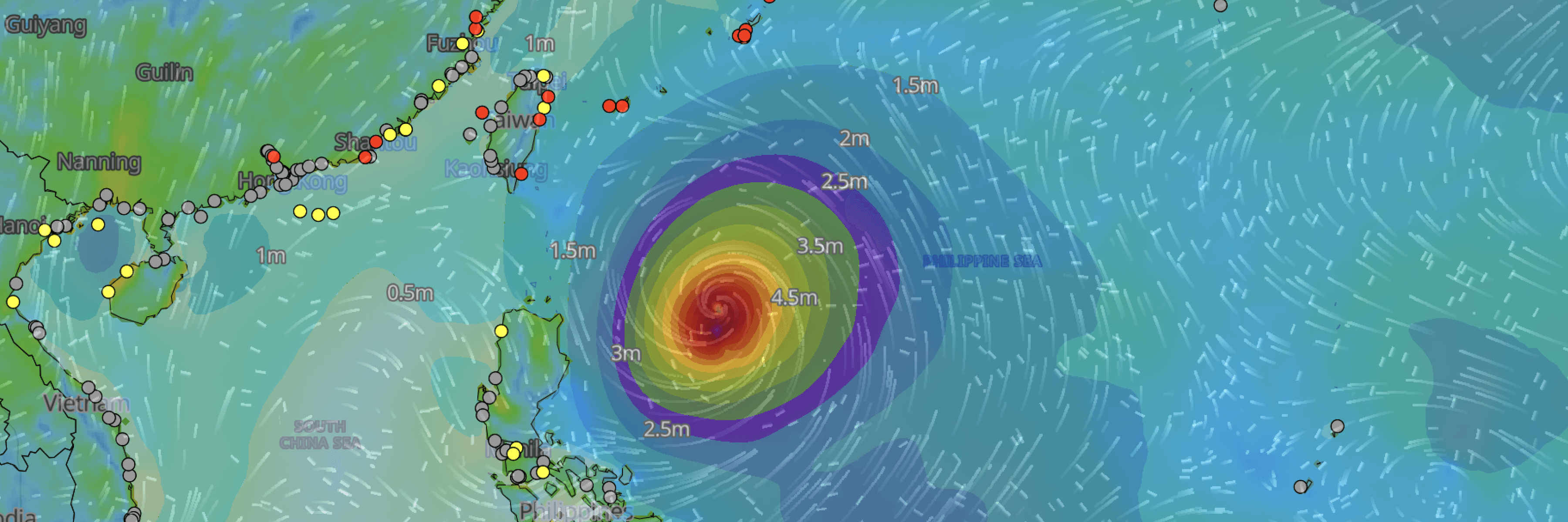
As of June 22nd at 06:00 UTC, the JMA reports that Typhoon Mekkhala is located at coordinates 17.8°N, 127.0°E. The system—officially classified by the JMA as a "Very Strong" typhoon—is advancing in a west-northwest direction at a speed of 15 km/h (9 kts).
Intensity and Wind Zones
According to the latest JMA analysis, the typhoon's central pressure has deepened to 935 hPa.
- Maximum Winds: Maximum sustained winds near the center are recorded at 50 m/s (95 kts), with maximum wind gusts reaching 70 m/s (135 kts).
- 50-Knot Wind Area: The radius of the 50-knot wind area extends 110 km (60 NM) across the entire area surrounding the center.
- 30-Knot Wind Area: The radius of the 30-knot wind area is asymmetrical, extending 280 km (150 NM) to the north and 220 km (120 NM) to the south.
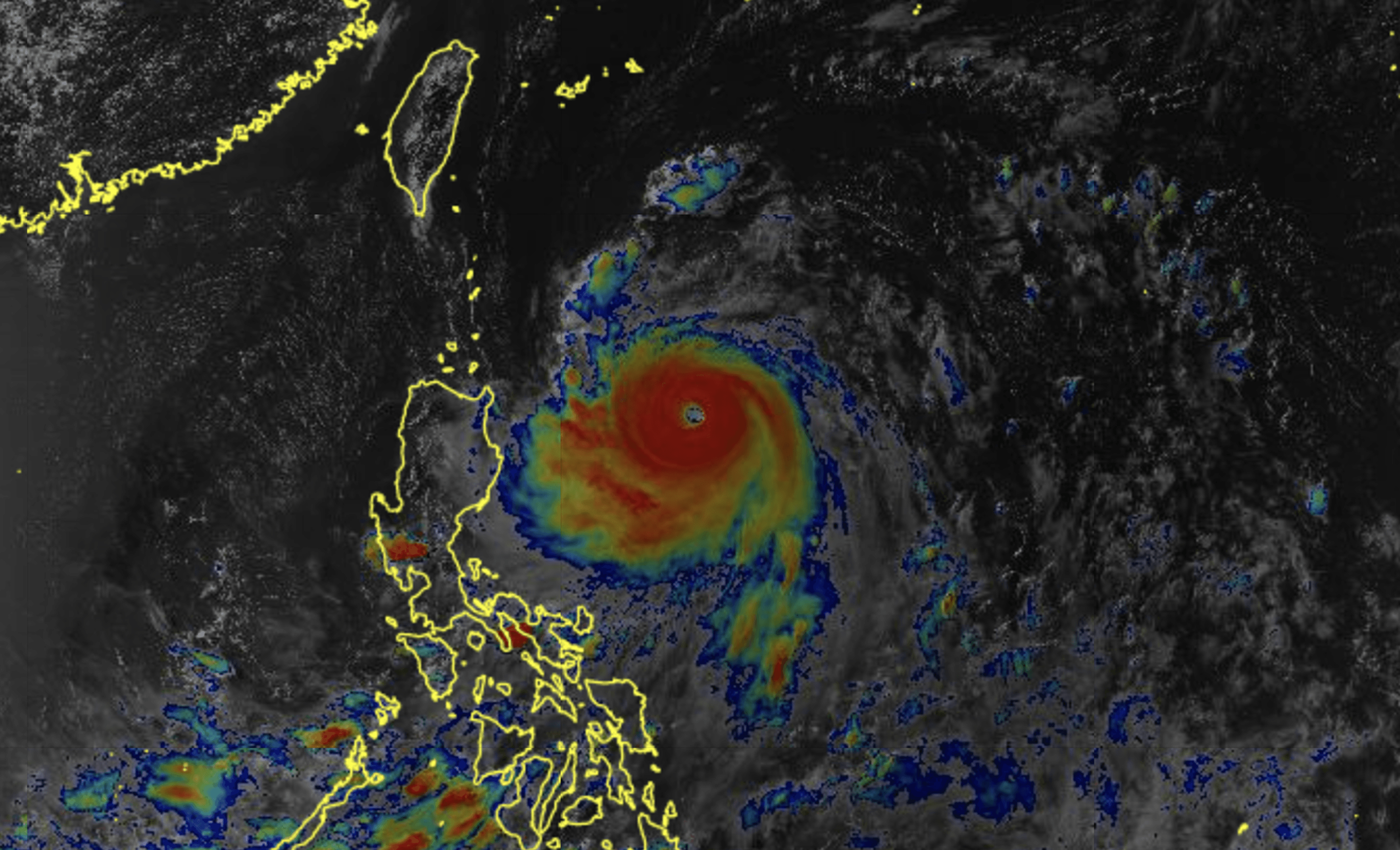
Himawari Satellite imagery valid June 22, 2026 08:30UTC
Port-Specific Operational Impacts
As the system advances west-northwest across the Philippine Sea, conditions across the Okinawa region will deteriorate rapidly. To provide a realistic view of the sustained hazards, the following charts represent the expected conditions during the most severe operational windows (caution and warning thresholds) for some of the major ports along the projected path:
Port Forecast Alert Threshold
Regional Map: Okinawa Ports (Naha, Kinwan, Ishigaki)
Map and port display via Weathernews SeaNavigator.
■ NAHA
■KINWAN
■ISHIGAKI
Weathernews Inc. assumes no liability for navigational decisions, losses, or damages resulting from reliance on this general overview.
While official observations guide the general threat assessment, highly detailed, proprietary routing and port forecasts are essential for safe navigation. Weathernews services provide customers with 24/7 localized data to ensure your vessels remain safe and well-informed. Please consult our dedicated services for the most up-to-date, detailed predictions for your specific routes and operations.
Note on the storm's name: The name "Mekala" (Mekkhala) was contributed by Thailand and translates to the "Angel of Thunder." The WMO and the ESCAP/WMO Typhoon Committee adopt these names sequentially to make tracking specific storms straightforward and to quickly communicate warnings. To learn more about how storms are named, please visit the World Meteorological Organization (WMO) website.