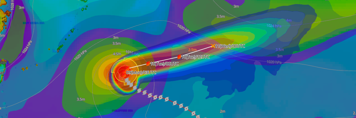
Typhoon No. 32 (Cempaka, formerly Tropical Depression 99W) is moving northwest in the Philippine Sea with maximum sustained winds of 65 kt (120 km/h), according to the Japan Meteorological Agency (JMA). The typhoon is forecast to strengthen to 80 kt (148 km/h) by 03 UTC on 10 November. It is then expected to turn east, weaken to a severe tropical storm by 12 November, and be a tropical depression by 14 November.
CURRENT STATUS
Based on the latest JMA observations on November 9, 2026 03:45 UTC
- Location: N23.9°, E135.0°, in the Philippine Sea, approximately 220 NM (405 km) north-northwest of Okinotorishima
- Intensity: Typhoon (TY)
- Movement: Northwest at 15 km/h (7 kt)
- Central pressure: 980 hPa
- Maximum sustained winds: 65 kt (120 km/h), with gusts to 95 kt (176 km/h)
- Wind radii: 50-kt winds extend 75 km (40 NM) from the center. 30-kt winds extend 330 km (180 NM) to the north and 165 km (90 NM) to the south.
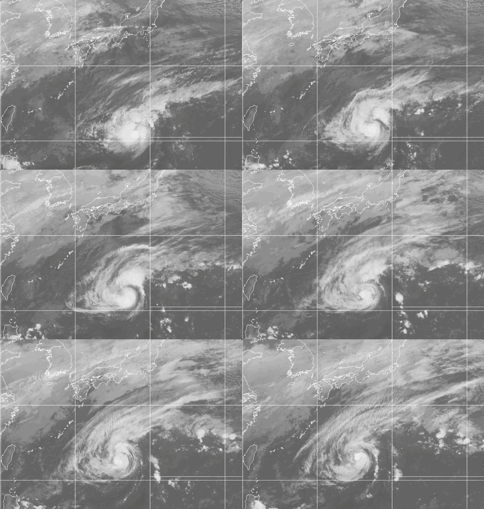
Weathernews Global Composite Satellite Imagery valid November 8, 2026 03:30 UTC to November 9, 2026 03:30 UTC
FORECAST TRACK SUMMARY
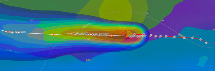
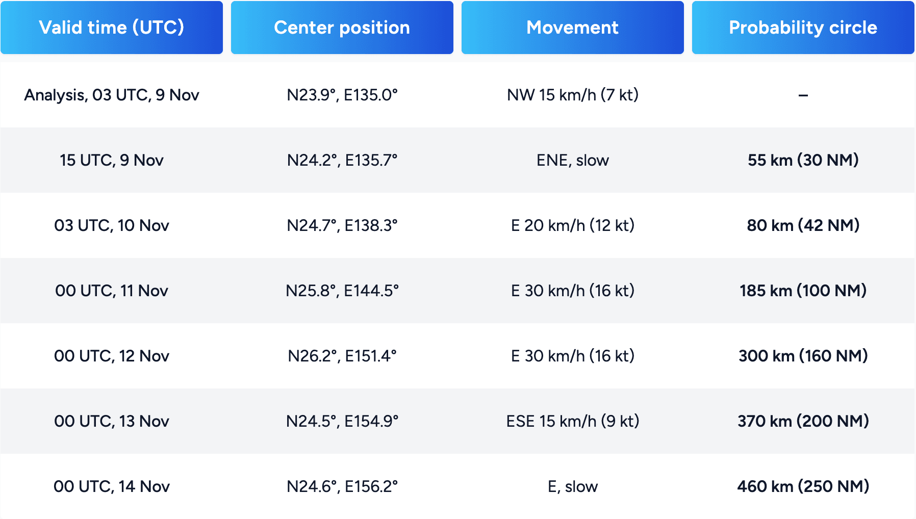
JMA forecasts Typhoon No. 32 (Cempaka) to slow and turn east-northeast by 15 UTC on 9 November, then accelerate eastward. Track confidence is expected to decrease with time as the probability circle widens from 55 km (30 NM) to 460 km (250 NM).
INTENSITY FORECAST
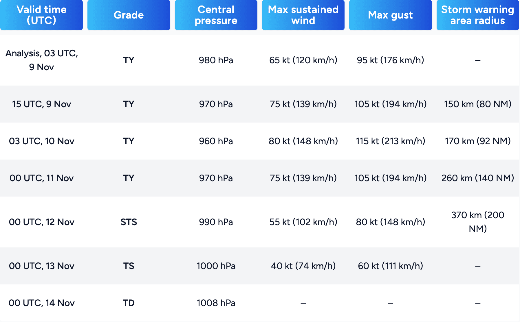
Expect Typhoon No. 32 (Cempaka) to peak at 80 kt (148 km/h) with a central pressure of 960 hPa by 03 UTC on 10 November. It is then forecast to weaken steadily, becoming a tropical depression by 00 UTC on 14 November.
IMPACTS & THREATS
JMA's forecast storm warning area expands from 150 km (80 NM) on 9 November to 370 km (200 NM) on 12 November. Vessels operating in the Philippine Sea and the open waters of the western North Pacific along the forecast track should expect rough seas and strong winds. The typhoon is forecast to be slow-moving near N24°–25°N, E135°–139°E through 10 November, so conditions in those waters may deteriorate for an extended period. As the system accelerates eastward and weakens, the area of strong winds may shift east. Because the probability circle grows with time, mariners should monitor updated advisories.
CONTEXT
Typhoon No. 32 (Cempaka) is the 32nd named storm of the 2026 season in the western North Pacific. It is the first season to reach this count since 1994, when 36 formed. In an average year, about 25 typhoons form (JMA's 1991–2020 average is 25.1). The system was first tracked as Tropical Depression 99W. JMA gave it a name and number once it reached tropical storm intensity, which means sustained maximum winds of 34 kt (39 mph / 63 km/h) or more.
Weathernews Inc. assumes no liability for navigational decisions, losses, or damages resulting from reliance on this general overview.
While official observations guide the general threat assessment, highly detailed, proprietary routing and port forecasts are essential for safe navigation. Weathernews services provide customers with 24/7 localized data to ensure your vessels remain safe and well-informed. Please consult our dedicated services for the most up-to-date, detailed predictions for your specific routes and operations.
Note on the storm's name: The name 'Cempaka' was contributed by Malaysia and refers to a plant known for its fragrant flowers. The WMO and the ESCAP/WMO Typhoon Committee adopt these names sequentially to make tracking specific storms straightforward and to quickly communicate warnings. To learn more about how storms are named, please visit the World Meteorological Organization (WMO) website.