Tropical Storm Pena is moving west about 540 miles south-southwest of South Point, Hawaii. Maximum sustained winds are 40 kt (45 mph) and minimum central pressure is 1002 mb. The Central Pacific Hurricane Center (CPHC) reports no coastal watches or warnings and no hazards to land.
CURRENT STATUS
Based on the latest CPHC Public Advisory analysis on November 9, 2026 03:00 UTC
- Location: 11.4°N, 157.6°W, about 540 miles south-southwest of South Point, Hawaii, and about 875 miles east-southeast of Johnston Island
- Intensity: Tropical Storm
- Movement: West at 7 kt (8 mph)
- Central pressure: 1002 mb
- Maximum sustained winds: 40 kt (45 mph), with gusts to 50 kt (58 mph)
- Wind radii: 34-kt (39 mph) winds extend up to 40 NM (45 miles) from the center, in the northeast quadrant only
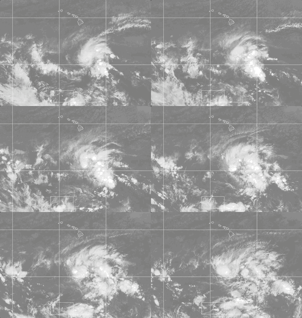
Weathernews Global Composite Satellite Imagery valid November 8, 2026 03:30 UTC to November 9, 2026 03:30 UTC
FORECAST TRACK SUMMARY
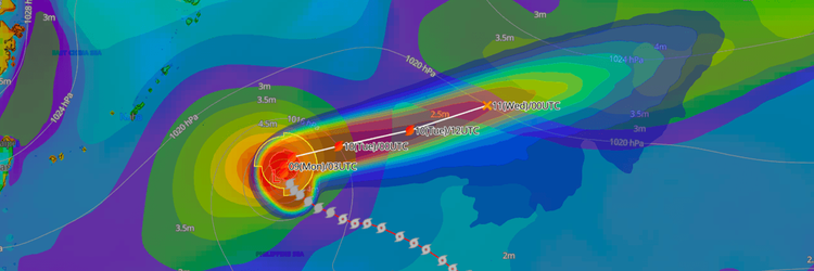
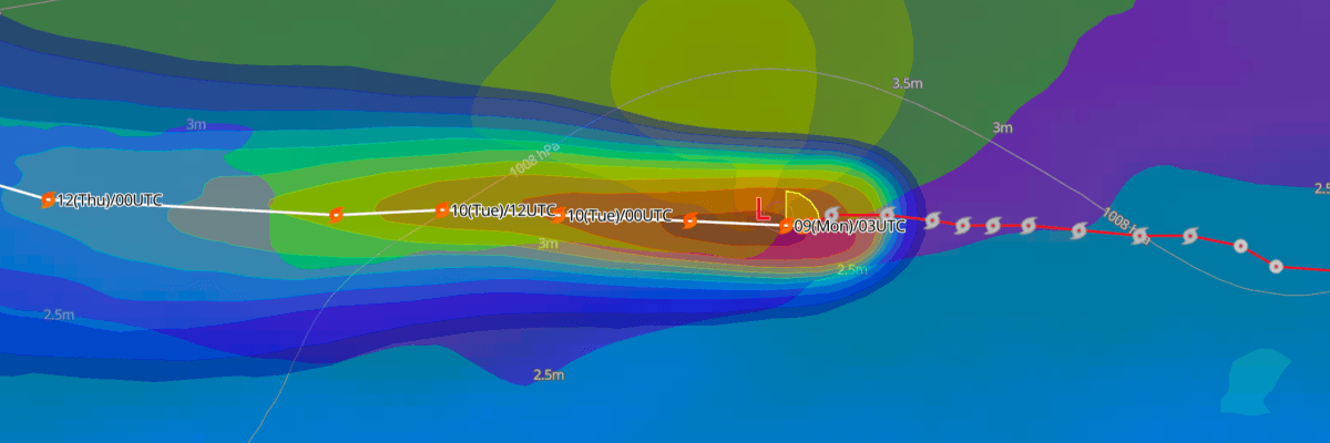
CPHC forecasts Pena to keep moving west at a slightly faster pace through midweek, passing well south of the Hawaiian Islands and Johnston Island. The storm should then turn west-northwest as a new area of high pressure builds to its north. Pena is forecast to cross the International Date Line during Friday, UTC.
INTENSITY FORECAST
Expect little change in strength. Pena stays near 40 kt (45 mph) through Tuesday, reaches 45 kt (50 mph) by Wednesday, and returns to 40 kt (45 mph) by Friday. The storm is over very warm water but is struggling to organize, which lowers the chance of significant strengthening.
WIND PROBABILITY & HIGHLIGHTS
An open-ocean location about 80 miles south of Pena's forecast path has a 4% chance of tropical-storm-force winds (34 kt / 39 mph) from 1200 UTC Tuesday to 0000 UTC Wednesday. A similar location farther west has a 6% chance from 0000 UTC Wednesday to 0000 UTC Thursday. Probabilities of 50 kt and 64 kt winds are not significant at any listed location.
IMPACTS & THREATS
No hazards to land are expected. CPHC forecast seas of 13 ft (4 m) or higher extend up to 270 nm northwest of the center and up to 120 nm northeast of it. CPHC has requested 3-hourly ship reports from vessels within 300 miles of the storm.
Pena could move into the area of responsibility of the Japan Meteorological Agency (JMA) after crossing the International Date Line. If it keeps its strength, JMA could designate it Typhoon No. 33. That would follow Typhoon No. 28 (Nolo), another system first monitored by CPHC that held its strength and moved into the JMA area.
Weathernews Inc. assumes no liability for navigational decisions, losses, or damages resulting from reliance on this general overview.
While official observations guide the general threat assessment, highly detailed, proprietary routing and port forecasts are essential for safe navigation. Weathernews services provide customers with 24/7 localized data to ensure your vessels remain safe and well-informed. Please consult our dedicated services for the most up-to-date, detailed predictions for your specific routes and operations.
Note on the storm's name: "Pena" is drawn from the Central North Pacific tropical cyclone name list maintained by the World Meteorological Organization (WMO). Central North Pacific tropical cyclone names are pre-selected Hawaiian names that rotate continuously across four lists. To learn more about how storms are named, please visit the World Meteorological Organization (WMO).