When Weathernews published its Spring 2026 ENSO outlook, the central message was clear: prepare early. Three months later, every major meteorological agency has confirmed El Niño's arrival — and the forecasts are no longer cautionary. They are urgent.
For foundational background on ENSO mechanics, ONI classification thresholds, and the full maritime risk framework first outlined this season, see our original April analysis.
The Numbers Tell a Stark Story
The Japan Meteorological Agency (JMA) confirmed in its July 10 bulletin that El Niño has been ongoing since spring 2026. The monitoring zone sea surface temperature (SST) anomaly for June hit +1.9°C — a +0.7°C single-month surge — with atmospheric coupling fully in place: weakened trade winds, suppressed convection over Indonesia, and enhanced convective activity over the central Pacific. JMA's probabilistic outlook assigns 100% probability of El Niño continuing through autumn.
NOAA's Climate Prediction Center independently reinforces this picture. The latest Niño-3.4 index stands at +1.2°C, while the easternmost Niño-1+2 region has already surged to +2.7°C. A recent downwelling Kelvin wave has deepened the thermocline across the eastern Pacific, loading additional heat energy into the system. NOAA now places an 81% probability on a "very strong" El Niño during October–December — an event that would rank among the largest since records began in 1950 — and a 97% probability of persistence through early spring 2027.
Most critically, JMA’s latest coupled model output projects the October SST anomaly median approaching +4.0°C, with even the lower bound holding above +3.0°C. The 1997–1998 El Niño — the strongest on record — peaked at +3.6°C. The 2026 event is on track to surpass it.
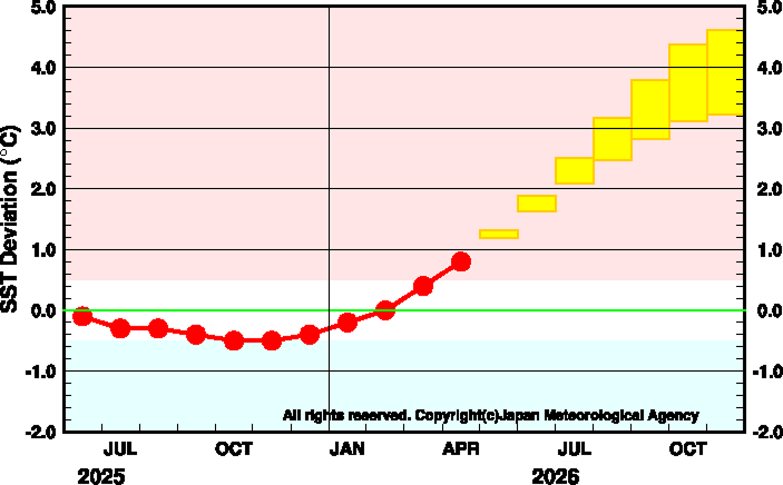
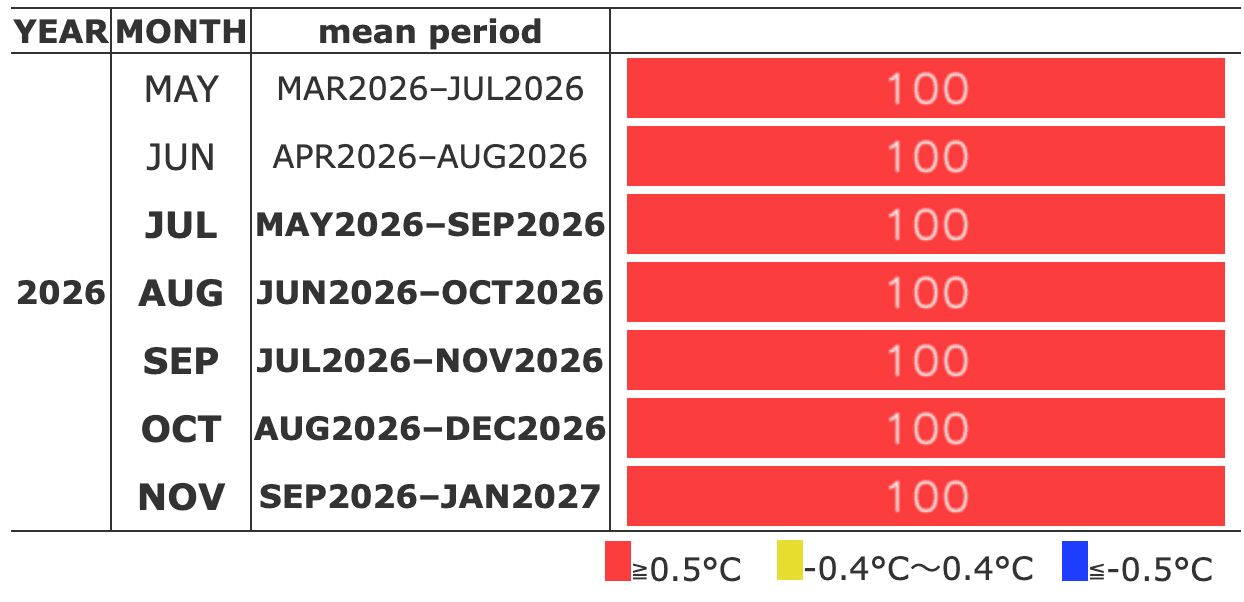
Sea surface temperature (SST) anomalies in the Niño-3 region and forecast probabilities of El Niño–Southern Oscillation (ENSO) conditions; image source: Japan Meteorological Agency (JMA), Tokyo Climate Center (TCC). El Niño Monitoring and Outlook. https://www.data.jma.go.jp/tcc/tcc/products/elnino/elmonout.html
Typhoon Season: Conventional Playbooks No Longer Apply
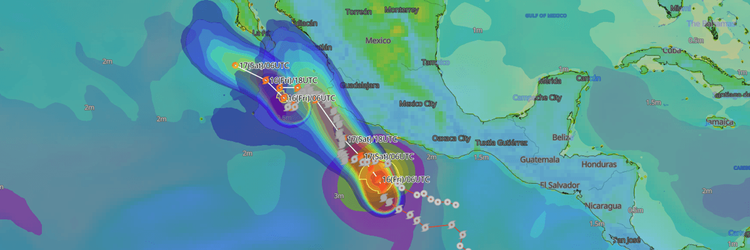
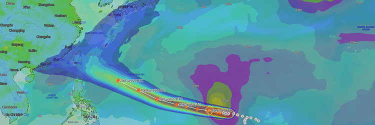
The Super El Niño's influence on the 2026 typhoon season is already becoming visible. Weathernews' latest extended-range tropical storm forecast models are detecting several emerging TC behavioral tendencies characteristic of El Niño conditions — patterns that, while not without precedent, are relatively uncommon and warrant close monitoring by maritime operators:
Genesis shifting dramatically eastward — several models are signaling the potential for disturbance genesis near and beyond the International Date Line.
East Pacific TCs tracking westward off Mexico, rather than the typical northward movement, increasing the risk of systems crossing into trans-Pacific routing corridors.
Elevated TC activity in the central North Pacific — a region not typically associated with sustained tropical cyclone presence.
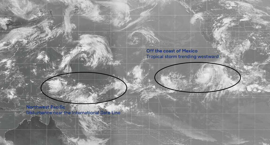
Composite satellite imagery, July 17, 2026 03:30 UTC
As outlined in our April piece, eastward genesis means storms spend longer over an anomalously warm open ocean before approaching shipping lanes — enabling sustained, extreme intensification. For operators, this translates directly into less warning time and less predictable tracks.
Further reading: Weathernews' 2026 Tropical Cyclone Outlook
Panama Canal: Early Warning Signals Are Already Visible
The Panama Canal risk outlined in our April analysis is no longer purely model-driven — observational data is now corroborating the forecast. According to the Panama Canal Authority, Gatun Lake currently sits at 84.7 ft as of July 16, tracking the 5-year seasonal average for now. However, the Canal's own water level projection forecasts a steady decline toward ~83.8 ft by mid-September — meaningfully below the 5-year September average of 85.2 ft. This deterioration is already underway before the El Niño peak has arrived.
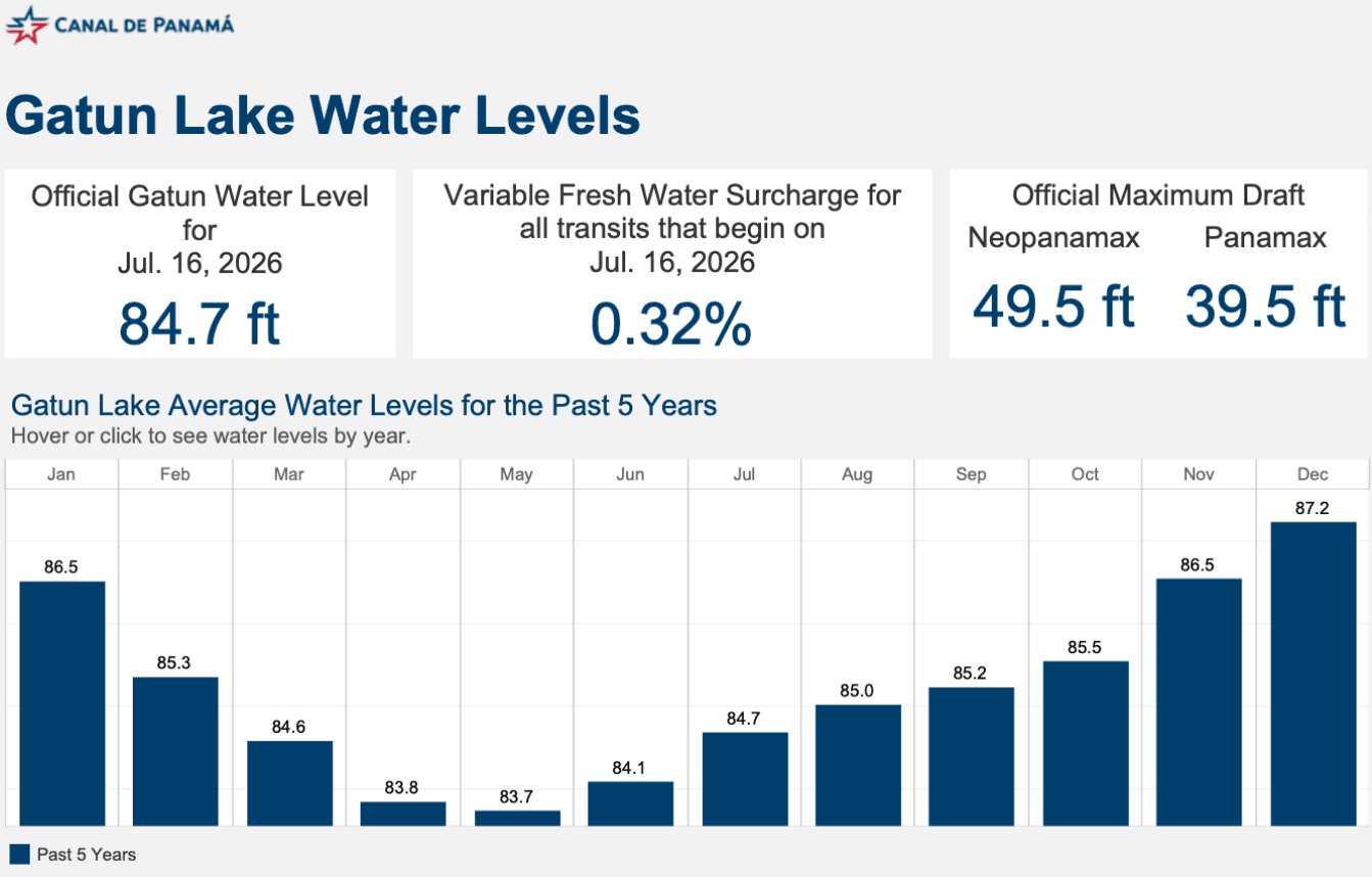
Gatun Lake water level indicators (adapted by the author); image source: Panama Canal Authority (ACP). Gatun Lake Water Levels. Available at: https://evtms-rpts.pancanal.com/eng/h2o/GatunWaterIndicators.pdf
The mechanism is consistent with what El Niño delivers to the region. JMA's Tokyo Climate Center classified southern Mexico through Colombia as Warm in June — a pattern that suppresses the rainfall the Canal watershed depends on. With NOAA placing an 81% probability on a very strong October–December El Niño, the September projection may itself prove optimistic as peak conditions take hold.
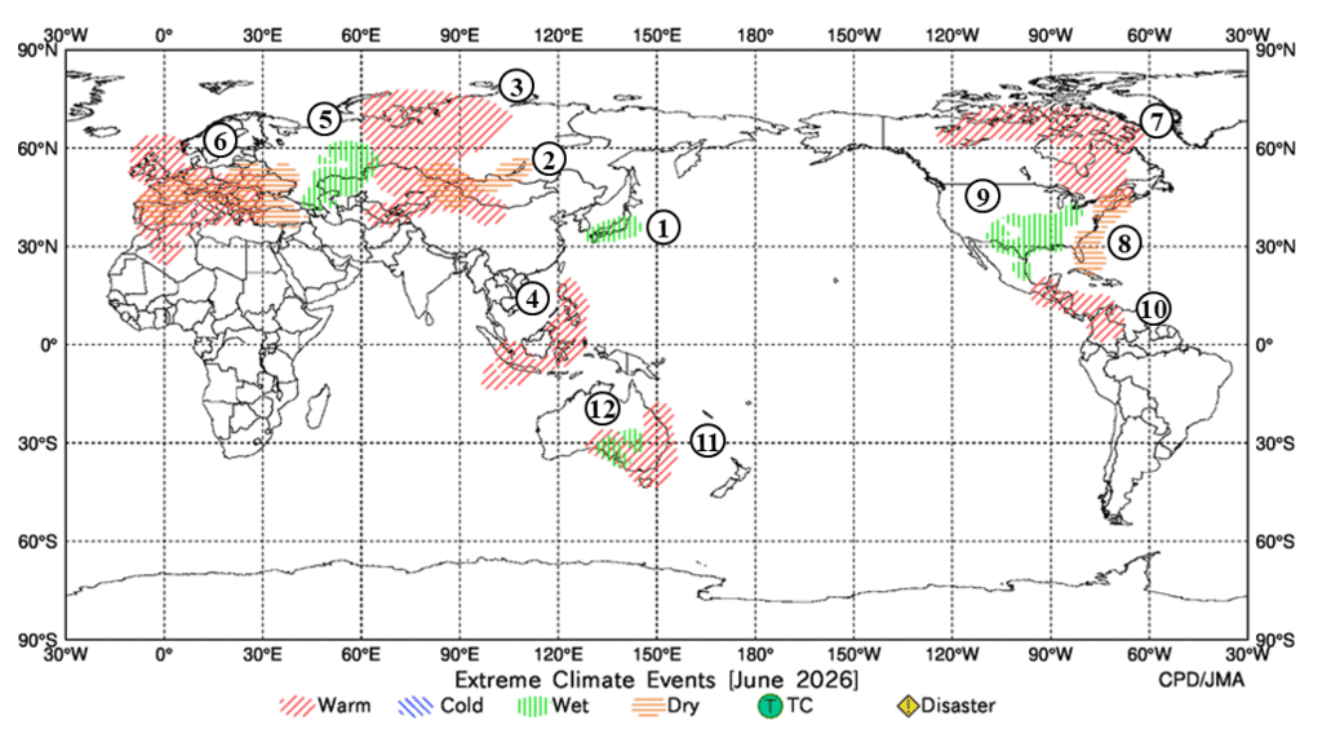
Monthly climate anomalies; image source: Tokyo Climate Center (TCC), Japan Meteorological Agency (JMA). Monthly Climate Monitoring Products. Available at: https://ds.data.jma.go.jp/tcc/tcc/products/climate/monthly/
For operators, the window to act is narrowing. As detailed in our April piece, severe draft restrictions trigger vessel priority rankings that disproportionately disadvantage bulk carriers and LPG vessels — forcing Cape of Good Hope rerouting at a time when alternative corridors remain constrained. Securing transit slots or locking in contingency routing plans now, ahead of market reaction, remains the strongest hedge available.
Key Dates Ahead
Two critical data releases will sharpen the picture further:
- JMA El Niño Monitoring Bulletin No. 407 — August 10, 2026
- NOAA ENSO Diagnostics Discussion — August 13, 2026
The question in April was whether El Niño would develop. The question now is how historic it will become — and whether your operations are positioned to respond.
For foundational background on ENSO mechanics, ONI thresholds, and the full 2026 maritime risk framework, see our original April 2026 analysis.